Related Research Articles
Okeover Arm Provincial Park is a provincial park in British Columbia, Canada, located on the west side of Okeover Inlet facing Desolation Sound, on the east side of the Malaspina Peninsula.

Lyell Island, known also in the Haida language as Athlii Gwaii, is a large island in the Haida Gwaii archipelago on the North Coast of British Columbia, Canada. The island is a part of the Gwaii Haanas National Park Reserve and Haida Heritage Site.

The Gwa'Sala-Nakwaxda'xw Nations are a union of two Kwakwaka'wakw peoples in a band government based on northern Vancouver Island in British Columbia, Canada, whose main reserve community is near the town of Port Hardy in the Queen Charlotte Strait region of the Central Coast region of British Columbia, Canada. The band government is a member of the Kwakiutl District Council and, for treaty negotiation purposes, the Winalagalis Treaty Group which includes three other members of the Kwakiutl District Council.
The Lytton First Nation, a First Nations band government, has its headquarters at Lytton in the Fraser Canyon region of the Canadian province of British Columbia. While it is the largest of all Nlaka'pamux bands, unlike all other governments of the Nlaka'pamux (Thompson) people, it is not a member of any of the three Nlaka'pamux tribal councils, which are the Nicola Tribal Association, the Fraser Canyon Indian Administration and the Nlaka'pamux Nation Tribal Council.
The Kluskus First Nation is the band government of the Lhoosk’uz, a Dakelh people whose main reserve located on the Chilcotin Plateau 130 km west of the city of Quesnel, British Columbia, Canada. The First Nation is a member of the Carrier-Chilcotin Tribal Council, which includes both Tsilhqot'in and Carrier (Dakelh) communities.

The Lil'wat First Nation, a.k.a. the Lil'wat Nation or the Mount Currie Indian Band, is a First Nation band government located in the southern Coast Mountains region of the Interior of the Canadian province of British Columbia. It is a member of the Lillooet Tribal Council, which is the largest grouping of band governments of the St'at'imc or Stl'atl'imx people. Other St'at'imc governments include the smaller In-SHUCK-ch Nation on the lower Lillooet River to the southwest, and the independent N'quatqua First Nation at the near end of Anderson Lake from Mount Currie, which is the main reserve of the Lil'wat First Nation, and also one of the largest Indian reserves by population in Canada.
Lady Ann Strait is a waterway in Jones Sound in the Canadian territory of Nunavut. It is 30 km (19 mi) wide at the point between Cape Fitz Roy on Devon Island to the southwest, and Coburg Island to the northeast. The strait empties into northwestern Baffin Bay.
The Porcupine River is a left tributary of the Stikine River in northwestern British Columbia, Canada, entering that stream south of the confluence of the Anuk River and above the confluence of the Iskut.
Sea Bird Island is an island in the Fraser River just east of Agassiz, British Columbia, Canada, in the Upper Fraser Valley region of that province, about 75 miles east of Vancouver. Though within the District of Kent, most of the island is the Seabird Island Indian reserve and is the community of the Seabird Island First Nation, a member government of the Sto:lo Tribal Council.

Corte de Peleas is a Spanish municipality in the province of Badajoz, Extremadura. It has a population of 1,257 (2007) and an area of 42.3 km².

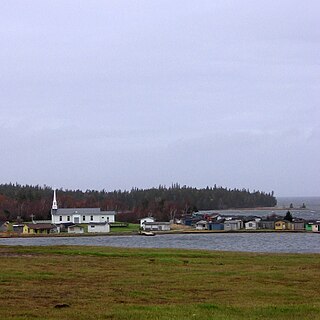
Chapel Island is an island in Bras d'Or Lake on Cape Breton Island, Nova Scotia, Canada. Its name in the kylee Miꞌkmaq language is Mniku but other names such as Vachlouacadie and Pastukopajitkewe'kati which translates to "sea cow place".
Juan Perez Sound is a sound off the east coast of Moresby Island in the Queen Charlotte Islands of British Columbia, Canada. It is named for Juan José Pérez Hernández, usually known as Juan Pérez, who was among the first European explorer in the region.
Nepean Sound is a sound on the North Coast of British Columbia, Canada. It lies north of Caamaño Sound, and separates Banks, Pitt, Campania and Trutch Islands.
The Hartley Bay Indian Band is also known as the Gitga'at First Nation or the Hartley Bay First Nation. The members of the Gitga'at First nation are often referred to as Gitka'a'ata. The population of Gitk’a’ata peoples living in Hartley Bay ranges from approximately 130-200 people. There are also about 400-500 Gitk’a’ata peoples living in Prince Rupert, British Columbia, Canada, a neighboring territory. The Gitk’a’ata people have lived in Hartley Bay for hundreds of years, if not always. Some notable things regarding the Gitga'at First Nation are their economy, geography, government, sports involvement, COVID-19 regulations, and relations.
Stratton Inlet is a body of water in the Qikiqtaaluk Region of Nunavut, Canada.
Pooley Island is an island in the North Coast region of British Columbia, Canada. To its west and southwest is Roderick Island, to its east Mathieson Channel. James Johnstone, one of George Vancouver's lieutenants during his 1791-95 expedition, first charted its north and east coasts in 1793. The island was later named after Charles Edward Pooley.
Lockeport is a locality on Moresby Island in the Haida Gwaii archipelago of the North Coast of British Columbia, Canada, located on Klunkwoi Bay.
The Moore Islands, also known as the Moore Group, are a group of small islands in the North Coast region of British Columbia, Canada. They are located in Hecate Strait to the west of Aristazabal Island.
References
Coordinates: 52°40′00″N131°43′00″W / 52.66667°N 131.71667°W