
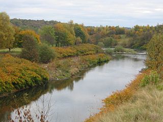
The River Douglas, also known as the River Asland or Astland, flows through parts of Lancashire and Greater Manchester in North West England. It is a tributary of the River Ribble and has several tributaries, the major ones being the River Tawd and the River Yarrow.

Bolton is a large town in Greater Manchester in North West England, historically and traditionally a part of Lancashire. A former mill town, Bolton has been a production centre for textiles since Flemish weavers settled in the area in the 14th century, introducing a wool and cotton-weaving tradition. The urbanisation and development of the town largely coincided with the introduction of textile manufacture during the Industrial Revolution. Bolton was a 19th-century boomtown and, at its zenith in 1929, its 216 cotton mills and 26 bleaching and dyeing works made it one of the largest and most productive centres of cotton spinning in the world. The British cotton industry declined sharply after the First World War and, by the 1980s, cotton manufacture had virtually ceased in Bolton.

For the river in the West Midlands, see River Tame, West Midlands.
The River Croal is a river located in Greater Manchester, England. It is a tributary of the River Irwell.
The River Wyre is a river in Lancashire, England, United Kingdom, which flows into the Irish Sea at Fleetwood. It is approximately 28 miles (45 km) in length. The river is a County Biological Heritage Site and has a sheltered estuary which, from its northwest corner, penetrates deep into the almost square peninsula of the Fylde.

Anglezarke is a sparsely populated civil parish in the Borough of Chorley in Lancashire, England. It is an agricultural area used for sheep farming, also site of reservoirs that were built to supply water to Liverpool. The area has a large expanse of moorland with many public footpaths and bridleways. The area is popular with walkers and tourists, it lies in the West Pennine Moors in Lancashire, sandwiched between the moors of Withnell and Rivington, and is close to the towns of Chorley, Horwich and Darwen. At the 2001 census it had a population of 23. At the 2011 Census the population is included within Heapey civil parish. The area was subjected to depopulation after the reservoirs were built.

Rivington is a village and civil parish of the Borough of Chorley, Lancashire, England, occupying 2,538 acres. It is about 6 miles (9.7 km) southeast of Chorley and about 8+1⁄2 miles (13.7 km) northwest of Bolton. Rivington is a rural area consisting primarily of agricultural grazing land, moorland, with hill summits including Rivington Pike and Winter Hill within the West Pennine Moors. The area has a thriving tourist industry centred around reservoirs created to serve Liverpool in the Victorian era and Lever Park created as a public park by William Lever at the turn of the 20th century, with two converted barns, a replica of Liverpool Castle and open countryside. Rivington and its village had a population of 109 at the 2011 Census.

Smithills Hall is a Grade I listed manor house, and a scheduled monument in Smithills, Bolton, Greater Manchester, England. It stands on the slopes of the West Pennine Moors above Bolton at a height of 500 feet, three miles north west of the town centre. It occupies a defensive site near the Astley and Raveden Brooks. One of the oldest manor houses in the north west of England, its oldest parts, including the great hall, date from the 15th century and it has been since been altered and extended particularly the west part. Parts of it were moated. The property is owned by Bolton Metropolitan Borough Council and open to the public.

The West Pennine Moors is an area of the Pennines covering approximately 90 square miles (230 km2) of moorland and reservoirs in Lancashire and Greater Manchester, England. It is a Site of Special Scientific Interest.

Halliwell is predominantly a residential area of Bolton, Greater Manchester, England. It gives its name to an electoral ward of the wider Metropolitan Borough of Bolton. The population of this ward taken at the 2011 census was 13,929. Halliwell lies about 2 miles (3.2 km) to the north west of Bolton town centre and is bounded by Tonge Moor to the east and Heaton to the south west. Smithills Hall to the north is within the ancient township. It lies on the lower south facing slopes of the West Pennine Moors.

The River Roddlesworth is a river in Lancashire, England, a tributary of the River Darwen.

Bradshaw Brook is a river draining parts of Lancashire and Greater Manchester in Northern England.

Pendleton Brook is a small river in Lancashire. The brook rises on Pendleton Moor and flows through the village of Pendleton, travelling north west to Higher Standen, then west past Standen Hall. From there, Pendleton Brook flows south of Clitheroe before meeting the River Ribble near Siddows.

Deane is an area of Bolton, in Greater Manchester, England. It is about 2 miles (3.2 km) south west of Bolton and 11 miles (17.7 km) northwest of the city of Manchester.
Heaton is mostly a residential district of Bolton, Greater Manchester, England. It lies about 2 miles (3 km) north west of Bolton town centre. It is bounded by Deane to the south, Markland Hill to the west, and Smithills and Halliwell to the north.

Skirden Beck is a minor river in Lancashire, England. It is approximately 4.3 miles (6.85 km) long and has a catchment area of 18.87 square miles (48.882 km2).
Rumworth is an electoral ward of Bolton, in Greater Manchester, England. The population of this ward at the 2011 census was 16,250. Historically it was part of the hundred of Salford in Lancashire and centre of the Parish of Deane which once covered roughly half of the present Metropolitan Borough of Bolton. St Mary's Church on which the parish was centred was in the township of Rumworth.

Ainsworth Mill, Breightmet is a mercerising mill near the Breightmet neighborhood of Bolton, Greater Manchester. It was bought by the Lancashire Cotton Corporation in the 1940s as an attempt to develop a cotton finishing presence.

Smithills is a mainly residential suburb of Bolton in Greater Manchester, England. It is 3.1 miles (5 km) northwest of Bolton, 14.5 miles (23 km) south of Blackburn and 11.9 miles (19 km) northwest of Manchester. Smithills lies on the lower south facing slopes of the West Pennine Moors.

