Dolina pri Lendavi

Last updated
Dolina pri Lendavi
Völgyifalu
Slovenia location map.svg
Red pog.svg
Dolina pri Lendavi
Location in Slovenia
Coordinates: 46°32′8.06″N16°30′19.5″E / 46.5355722°N 16.505417°E / 46.5355722; 16.505417 Coordinates: 46°32′8.06″N16°30′19.5″E / 46.5355722°N 16.505417°E / 46.5355722; 16.505417
Country Flag of Slovenia.svg Slovenia
Traditional region Prekmurje
Statistical region Mura
Municipality Lendava
Area
  Total 6.69 km2 (2.58 sq mi)
Elevation 163.3 m (535.8 ft)
Population (2002)
  Total 343
[1]

Dolina pri Lendavi (pronounced  [ˈdoːlina pɾi ˈleːndaʋi] ; Hungarian : Völgyifalu) is a settlement southeast of Lendava in the Prekmurje region of Slovenia. It lies close to the border with Hungary. [2]

Hungarian language language spoken in and around Hungary

Hungarian is a Finno-Ugric language spoken in Hungary and several neighbouring countries. It is the official language of Hungary and one of the 24 official languages of the European Union. Outside Hungary it is also spoken by communities of Hungarians in the countries that today make up Slovakia, western Ukraine (Subcarpathia), central and western Romania (Transylvania), northern Serbia (Vojvodina), northern Croatia, and northern Slovenia. It is also spoken by Hungarian diaspora communities worldwide, especially in North America and Israel. Like Finnish and Estonian, Hungarian belongs to the Uralic language family. With 13 million speakers, it is its largest member in terms of speakers.

Lendava Town and Municipality in Slovenia

Lendava is a town and a municipality in Slovenia in the region of Prekmurje. The name of the settlement was changed from Dolnja Lendava to Lendava in 1955. It is close to the border crossing with Hungary at Dolga Vas-Rédics, and Hungarian is one of the official languages of the municipality, along with Slovene.
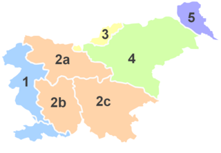
Prekmurje

Prekmurje is a geographically, linguistically, culturally and ethnically defined region settled by Slovenes and a Hungarian minority, lying between the Mur River in Slovenia and the Rába Valley in the most western part of Hungary. It maintains certain specific linguistic, cultural and religious features that differentiate it from other Slovenian traditional regions. It covers an area of 938 km2 and has a population of 78,000 people.


Contents

Name

The name of the settlement was changed from Dolina to Dolina pri Lendavi in 1953. [3]

Related Research Articles

NK Nafta Lendava association football club in Slovenia

Nogometni klub Nafta Lendava, commonly referred to as NK Nafta Lendava or simply Nafta, was a Slovenian football club, which played in the town of Lendava. They were founded as Lendvai Football Egyesület in 1903 during Hungarian administration. They were regarded as the oldest Slovenian football club until they filled for bankruptcy and were dissolved following the 2011–12 Slovenian PrvaLiga season. The club played in the Yugoslav First League for one season, in 1946–47.

Dolina is a Slavic toponym, meaning "valley" or "dale". It may refer to:

Languages of Slovenia languages of a geographic region

Slovenia has been a meeting area of the Slavic, Germanic, Romance, and Uralic linguistic and cultural regions, which makes it the most complex meeting point of languages in Europe. The official and national language of Slovenia is Slovene, which is spoken by a large majority of the population. It is also known, in English, as Slovenian. Two minority languages, namely Hungarian and Italian, are recognised as co-official languages and accordingly protected in their residential municipalities. Other significant languages are Croatian and its variants and Serbian, spoken by most immigrants from former Yugoslavia and their descendants. Slovenia is ranked among the top European countries regarding the knowledge of foreign languages. The most often taught foreign languages are English and German, followed by Italian, French, and Spanish.

Kot or KOT, may refer to:

Jarčja Dolina in Upper Carniola, Slovenia

Jarčja Dolina is a dispersed settlement in a small valley west of Selo in the Municipality of Žiri in the Upper Carniola region of Slovenia. Rupe, in the eastern part of the settlement, was formerly an independent settlement known as Rupe pri Selu.

Stari Trg pri Ložu Village in Inner Carniola, Slovenia

Stari Trg pri Ložu is a settlement and the administrative centre of the Municipality of Loška Dolina in the Inner Carniola region of Slovenia.

Kozarišče Place in Inner Carniola, Slovenia

Kozarišče is a village south of Stari Trg pri Ložu in the Municipality of Loška Dolina in the Inner Carniola region of Slovenia. The area of the village extends south of the main settlement right to the Snežnik Plateau and to the border with Croatia. Snežnik Castle, a 13th-century castle, is located just southwest of the village.

Podgora pri Ložu in Inner Carniola, Slovenia

Podgora pri Ložu is a village south of Stari Trg in the Municipality of Loška Dolina in the Inner Carniola region of Slovenia.

Pudob in Inner Carniola, Slovenia

Pudob is a village south of Stari Trg pri Ložu in the Municipality of Loška Dolina in the Inner Carniola region of Slovenia.

Vrhnika pri Ložu Place in Inner Carniola, Slovenia

Vrhnika pri Ložu is a village southeast of Stari Trg in the Municipality of Loška Dolina in the Inner Carniola region of Slovenia.

Dolgovaške Gorice in Prekmurje, Slovenia

Dolgovaške Gorice is a settlement in the hills east of Lendava in the Prekmurje region of Slovenia. It lies on the border with Hungary.

Dolnji Lakoš in Prekmurje, Slovenia

Dolnji Lakoš is a village southwest of Lendava in the Prekmurje region of Slovenia.

Čentiba in Prekmurje, Slovenia

Čentiba is a settlement southeast of Lendava in the Prekmurje region of Slovenia, close to the border with Hungary.

Kapca in Prekmurje, Slovenia

Kapca is a village west of Lendava in the Prekmurje region of Slovenia.

Mostje, Lendava in Prekmurje, Slovenia

Mostje is a settlement north of Lendava in the Prekmurje region of Slovenia, on the border with Hungary.

Selo pri Robu Place in Lower Carniola, Slovenia

Selo pri Robu is a settlement on the Rute Plateau in the hills southwest of Rob in the Municipality of Velike Lašče in central Slovenia. The municipality is part of the traditional region of Lower Carniola and is now included in the Central Slovenia Statistical Region.

Razgor pri Žabljeku in Styria, Slovenia

Razgor pri Žabljeku is a settlement in the Municipality of Slovenska Bistrica in northeastern Slovenia. It lies just off the regional road leading south from Slovenska Bistrica to Poljčane. The area is part of the traditional region of Styria. It is now included with the rest of the municipality in the Drava Statistical Region. The settlement includes the hamlet of Rožna Dolina.

Polje pri Višnji Gori in Lower Carniola, Slovenia

Polje pri Višnji Gori is a settlement southeast of Višnja Gora in the historical Lower Carniola region in central Slovenia. It belongs to the Municipality of Ivančna Gorica, which is included in the Central Slovenia Statistical Region.

References

  1. Statistical Office of the Republic of Slovenia
  2. Lendava municipal site
  3. Spremembe naselij 1948–95. 1996. Database. Ljubljana: Geografski inštitut ZRC SAZU, DZS.