
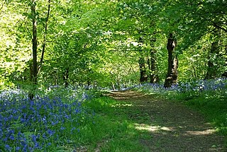
The Chasewater Railway is a former colliery railway running round the shores of Chasewater in Staffordshire, England. It is now operated as a heritage railway.
Hay Head Quarry is a 5.8 hectares geological site of Special Scientific Interest in the West Midlands. The site was notified in 1986 under the Wildlife and Countryside Act 1981 and is currently managed by the Country Trust.
Webster's Claypit is a 0.3 hectares geological site of Special Scientific Interest in the West Midlands. The site was notified in 1986 under the Wildlife and Countryside Act 1981 and is currently managed by the Country Trust.
Swan Pool & The Swag is a 5.7-hectare (14-acre) biological site of Special Scientific Interest in the West Midlands in western-central England. The site was notified in 1986 under the Wildlife and Countryside Act 1981 and is currently managed by the Country Trust.
Herald Way Marsh is a 10.6 hectares biological site of Special Scientific Interest in Coventry in the West Midlands. The site was notified in 1988 under the Wildlife and Countryside Act 1981. It is also a Local Nature Reserve.
Brewin's Canal Section is a 1.34-hectare (3.3-acre) geological site of Special Scientific Interest in the West Midlands. The site was notified in 1990 under the Wildlife and Countryside Act 1981 and is currently managed by the Country Trust. The site was deemed invaluable for understanding the development of coal deposits in the Midlands.
Daw End Railway Cutting is an 8.1 hectares geological site of Special Scientific Interest in the West Midlands. The site was notified in 1986 under the Wildlife and Countryside Act 1981 and is currently managed by the Country Trust.
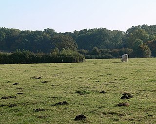
Berkswell Marsh is a 7.5 hectares biological site of Special Scientific Interest in the West Midlands, en. The site was notified in 1991 under the Wildlife and Countryside Act 1981. It is located in the Meriden Gap which is between Birmingham and Coventry.
Bickenhill Meadows is a 7.2 hectares biological site of Special Scientific Interest in the West Midlands. The site was notified in 1991 under the Wildlife and Countryside Act 1981.
Bromsgrove Road Cutting is a 0.2 hectares geological site of Special Scientific Interest in the West Midlands. The site was notified in 1990 under the Wildlife and Countryside Act 1981. It is located on the eastern edge of Halesowen.
Ketley Claypit is a 13.7 hectares geological site of Special Scientific Interest in the West Midlands. The site was notified in 1990 under the Wildlife and Countryside Act 1981. It is located in Kingswinford.
Saltwells Local Nature Reserve is situated in the Netherton area of Dudley Metropolitan Borough in West Midlands, England. The reserve, created in 1981, covers 247 acres and includes Saltwells Wood and part of Netherton Hill within its boundaries. The reserve encloses two Sites of Special Scientific Interest and one scheduled ancient monument.
Warboys Clay Pit is a 12.6-hectare (31-acre) geological Site of Special Scientific Interest west of Warboys in Cambridgeshire. It is a Geological Conservation Review site.

Helmdon Disused Railway is a 16.6-hectare (41-acre) linear biological Site of Special Scientific Interest between Helmdon and Brackley in Northamptonshire.
Cowthick Quarry is a 1.4-hectare (3.5-acre) geological Site of Special Scientific Interest east of Corby in Northamptonshire.

Bradgate Park and Cropston Reservoir is a 399.7-hectare (988-acre) geological Site of Special Scientific Interest north–west of Leicester. It is also a Nature Conservation Review site, and Bradgate Park contains Geological Conservation Review sites and a Scheduled Monument.
Cotes Grassland is a 3.3-hectare (8.2-acre) biological Site of Special Scientific Interest in Cotes in Leicestershire.
Debdale Meadow, Muston is a 4.3-hectare (11-acre) biological Site of Special Scientific Interest north of Muston in Leicestershire.

River Mease SSSI is a 23.0 hectares biological Site of Special Scientific Interest. It is a stretch of the River Mease and its tributary Gilwiskaw Brook, running between Alrewas in Staffordshire and Packington in Leicestershire. It is also a Special Area of Conservation The river goes through private land, but it is crossed by roads and footpaths.

Benscliffe Wood is a 9.8 hectares biological Site of Special Scientific Interest in Leicestershire.
