Avon Water, also known locally as the River Avon, is a 24-mile-long (39 km) river in Scotland, and a tributary of the River Clyde.
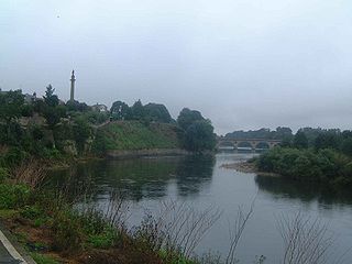
The River Tweed, or Tweed Water, is a river 97 miles (156 km) long that flows east across the Border region in Scotland and northern England. Tweed (cloth) derives its name from its association with the River Tweed. The Tweed is one of the great salmon rivers of Britain and the only river in England where an Environment Agency rod licence is not required for angling. Tweed is an Old Brythonic (Celtic) name meaning 'border'.

The Rotten Calder is a river to the east of East Kilbride, South Lanarkshire, Scotland and along with the Rotten Burn it forms the southern and western boundaries of Blantyre.

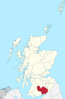
Annandale is a strath in Dumfries and Galloway, Scotland, named after the River Annan. It runs north–south through the Southern Uplands from Annanhead to Annan on the Solway Firth, and in its higher reaches it separates the Moffat hills on the east from the Lowther hills to the west. A 53-mile (85 km) long-distance walking route called Annandale Way running through Annandale was opened in September 2009.
The Water of Ae is a tributary of the River Annan into which it flows west of Lockerbie in Dumfries and Galloway administrative county of South West Scotland in the United Kingdom. It rises on the eastern slopes of Queensberry.

The River Kelvin is a tributary of the River Clyde in northern and northeastern Glasgow, Scotland. It rises on the moor south east of the village of Banton, east of Kilsyth. At almost 22 miles (35 km) long, it initially flows south to Dullatur Bog where it falls into a man made trench and takes a ninety degree turn flowing west through Strathkelvin and along the northern boundary of the bog parallel with the Forth and Clyde Canal.

Broughton is a village in Tweeddale in the historical county of Peeblesshire in the Scottish Borders council area, in the south of Scotland, in the civil parish of Broughton, Glenholm and Kilbucho and Upper Tweed Community Council. Broughton is on the Biggar Water, near where it flows into the River Tweed. It is about 7 km east of Biggar, and 15 km west of Peebles.
The Gala Water is a river in the Scottish Borders area of Scotland and a tributary of the River Tweed. It is sometimes known as the "Gala", which nickname is also shared with Galashiels, which it flows through. The "Braw Lads O Gala Watter" is a song about people from Galashiels.
The North Calder Water is a river in North Lanarkshire, Scotland. It flows for 12 miles (19 km) from the Black Loch via the Hillend Reservoir, Caldercruix, Airdrie and Calderbank to the River Clyde at Daldowie, south-east of Glasgow. For the last 2 miles (3.2 km) of its course, it forms part of the boundary between North Lanarkshire and Glasgow.
Crawfordjohn is a small village and civil parish of 117 residents located in South Lanarkshire, Scotland. It is 3 miles (4.8 km) west of Abington and 7 miles (11 km) north east of Leadhills, near junction 13 of the M74. It lies to the north of the Duneaton Water, a tributary of the River Clyde. It is known for the manufacture of curling stones.

Newton Wamphray is a village in Dumfries and Galloway. Wamphray is the name of the surrounding parish and of the Wamphray Water, which flows south-west through the Wamphray Glen to join the River Annan near the small village, or hamlet, of Newton.

Eddleston Water is a small river north of Peebles, in the Scottish Borders area of Scotland which joins the River Tweed at Peebles. It is also known locally as "The Cuddy".

Manor Water is a river in the parish of Manor, Peeblesshire in the Scottish Borders. It rises in the Ettrick Forest and flows down through the Maynor valley passing the various farms and hamlets of Maynor as well as Kirkton Manynor where the Maynor kirk and village hall are flowing into the River Tweed one mile south of Peebles at Olde Maynor Brig which is closed to traffic for the foreseeable future.

The Holms Water is a river and a tributary of the River Tweed, in the parish of Broughton, Glenholm and Kilbucho in the Scottish Borders area of Scotland, near Glenkirk, Stanhope, Peeblesshire and Hearthstane.

The River Ardle is a tributary of the River Ericht. It runs for 10 miles (16 km) through Strathardle in Perthshire, Scotland. It is a salmon and trout river.

The River Fiddich is a right bank tributary of the River Spey in northeast Scotland. It rises on the eastern slopes of Corriehabbie Hill in Glenfiddich Forest and flows northeastwards beneath the A941 road, past Auchindoun Castle to a sharp bend adjacent to the A920 road where it turns westwards to flow to Dufftown. The Fiddich is joined on the eastern edge of the town by the Dullan Water which drains Glen Rinnes. Their combined waters then flow generally northwestwards, passing beneath the B9014 road near Balvenie Castle and then the A95 at Craigellachie immediately before meeting the Spey.
The Battle of Dryfe Sands was a battle between the clans of Clan Maxwell and Clan Johnstone in Scotland, in 1593.

Daer Water is one of the streams located in the watershed region which surrounds the River Clyde in Scotland. It begins in the Lowther Hills about 600 metres (2,000 ft) above sea level and joins with Portrail Water near the Scottish town of Elvanfoot at which point they become the River Clyde. The Daer Water flows through the Daer Reservoir which supplies water to the nearby towns of Lanarkshire.