Dunderland

Last updated
Dunderland
Village
Norway Nordland location map.svg
Red pog.svg
Dunderland
Location in Nordland
Norway location map.svg
Red pog.svg
Dunderland
Dunderland (Norway)
Coordinates: 66°26′44″N14°50′20″E / 66.4456°N 14.8389°E / 66.4456; 14.8389 Coordinates: 66°26′44″N14°50′20″E / 66.4456°N 14.8389°E / 66.4456; 14.8389
Country Norway
Region Northern Norway
County Nordland
District Helgeland
Municipality Rana
Elevation
[1]
131 m (430 ft)
Time zone UTC+01:00 (CET)
  Summer (DST) UTC+02:00 (CEST)
Post Code
8630 Storforshei

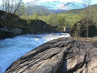
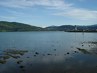
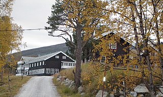
Dunderland is a village in the Dunderland Valley in the municipality of Rana in Nordland county, Norway. The village is located along the Ranelva river, about 10 kilometres (6.2 mi) northeast of the village of Eiteråga and about 40 kilometres (25 mi) from the town of Mo i Rana.

Dunderland Valley valley in Rana, Norway

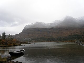
The Dunderland Valley is a valley in the municipality of Rana in Nordland county, Norway. It reaches from just below the eastern Saltfjellet plateau about 8 miles (13 km) south of the Arctic circle. The mountain Bolna is situated in the uppermost boundary of the valley which then proceeds to the southwest all the way down to the Ranfjorden. Some of the minor side valleys include Plurdalen, Røvassdalen, Bjøllådalen, Grønfjelldalen and Virvassdalen. The valley also includes several villages such as Krokstrand, Bjøllånes, Storvoll, Dunderland, Eiterå, Nevernes, Storforshei, Nevermoen and Røssvoll.

Rana, Norway Municipality in Nordland, Norway

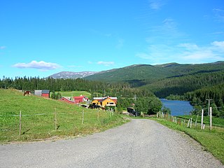
Rana is a municipality in Nordland county, Norway. It is part of the Helgeland traditional region. The administrative centre of the municipality is the town of Mo i Rana, which houses the National Library of Norway. Other population centers in Rana include Alterneset, Båsmoen, Dunderland, Eiteråga, Flostrand, Hauknes, Mæla, Myklebustad, Nevernes, Røssvoll, Selfors, Skonseng, Storforshei, Utskarpen, and Ytteren.

Nordland County (fylke) of Norway

Nordland is a county in Norway in the Northern Norway region, bordering Troms in the north, Trøndelag in the south, Norrbotten County in Sweden to the east, Västerbotten County to the southeast, and the Atlantic Ocean to the west. The county was formerly known as Nordlandene amt. The county administration is in Bodø. The remote Arctic island of Jan Mayen has been administered from Nordland since 1995.

Dunderland Station Dunderland stasjon.jpg
Dunderland Station

The village has a train station, Dunderland Station, on the Nordland Line, between the villages of Skonseng and Lønsdal. The station is situated at an elevation of 127 metres (417 ft) above sea level. [2] [3]

Nordland Line railway line in Norway

The Nordland Line is a 729-kilometer (453 mi) railway line between Trondheim and Bodø, Norway. It is the longest in Norway and lacks electrification. The route runs through the counties of Trøndelag and Nordland, carrying a combination of commuter, long-haul passenger and freight trains. From Trondheim Central Station to Steinkjer Station the line is most heavily used, with hourly services by the Trøndelag Commuter Rail. There are three branch lines—the Stavne–Leangen Line at Leangen Station, the Meråker Line at Hell Station and the Namsos Line at Grong Station.

Skonseng Village in Northern Norway, Norway

Skonseng is a village in the municipality of Rana in Nordland county, Norway. The village is located about 10 kilometres (6.2 mi) northeast of the town of Mo i Rana in an agricultural area with a population of about 1000. The village is located along the south side of the river Ranelva where three valleys meet each other: the Dunderland Valley, Plurdal, and Rødvassdal. The village of Røssvoll lies on the north side of the river, just across from Skonseng. The Nordland Line passes through the village.

Lønsdal Village in Northern Norway, Norway

Lønsdal is a village in the municipality of Saltdal in Nordland county, Norway. The village is located in the Lønsdal valley, along the Lønselva river. European route E06 highway and the Nordland Line both pass through the village. The village also has a train station on the Nordland Line, about halfway between Dunderland Station and Røkland Station.

Related Research Articles

Mo i Rana Town in Northern Norway, Norway

Mo i Rana is a town and the administrative centre of the municipality of Rana in Nordland county, Norway. It is located in the Helgeland region of Nordland, just south of the Arctic Circle. Some of the outlying areas of the town include the suburbs of Båsmoen and Ytteren in the north and Selfors in the east and Åga/Hauknes/Dalsgrenda in the south.

Båsmoen Village in Northern Norway, Norway

Båsmoen is a small village located in the municipality of Rana in Nordland county, Norway. It is located about 7 kilometres (4.3 mi) northwest of the town Mo i Rana. Båsmoen has grown together with its neighboring village to the east, Ytteren. Both villages are sometimes considered a northern suburb of the town of Mo i Rana.

Andfiskvatnet lake in Rana, Norway

Andfiskvatnet is a lake in the municipality of Rana in Nordland county, Norway. The 2.7-square-kilometre (1.0 sq mi) lake lies about 3 kilometres (1.9 mi) southeast of the village of Hauknes and about 6 kilometres (3.7 mi) south of the town of Mo i Rana. The lake flows out into the river Andfiskåga which flows into the Ranfjorden.

Helgåvatnet lake in the municipality of Rana in Nordland county, Norway

Helgåvatnet is a lake in the municipality of Rana in Nordland county, Norway. The 3.52-square-kilometre (1.36 sq mi) lake lies about 5 kilometres (3.1 mi) northeast of the village of Flostrand.

Storakersvatnet lake in Rana, Nordland, Norway

Storakersvatnet or Akersvatnet is a lake in the municipality of Rana in Nordland county, Norway. The lake lies about 15 kilometres (9.3 mi) south of the town of Mo i Rana and less than 900 metres (3,000 ft) from the border with Sweden. The original lake was only 15.9 square kilometres (6.1 sq mi), but a dam was built at the northern end so that it can serve as a reservoir for the Rana power station. This dam has caused the lake to enlarge to an area of 42.3 square kilometres (16.3 sq mi).

Storforshei Village in Northern Norway, Norway

Storforshei is a village in the Dunderland Valley in the municipality of Rana in Nordland county, Norway. The village is located along the river Ranelva, about 25 kilometres (16 mi) northeast of the town of Mo i Rana. The European route E06 and the Nordland Line both pass through the village. The village of Nevernes and the Nevernes Church both lie about 3 kilometres (1.9 mi) to the south.

Saltfjellet mountain range in Nordland, Norway

Saltfjellet is a mountain area in Nordland county, Norway that separates the two regions of Helgeland and Salten. It is also a cultural border between the Southern and Central parts of Sápmi.

Dunderland Line former railway line in Rana, Norway

The Dunderland Line was a 23.7 km (14.7 mi) railway line between Gullsmedvik in the town of Mo i Rana and the village of Storforshei in Rana Municipality in Nordland county, Norway. Since 1942 the line has been part of the Nordland Line. The line was originally built and owned by Dunderland Iron Ore Company, which used it to freight iron ore from their mine at Storforshei to the port at Gullsmedvik.

Ranelva river in Rana, Norway

Ranelva is a 130-kilometre (81 mi) long river in the municipality of Rana in Nordland county, Norway. It is one of the longest rivers in Nordland county. The catchment area of the river is 3,790 square kilometres (1,460 sq mi). Before the power stations of Reinforsen (1925) and Langvatnet (1964) were built, the catchment area was 3,843 square kilometres (1,484 sq mi).

Messingåga river in Rana, Norway

Messingåga (Norwegian) or Siejphjohke (Southern Sami) is a 8-kilometre (5.0 mi) long river which flows northwards, ending up as a tributary to the river Ranelva at Hjartåsen in the small village of Storvoll in the Dunderland Valley in the municipality of Rana in Nordland county, Norway. The river should not be confused with the nearby stream, also named Messingåga, which flows into the river Ranelva from the east, just north of the village of Dunderland.

Virvasselva river in Rana, Norway

Virvasselva or Virvassåga (Norwegian) or Viresjåhkå (Lule Sami) is a river in the municipality of Rana in Nordland county, Norway. The river flows out of the eastern part of the lake Virvatnet. The stream Boneselva meets Virvasselva about 1 kilometre (0.62 mi) east of the lake Virvatnet. This is a large, continuous, very rich and untouched wetland area with tarns, rivers, marshes, and very tight vegetation. Virvasselva has a good population of Arctic char.

Eiteråga Village in Northern Norway, Norway

Eiteråga or Eiterå is a village in the Dunderland Valley in the municipality of Rana in Nordland county, Norway. The village is located along the Ranelva river about 7 kilometres (4.3 mi) east of the village of Storforshei and about 10 kilometres (6.2 mi) south of the village of Dunderland. The European route E6 highway passes through the village. "Stjernen Art and Silver Gallery" is a local shop that produces pieces of jewelry from silver and precious stones.

Bolna Station railway station in Rana, Norway

Bolna Station is a train station on the Nordland Line at Bolna in Rana Municipality in Nordland county, Norway. It is located in the upper Dunderland Valley, along the Ranelva river, between the mountains Bolna and Nasafjellet in the eastern part of the municipality, just 6 kilometres (3.7 mi) west of the border with Sweden. The station is located along the European route E06 highway about 28 kilometres (17 mi) northeast of Dunderland Station. The station opened in 1947, but it is now closed to regular traffic.

Nevernes Village in Northern Norway, Norway

Nevernes is a village in the municipality of Rana in Nordland county, Norway. The rural village is located about 30 kilometres (19 mi) northeast of the town of Mo i Rana. The village is located in the Dunderland Valley along the river Ranelva, about 5 kilometres (3.1 mi) southeast of the village of Storforshei. European route E06 and the Nordland Line both pass through the village. Nevernes Church is located in this village.

Røssvoll Village in Northern Norway, Norway

Røssvoll is a village in the municipality of Rana in Nordland county, Norway. The village is located about 10 kilometres (6.2 mi) north-east of the town of Mo i Rana. The village is located along the north side of the river Ranelva. The European route E06 highway passes through the village, passing right by Røssvoll Church in the centre of the village. Mo i Rana Airport, Røssvoll is also located here.

Ytteren Village in Northern Norway, Norway

Ytteren is a village in the municipality of Rana in Nordland county, Norway. Ytteren and the neighboring village of Båsmoen are northern suburbs of the town of Mo i Rana. They are both located on the northern edge of the mouth of the Ranelva river at the Ranfjorden. Norwegian County Road 12 runs through the village. The large lake Langvatnet lies about 2 kilometres (1.2 mi) north of the village.

References

  1. "Dunderland, Rana (Nordland)". yr.no . Retrieved 2019-02-09.
  2. "List of stations on the Nordlandsbane". Archived from the original on 2006-09-24.
  3. Store norske leksikon. "Dunderland" (in Norwegian). Retrieved 2011-12-22.