The Lower Mainland is a geographic and cultural region of the mainland coast of British Columbia that generally comprises the regional districts of Metro Vancouver and the Fraser Valley. Home to approximately 3.05 million people as of the 2021 Canadian census, the Lower Mainland contains sixteen of the province's 30 most populous municipalities and approximately 60% of the province's total population.

The Fraser Valley is a geographical region in southwestern British Columbia, Canada and northwestern Washington State. It starts just west of Hope in a narrow valley encompassing the Fraser River and ends at the Pacific Ocean stretching from the North Shore Mountains, opposite the city of Vancouver BC, to just south of Bellingham, Washington.

Mission is a city in the Lower Mainland of the province of British Columbia, Canada. It was originally incorporated as a district municipality in 1892, growing to include additional villages and rural areas over the years, adding the original Town of Mission City, long an independent core of the region, in 1969. It is bordered by the city of Abbotsford to the south and the city of Maple Ridge to the west. To the east are the unincorporated areas of Hatzic and Dewdney.

The Stein Valley Nlaka’pamux Heritage Park is located near Lytton, British Columbia, northeast of Vancouver. The park was established in 1995. Currently, the park is being co-managed, operated, and planned through partnership between the Lytton First Nations and the British Columbia Government. The park provides recreational opportunities and cultural heritage activities.

The Fraser Valley Regional District (FVRD) is a regional district in British Columbia, Canada. Its headquarters are in the city of Chilliwack. The FVRD covers an area of 13,361.74 km² (5,159 sq mi). It was created in 1995 by an amalgamation of the Fraser-Cheam Regional District and Central Fraser Valley Regional District and the portion of the Dewdney-Alouette Regional District from and including the District of Mission eastwards.

The Bulkley Valley is in the northwest Central Interior of British Columbia, Canada.

Cheam Peak or Mount Cheam.

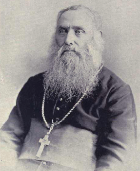
Pierre-Paul Durieu, was a Roman Catholic missionary and the first Bishop of New Westminster, in British Columbia, Canada.
Dewdney, originally named Johnson's Landing from 1884–1892, is an unincorporated community in the Central Fraser Valley of British Columbia, Canada, about 15 km east of the city of Mission. It was incorporated as a district municipality on April 17, 1892, including adjoining areas of Hatzic and Hatzic Island but the anticipated real estate boom on that island didn't pan out and economic damage from the Great Fraser Flood of 1894 led to the municipality's disincorporation on March 12, 1906. Another municipality eastwards, Nicomen, was incorporated in the same year but similarly later disincorporated. Though in the same school district as Mission, it and other adjoining rural areas did not join that municipality when offered. It is now represented as part of Electoral Area 'G' in the regional district government, which currently is the Fraser Valley Regional District.
The Dewdney Trunk Road was one of the earliest major roads in the Fraser Valley of British Columbia, Canada. Originally running from Port Moody to Dewdney, just east of Mission, it exists in three sections today:
Sumas Mountain, also referred to as Canadian Sumas to distinguish it from an identically named mountain just 10 km (6.2 mi) to the south in U.S. state of Washington across the border, is a mountain in eastern Fraser Lowland, in the Lower Mainland region of the Canadian province of British Columbia. It sits on the south bank of the Fraser River, west of the smaller Chilliwack Mountain across the Vedder River mouth, and serves as a geographic landmark dividing the Fraser Valley into "Upper" and "Lower" sections. Sumas Peak is an official name for the summit located on the south shore of the Fraser River in the Fraser Valley between Abbotsford and Chilliwack, British Columbia. Elevation 910 m (2,986 ft) above sea level, prominence 875 m (2,871 ft).
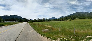
Dewdney Peak, also known unofficially as Hatzic Mountain, is the southwesternmost summit of the Douglas Ranges in the Lower Mainland of southern British Columbia, Canada. Dewdney Peak is located east of Hatzic Prairie and north of Dewdney, British Columbia, from whence it got its name.
Flood is a rural community in the District of Hope, British Columbia, Canada, located west of the town of Hope on the south bank of the Fraser River in the far eastern end of the Fraser Valley region. It is primarily agricultural in nature. Its official name is Floods, though it is usually referred to by its post office name in the singular, Flood.
Pekw'Xe:yles or Peckquaylis is an Indian reserve on the north bank of the Fraser River in Mission, British Columbia, Canada, located between Lower Hatzic Slough and D'Herbomez Creek. It sits on the former site of St. Mary's Indian Residential School 10.3 ha. in area, it was reinstated in June 2005 by Order in Council and is used by 21 Indian bands.

Hatzic Lake is an oxbow lake north of and draining into the Fraser River, immediately south of Hatzic Valley, and east of the benchland neighbourhood of Hatzic.
Hatzic Island is an island located in the centre of Hatzic Lake, an oxbow lake formation north of the Fraser River, on the east side of Mission, British Columbia, Canada.

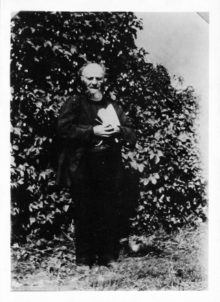
Jean-Marie-Raphaël Le Jeune was a Canadian Roman Catholic priest, linguist, author, and newspaper publisher.

Cascade Falls Regional Park is a regional park under the administration of the Fraser Valley Regional District in the Hatzic Valley of the Lower Mainland region of British Columbia, Canada. The park was originally 9.5 hectares in area but was expanded to a current 22 hectares. It has picnic tables and pit toilets, with various hiking trails and a walkway leading to a viewing platform over a large waterfall, which is 15 minutes walk from the park's parking lot.

Hatzic is a historic community in the Central Fraser Valley region of the Lower Mainland of British Columbia, Canada, located on the east side of the City of Mission and including areas beyond the municipal boundary to the east and northeast.

The Hatzic Valley is the southerly, lowland portion of the Fraser Valley Regional District Electoral Area "F" of British Columbia's Lower Mainland. The valley was carved as a result of southward glacial action, being "centered along a low‐lying glacial trough that extends from Stave Lake to the Fraser Valley."


