
Julian is a census-designated place (CDP) in San Diego County, California, in the United States. As of the 2010 census, the population was 1,502, down from 1,621 at the 2000 census.

The Cuyamaca Mountains, locally the Cuyamacas, are a mountain range of the Peninsular Ranges System, in San Diego County, southern California. The mountain range runs roughly northwest to southeast. The Laguna Mountains are directly adjacent to the east, with Palomar Mountain and Hot Springs Mountain more distant to the north.

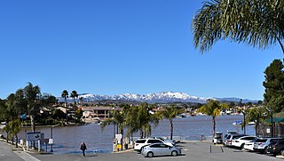
Banner is an unincorporated community in San Diego County, California. It lies at an elevation of 2743 feet. It is located on State Highway 78.
Horno Creek is a creek that empties into the Pacific Ocean through Horno Canyon on the coast of northern San Diego County on the Marine Corps Base Camp Pendleton. It lies south of Foley Creek and north of Las Flores Creek.
Wynola is an unincorporated community located in the Spencer Valley in San Diego County, California.
Spencer Valley, originally known as Coleman Valley in the 19th century, is a mountain valley located in San Diego County, California, at an elevation of 3605 ft. It lies east of the Santa Ysabel Valley and northwest of the town of Julian in the Cuyamaca Mountains. It is drained by Baily Creek which runs down the valley from the north to its confluence with Coleman Creek in the south end of the valley. Its tributary from the east, Jim Green Creek meets Baily Creek just before its confluence with Coleman Creek, that runs from east to west down from Julian to the headwaters of the San Diego River. The unincorporated community of Wynola lies along State Highway 78, in the middle of the valley.
Kentwood-In-The-Pines is an unincorporated community, 0.8 miles east southeast of Julian in San Diego County, California.

Coleman City, also called Emily City, is a ghost town in San Diego County, California. It lies at an elevation of 3601 feet. It is located on State Highway 78 where it crosses Coleman Creek, about four miles west of Julian.

San Mateo Peak is the unofficially named 3,591-foot (1,095 m) peak, at the western end of the ridge running west then northwest from Elsinore Peak to Morrell Canyon, south and west of the Morrell Potrero in the Elsinore Mountains of the Santa Ana Mountain Range. The peak name was given by Sierra Club Lower Peaks Committee Guide, originally named by Ken Croker who for 20 years maintained trails in the Santa Ana Mountains with volunteers from the Sierra Club. It remains officially nameless despite being the highest summit in the Elsinore Mountains, higher than Elsinore Peak, at 3536 ft., the highest named peak in those mountains.
Carbondale, in Orange County, California, is a historical coal mining town in Santiago Canyon, where Santiago Creek had its confluence with Silverado Creek. It had a post office from May 11, 1881, to January 29, 1884, when it was closed and mail sent to the Santa Ana post office.
Elsinore Mountains, a ridge of mountains within the larger range of the Santa Ana Mountains, in the Cleveland National Forest, Riverside County, California, United States. the tallest peaks within the range is the unofficially named San Mateo Peak at 3,591 ft (1,095 m). Second is officially named Elsinore Peak at 3,536 ft (1,078 m). The Elsinore Mountanins run in a ridge from just east of El Cariso, southeast to Elsinore Peak. Beyond that peak the ridge begins to descend and curves to the east. From Elsinore Peak, a ridge runs to the west and then northwest to San Mateo Peak, enclosing the Morrell Potrero on the south and west.
Morrell Potrero is a flat located in the Cleveland National Forest in Riverside County, California. It has an elevation of approximately 3,041 ft (927 m) in the Elsinore Mountains northwest of Elsinore Peak. It is drained by Morrell Canyon Creek, a tributary of San Juan Creek.

Morrell Canyon Creek is a stream or Arroyo, tributary to San Juan Creek, located in the Cleveland National Forest in Riverside County, California, at an elevation of 3,080 ft (939 m), in the Elsinore Mountains northeast of Elsinore Peak. It arises on the eastern slope of San Mateo Peak. An eastern fork draining the Morrell Potrero joins it a little over a mile north of its source and then flows northwestward about a third of a mile where it turns southeast descending the narrow Morrell Canyon east of Lion Spring. After descending 2.5 miles it turns north for half a mile then returns to a southwestern direction for another mile, the canyon widening here until it turns northwestward and down a steep canyon again for half a mile where it takes in from the right Decker Canyon Creek and Long Canyon Creek. It then turns southwestward again into a wider canyon and descends to its confluence with Bear Canyon Creek and becomes the head of San Juan Creek.

Los Alamos Canyon Creek, a stream or arroyo, tributary to San Mateo Creek, in the Cleveland National Forest in Riverside County, California. Its source is at an altitude of 2300 feet, in a canyon on the south face of the ridge of Elsinore Mountains that descends to the southeast from Elsinore Peak. The creek descends southward for a short distance then turns southwest for 4 miles where it turns west for 3 miles down Los Alamos Canyon to its confluence with San Mateo Creek at an elevation of 1312 feet.
Tenaja Canyon Creek, a stream or arroyo, tributary to San Mateo Creek, in the Cleveland National Forest in Riverside County, California. Its source is at an altitude of 1875 feet. The creek has its source at the confluence of arroyos from El Potrero del Tenaja, Redonda Mesa and Squaw Mountain highlands. and it flows northwestward 3 1/2 miles down Tenaja Canyon to its mouth and its confluence near Fishermans Camp, at an elevation of 1112 feet with San Mateo Creek.
Devil Canyon Creek, a stream or arroyo, tributary to San Mateo Creek, in the Santa Margarita Mountains, all but its first and last part within the Cleveland National Forest in San Diego County, California. Its source is at an altitude of 2440 feet on a flat private land in the Santa Margarita Mountains. and it flows southwestward then turns down into the canyon and the San Mateo Wilderness and northward 2 miles before turning westward toward its confluence in San Mateo Canyon with San Mateo Creek at an elevation of 453 feet. The last half mile of the creek before this confluence is outside the National Forest boundary, and within the Camp Pendleton Marine Corps Base. Devil Canyon has one named tributary, Cold Spring Canyon Creek, draining the Santa Margarita Mountains north of the Devil Canyon watershed that enters it from the right about a mile and half above the confluence of Devil Canyon Creek with San Mateo Creek.
Cristianitos Canyon Creek, a stream or arroyo, tributary to San Mateo Creek, in the Santa Ana Mountains. its source is within Orange County, California. Its source is at an altitude of 800 feet, at the head of Cristianitos Canyon, in the foothills of the Santa Ana Mountains, in Orange County. It flows southwestward down Cristianitos Canyon, then turns south towards its confluence with San Mateo Creek, at an elevation of 75 feet, in San Diego County.


