
Thebes, known to the ancient Egyptians as Waset, was an ancient Egyptian city located along the Nile about 800 kilometers (500 mi) south of the Mediterranean. Its ruins lie within the modern Egyptian city of Luxor. Thebes was the main city of the fourth Upper Egyptian nome and was the capital of Egypt for long periods during the Middle Kingdom and New Kingdom eras. It was close to Nubia and the Eastern Desert, with its valuable mineral resources and trade routes. It was a cult center and the most venerated city during many periods of ancient Egyptian history. The site of Thebes includes areas on both the eastern bank of the Nile, where the temples of Karnak and Luxor stand and where the city was situated; and the western bank, where a necropolis of large private and royal cemeteries and funerary complexes can be found. In 1979, the ruins of ancient Thebes were classified by UNESCO as a World Heritage Site.
Mendes, the Greek name of the ancient Egyptian city of Djedet, also known in ancient Egypt as Per-Banebdjedet and Anpet, is known today as Tell El-Ruba.
Intef III was the third pharaoh of the Eleventh Dynasty of Egypt during the late First Intermediate Period in the 21st century BC, at a time when Egypt was divided in two kingdoms. The son of his predecessor Intef II and father of his successor Mentuhotep II, Intef III reigned for 8 years over Upper Egypt and extended his domain North against the 10th Dynasty state, perhaps as far north as the 17th nome. He undertook some building activity on Elephantine. Intef III is buried in a large saff tomb at El-Tarif known as Saff el-Barqa.
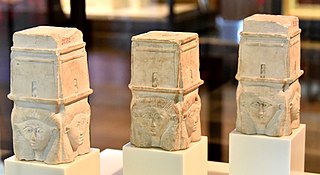
Tuna el-Gebel was the necropolis of Khmun. It is the largest known Greco-Roman necropolis in Egypt, dating from the New Kingdom to the Roman Period, and seeing heavy use in the Ptolemaic Period. Tuna el-Gebel is located in Al Minya Governorate in Middle Egypt.

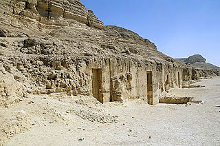
Beni Hasan is an ancient Egyptian cemetery. It is located approximately 20 kilometers (12 mi) to the south of modern-day Minya in the region known as Middle Egypt, the area between Asyut and Memphis.
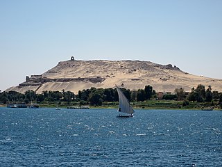
Qubbet el-Hawa or "Dome of the Wind" is a site on the western bank of the Nile, opposite Aswan, that serves as the resting place of ancient nobles and priests from the Old and Middle Kingdoms of ancient Egypt. The necropolis in use from the Fourth Dynasty of Egypt until the Roman Period.

El-Tarif is a necropolis on the West Bank of the Nile, at the site of ancient Thebes (Luxor), Egypt. It is located in the northwestern outskirts of Luxor and southeast of the Valley of the Kings, opposite Karnak, just to the southwest of the modern village of At-Tarif. It is the oldest of West Thebes' necropolises. It is a small mortuary temple, and the farthest north of the Tombs of the Nobles, and contains tombs of the late First Intermediate Period, Second Intermediate Period and early Middle Kingdom. Old Kingdom mastabas are possibly attributed to local rulers of the Fourth or Fifth Dynasty. Eleventh Dynasty tombs of local rulers have also been noted in the form of a series of rock-cut tombs dated to 2061-2010 B.C.E, the largest of which are Intef I to Intef III, who were kings of this dynasty.
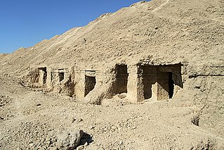
El Hawawish is the ancient necropolis (cemetery) for the city of Akhmim in the 9th Nome of Upper Egypt (UE09), in modern the Sohag Governorate, Egypt.
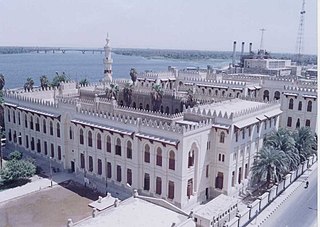
Asyut is the capital of the modern Asyut Governorate in Egypt. It was built close to the ancient city of the same name, which is situated nearby. The modern city is located at 27°11′00″N31°10′00″E, while the ancient city is located at 27°10′00″N31°08′00″E. The city is home to one of the largest Coptic Catholic churches in the country.
Akoris ; Egyptian: Mer-nefer(et), Per-Imen-mat-khent(j), or Dehenet is the Greek name for the modern Egyptian village of Ṭihnā al-Ǧabal, located about 12 km north of Al Minya. The ancient site is situated in the southeast of the modern village.
Deir El Bersha is a Coptic village in Middle Egypt, in the Minya Governorate. It is located on the east bank of the Nile to the south of Antinoöpolis and almost opposite the city of Mallawi. During the pharaonic period, there was a vast cemetery, which is most well known for its decorated Middle Kingdom tombs on the north flank of Wadi Nakhla.

Minya is the capital of the Minya Governorate in Upper Egypt. It is located approximately 245 km (152 mi) south of Cairo on the western bank of the Nile River, which flows north through the city.
Deir el-Gabrawi is a village in Upper Egypt. It is located on the east bank of the Nile, directly east of the city of Manfalut, in the Asyut Governorate.
The necropolis of Meir is an archaeological site in Middle Egypt in the Asyut Governorate located on the west bank of the Nile. Here are the graves of the nomarchs, mayors and priests of Cusae from the ancient Egyptian Old and Middle Kingdom.

El Kab is an Upper Egyptian site on the east bank of the Nile at the mouth of the Wadi Hillal about 80 kilometres (50 mi) south of Luxor. El Kab was called Nekheb in the Egyptian language, a name that refers to Nekhbet, the goddess depicted as a white vulture. In Greek it was called Eileithyias polis, "city of the goddess Eileithyia".
Gabal El Haridi is an archaeological site in Egypt approximately 350 kilometers south of Cairo within Sakulta, in Sohag Governorate in Upper Egypt. The site is located south of Qaw El Kebir (Tjebu), in an area between the towns of El Nawawra and El Gelawiya. The site is very important historically because of the Coptic presence throughout the site. This is because this was the beginning of the use of isolated monasteries that brought the hermits together in a settled community. Significant unknown writings from the Ptolemaic period were found and recorded. The extensive quarrying throughout time suggests that Gabal El Haridi contained one of the more important sources of stone under the Ptolemies and Ramses III. The looting and destruction of the site has caused the site archaeologists great difficulty in determining specific details such as dates and owners of tombs. The details that have been obtained have allowed for a greater understanding of the changes in use of the site throughout its occupation for three thousand years.
Baqet III was an ancient Egyptian official and Great Chief of the Oryx nome during the 11th Dynasty in the 21st century BCE. Apart from the position of governor of the entire nome, Baqet III also held the titles haty-a, treasurer of the king of Lower Egypt, confidential friend, true royal acquaintance, and mayor of Nekheb.

The Oryx nome was one of the 42 nomoi in ancient Egypt. The oryx nome was the 16th nome of Upper Egypt, and was named after the Scimitar oryx. It was located, approximately, in the territories surrounding the modern city of Minya in Middle Egypt.

The Hare nome, also called the Hermopolite nome was one of the 42 nomoi in ancient Egypt; more precisely, it was the 15th nome of Upper Egypt.


