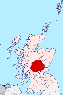
Perthshire, officially the County of Perth, is a historic county and registration county in central Scotland. Geographically it extends from Strathmore in the east, to the Pass of Drumochter in the north, Rannoch Moor and Ben Lui in the west, and Aberfoyle in the south; it borders the counties of Inverness-shire and Aberdeenshire to the north, Angus to the east, Fife, Kinross-shire, Clackmannanshire, Stirlingshire and Dunbartonshire to the south and Argyllshire to the west. It was a local government county from 1890 to 1930.

Perth is a city in central Scotland, on the banks of the River Tay. It is the administrative centre of Perth and Kinross council area and the historic county town of Perthshire. It had a population of about 47,430 in 2018.

Aberfeldy is a burgh in Perth and Kinross, Scotland, on the River Tay. A small market town, Aberfeldy is located in Highland Perthshire. It was mentioned by Robert Burns in the poem The Birks Of Aberfeldy.
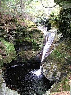
Acharn is a hamlet in the Kenmore parish of the Scottish council area of Perth and Kinross. It is situated on the south shore of Loch Tay close to its eastern end. The hamlet was built in the early 19th century to house workers from the surrounding estates. A watermill was constructed to harness the power of the nearby Acharn Burn, and this was converted into a craft centre in the 1970s, and later into a private residence. There is a bridge in the middle that goes over the Acharn burn.

John Murray, 4th Duke of Atholl, KT, PC, FRS, styled Marquess of Tullibardine from 1764 to 1774, was a Scottish peer.

Dunkeld is a town in Perth and Kinross, Scotland. The location of a historic cathedral, it lies on the north bank of the River Tay, opposite Birnam. Dunkeld lies close to the geological Highland Boundary Fault, and is frequently described as the "Gateway to the Highlands" due to its position on the main road and rail lines north. Dunkeld has a railway station, Dunkeld & Birnam, on the Highland Main Line, and is about 25 kilometres north of Perth on what is now the A9 road. The main road formerly ran through the town, however following modernisation of this road it now passes to the west of Dunkeld.

Kinloch Rannoch is a village in Perth and Kinross, Scotland, at the eastern end of Loch Rannoch, 18 miles (29 km) west of Pitlochry, on the banks of the River Tummel. The village is a tourist and outdoor pursuits centre. It has a small population and is fairly remote.
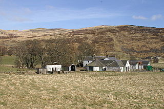
Finegand is a farming hamlet located in eastern Perth and Kinross, Scotland and also refers historically to the portion of lands surrounding the hamlet. Finegand is located in Glen Shee and encompasses the lands east of the Shee Water adjacent to a burn which joins it about 4 miles below the Spittal and about 18 miles north of Blairgowrie.

Logierait is a village and parish in Atholl, Scotland. It is situated at the confluence of the rivers Tay and Tummel, 500 metres west of the A9 road in Perth and Kinross.

The Hermitage is a National Trust for Scotland-protected site in Dunkeld, Perth and Kinross. Located just to the west of the A9, it sits on the banks of the River Braan in Craigvinean Forest. It was created by John Murray, the third Duke of Atholl, who lived in nearby Dunkeld House, in the 18th century to honour the blind bard Ossian. It is home to Ossian's Hall of Mirrors and Ossian's Cave, Georgian follies. The hermit's cave was built around 1760 for the third Earl of Breadalbane, who unsuccessfully advertised for a permanent eremite. The guide in 1869, Donald Anderson, dressed up with a long beard of lichens and clothes of animal skins.

Kirkmichael is a village located in Strathardle, Perth and Kinross, Scotland. It is 13 miles north-northwest of Blairgowrie and 12 miles east-northeast of Pitlochry on the A924 Bridge of Cally to Pitlochry road, and is linked to the A93 Perth to Aberdeen road by the B950. The village is centred around Kirkmichael Bridge over the River Ardle.

Rumbling Bridge is a small village built on both side of a gorge of the River Devon, which formed the boundary between the historic counties of Perthshire and Kinross-shire and is now within the combined Perth and Kinross council area, Scotland, where the A823 leaves the A977. It lies roughly 1 mile equidistant from Muckhart to its north, Crook of Devon to its east and Powmill to its south. It is named after an unusual double bridge, which gives off a distinctive rumbling reverberation at lower levels. Comprising only a few scattered houses until the mid-20th century, most property in the village dates from the 1970s onwards.
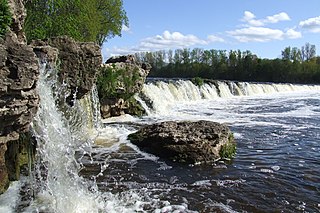
Venta Rapid is a waterfall on the Venta River in Kuldīga, Latvia. It is the widest waterfall in Europe at 249 metres (817 ft), and becomes as wide as 270 metres (886 ft) during spring floods. The height of the falls varies from 1.80 to 2.20 metres depending on the level of water in the river.

Murthly is a village in Perth and Kinross, Scotland. It lies on the south bank of the River Tay, 5 miles southeast of Dunkeld, and 9+1⁄2 miles north of Perth. Perth District Asylum, later known as Murthly Hospital, was opened in the village on 1 April 1864 for 'pauper lunatics'. It was the second district asylum to be built in Scotland under the terms of the 1857 Lunacy (Scotland) Act. It closed in 1984 and was later demolished. The village has a stone circle, in the former grounds of the hospital. The village formerly had a railway station on the Perth and Dunkeld Railway, which closed in 1965.
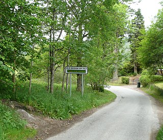
Bridge of Tilt is a village in Perthshire, Scotland, built around the River Tilt, near its confluence with the River Garry. It is 5+3⁄4 miles northwest of Pitlochry. The newer part of the village is continuous with Blair Atholl, only separated by the River Tilt. The village is located primarily on the B8079 between Pitlochry and Dunalastair Water, but the older part of the village is located further up the River Tilt. The A9 runs past the River Garry to the south of Bridge of Tilt, and connects the village with Newtonmore and Inverness in the north and Pitlochry, Perth and Stirling in the south.
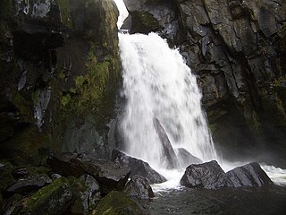
Cauldron Linn, or Caldron Linn, is a waterfall on the River Devon on the border between Clackmannanshire and Perth and Kinross in Scotland.

Puck's Glen is a river-formed ravine on the Cowal peninsula in Argyll and Bute, Scotland, with a popular scenic walking trail beside the Eas Mòr stream. In 2020 the glen and adjoining trails were closed temporarily due to COVID-19 restrictions, issues of stability of the gorge, and felling of trees infected by larch disease.
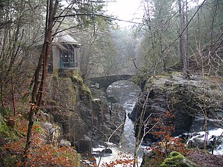
The Hermitage Bridge is an ancient, single-arch stone pedestrian bridge crossing the River Braan near Dunkeld, Perth and Kinross, Scotland. A Category A listed structure, it is in the bounds of The Hermitage, a National Trust for Scotland-protected site. The bridge should not be confused with the Rumbling Bridge, which carries motorised traffic, about 0.62 miles (1.00 km) to the southwest.
Tay Street is a major thoroughfare in the Scottish city of Perth, Perth and Kinross. It is part of the A989. Constructed in the second half of the 19th century, it is named for the River Tay, Scotland's longest river, on the western banks of which it sits. The street runs from the confluence of West Bridge Street and Charlotte Street in the north to a roundabout at Marshall Place and Shore Road in the south. Three of the city's four bridges that cross the Tay do so in this stretch : Perth Bridge, Queen's Bridge and the single-track Tay Viaduct, carrying Perth and Dundee trains to and from the railway station, 0.5 miles (0.80 km) to the north-west.


