Falls of Dee

Last updated
Falls of Dee in July Falls of Dee, Braeriach - geograph.org.uk - 229042.jpg
Falls of Dee in July

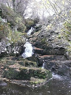
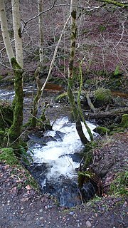
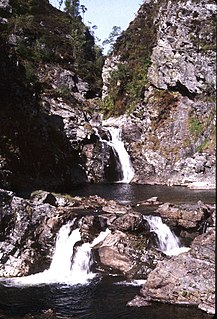
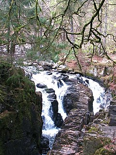
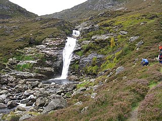
Falls of Dee is a waterfall on Braeriach in the Cairngorms, Scotland. [1]

Braeriach mountain

Braeriach is the third-highest mountain in the British Isles, surpassed only by Ben Nevis and Ben Macdui. It is the highest point in the western massif of the Cairngorms, separated from the central section by the pass of the Lairig Ghru. The summit has a crescent shape, with several corries. In the north-facing corrie of Garbh Coire Mor the snow has completely melted just six times in the last century: 1933, 1959, 1996, 2003, 2006 & 2017 and the patches that linger there are the longest-lying snow patches in Scotland.

Cairngorms mountain range in the eastern Highlands of Scotland

The Cairngorms are a mountain range in the eastern Highlands of Scotland closely associated with the mountain of the Cairn Gorm. The Cairngorms became part of Scotland's second national park on 1 September 2003. Although the Cairngorms give their name to, and are at the heart of, the Cairngorms National Park, they only form one part of the national park, alongside other hill ranges such as the Angus Glens and the Monadhliath, and lower areas like Strathspey.

Scotland Country in Europe, part of the United Kingdom

Scotland is a country that is part of the United Kingdom. Sharing a border with England to the southeast, Scotland is otherwise surrounded by the Atlantic Ocean to the north and west, by the North Sea to the northeast and by the Irish Sea to the south. In addition to the mainland, situated on the northern third of the island of Great Britain, Scotland has over 790 islands, including the Northern Isles and the Hebrides.

See also

Related Research Articles

Chest of Dee

Chest of Dee is a waterfall of Scotland.

The Linn, Ochils is a waterfall of Scotland.

The Stulan is a waterfall of Scotland.

Reekie Linn

Reekie Linn is a waterfall on the River Isla in Perthshire in Scotland.

Linn of Tanar is a waterfall of Scotland.

Eas na Dabhaich

Eas na Dabhaich is a waterfall on the island of Mull in Scotland. The falls lie on a burn that flows from Loch Fraing on the Ross of Mull over high cliffs above Carsaig Bay. There are several more unnamed waterfalls above and along the 200 metres (660 ft) cliffs that stretch from east of Carsaig along to Malcolm's Point and the Carsaig Arches 5 kilometres (3.1 mi) to the west where they are called Aoineadh Mòr and beyond where the height is reduced to about 130 metres (430 ft) and they are known as Aoineadh Beag.

Eas nan Liathanach is a waterfall of Scotland.

Falls of Balnaguard

Falls of Balnaguard is a waterfall of Scotland.

Falls of Camserney

Falls of Camserney is a waterfall of Scotland.

Falls of Damff

Falls of Damff is a waterfall of Scotland.

Falls of Fender is a waterfall of Scotland.

Falls of Moness is a waterfall of Scotland. The Falls of Moness located in Aberfeldy, Perthshire, Scotland is a 150m high waterfall tucked away in the Birks of Aberfeldy.

Falls of Monzie is a waterfall of Scotland.

Falls of Tarf

The Falls of Tarf is a waterfall on the Tarf Water in the eastern Highlands of Scotland. Immediately downstream of the falls the Tarf is joined by a second, smaller river to become the River Tilt.

Falls of the Braan

Falls of the Braan is a waterfall of Scotland located in the Hermitage at the National Trust for Scotland-protected site in Dunkeld, Perth and Kinross.

Falls of Glas Allt is a 50-metre (160 ft) waterfall near the head of Loch Muick, Aberdeenshire, Scotland. Queen Victoria liked to take walks here beside the stream flowing from Lochnagar down to Loch Muick. After the death of Prince Albert she had a cottage, Glas-allt-Shiel, rebuilt for her on the delta where the stream flows into the loch.

Falls of Turret

Falls of Turret is a waterfall of Scotland.

Falls of Unich

Falls of Unich is a waterfall of Scotland.

Stuck Chapel Spout is a waterfall of Scotland.

Swallow Craig is a waterfall of Scotland.

References

  1. Ordnance Survey 1:25,000 scale Explorer map series, sheets 309-470

Coordinates: 56°59′56″N3°44′30″W / 56.99892°N 3.74161°W / 56.99892; -3.74161

Geographic coordinate system Coordinate system

A geographic coordinate system is a coordinate system that enables every location on Earth to be specified by a set of numbers, letters or symbols. The coordinates are often chosen such that one of the numbers represents a vertical position and two or three of the numbers represent a horizontal position; alternatively, a geographic position may be expressed in a combined three-dimensional Cartesian vector. A common choice of coordinates is latitude, longitude and elevation. To specify a location on a plane requires a map projection.