The Kechika River, also historically known as Black's River, is a tributary of the Liard River, about 230 km (140 mi) long, located in northern British Columbia, Canada.
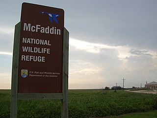
The McFaddin and Texas Point National Wildlife Refuges are located in proximity in southern Jefferson County on the upper Texas coast at Sabine Pass. The refuges have a combined 105.96 square miles (274.4 km2) of fish and wildlife habitat. McFaddin, much the larger one, located at around 29°40′00″N94°09′00″W, has a total area of 58,861.43 acres (238.20 km²), while the smaller Texas Point, located at around 29°42′00″N93°53′00″W, has 8,952.02 acres (36.23 km²).
Hyland River Provincial Park is a provincial park in British Columbia, Canada, located near the boundary with Yukon along the Alaska Highway just east of the community of Lower Post and north of the Liard River. Established in 2000, the park is 34 ha. in area.
Roberts Creek Provincial Park is a provincial park in British Columbia, Canada, located northwest of the community of Roberts Creek, between Gibsons and Sechelt. First created in 1947 with an area of 100 acres (0.40 km2), it was modified in size in 2000 to approximately 40 ha.
Sustut Provincial Park and Protected Area is a provincial park in British Columbia, Canada, located on the east side of the Sustut River and above the Bear River. Established by order-in-council in 2001, the park has an area of 75,037 ha. The park protects the Hogem Ranges and the Connelly Range and is in the traditional territories of the Tsay Keh Dene First Nation and the Gitxsan First Nation.

The Gwa'Sala-Nakwaxda'xw Nations are a union of two Kwakwaka'wakw peoples in a band government based on northern Vancouver Island in British Columbia, Canada, whose main reserve community is near the town of Port Hardy in the Queen Charlotte Strait region of the Central Coast region of British Columbia, Canada. The band government is a member of the Kwakiutl District Council and, for treaty negotiation purposes, the Winalagalis Treaty Group which includes three other members of the Kwakiutl District Council.

'Ksan is a historical village and living museum of the Gitxsan Indigenous people in the Skeena Country of Northwestern British Columbia, Canada. 'Ksan is located near Hazelton at the confluence of the Skeena and Bulkley Rivers on Gitxsan territory.
The Jennings River is a river in far northern British Columbia, Canada, rising in the northern reaches of the Stikine Ranges of the Cassiar Mountains, at first running southwest, then turning northeast near the Tuya Range to enter Teslin Lake at its southern end, just to the east of the estuary of the Teslin River; also joining the lake in the same area is the Hayes River. The lower reaches of the Jennings form the boundary of the Nisutlin Plateau, which extends north into the Yukon along the eastern flank of Teslin Lake and to the west of the northernmost reaches of the Stikine Ranges; Simpson Peak is one of the few named summits in that region of the Stikines, and stands above the lower Jennings to the east of its estuary. To the south of the Jennings, west of the Tuya Range, is the Kawdy Plateau, which includes the small but rugged Atsutla Range, and southwest of which is the course of the Teslin River, which traverses the Kawdy, a subset of the Stikine Plateau, from south to north.

Fitz Hugh Sound, sometimes spelled Fitzhugh Sound, is a sound on the British Columbia Coast of Canada, located between Calvert Island and the mainland. Fitz Hugh Sound is part of a group of named bodies of water around the opening of Dean Channel, one of the coast's main fjords, where it intersects the infra-insular waterway known as the Inside Passage. Queen Charlotte Sound lies to its west, beyond which is the open ocean. Fitz Hugh Sound is the southern limit of the large group of offshore islands known as the North Coast Archipelago, which extends to the Dixon Entrance and the opening of the Portland Canal at the boundary of Alaska.
Belize Inlet is an inlet on the Central Coast of British Columbia, Canada, located to the north of and adjoining Seymour Inlet.
The Teslin Plateau is a plateau, of the Yukon Plateau physiographic section, in northern British Columbia, Canada, located north of the Nakina River between Atlin Lake and Teslin Lake.
The Taku River Tlingit First Nation are the band government of the Inland Tlinkit in far northern British Columbia, Canada and also in Yukon. They comprise two ḵwaan (tribes) of the Tlingit people, who are otherwise coastal, the Áa Tlein Ḵwáan of the Atlin Lake area and the Deisleen Ḵwáan of Teslin Lake, whose main focus is the Teslin Tlingit Council in Teslin, Yukon. Their band offices are in Atlin, British Columbia.
Kitselas First Nation is the band government of the Kitselas subgroup of the Tsimshian. The band government is based at Gitaus in the Skeena Valley in the Skeena River valley to the northeast of the city of Terrace, British Columbia, Canada. Though there is no Tsimshian tribal council, they are a participant in the Tsimshian First Nations treaty council.
Horneline Creek Provincial Park is a provincial park in far northern British Columbia, Canada. It is located west of the Kechika River about 130 km south of Lower Post and 30 km north of Denetiah Provincial Park and southwest of the community of Liard River.
The Red River is a tributary of the Kechika River in the far north of British Columbia, Canada, flowing east to meet the Kechika from headwaters in the Cassiar Mountains. In its middle reaches it forms the boundary between the Dease Plateau (N) and the Cassiar Mountains (S) and for its final stretch it crosses part of the Liard Plain. It is crossed by an unnamed road about 17.5 kilometres (10.9 mi) upstream from its confluence with the Kechika, and is just to the north of Aeroplane Lake.
The Liard Plateau is a plateau in far northern British Columbia, Canada, located between the Smith and Liard Rivers, and extending north into the Yukon.
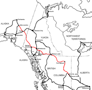
The Liard Country, sometimes known simply as "the Liard", is the usual name for a region of far northern British Columbia, Canada, generally describing the immediate environs of the Liard River along the Alaska Highway, and west of the line of the Rockies.
South Bentinck is a locality on South Bentinck Arm in the Central Coast region of British Columbia, Canada, located on the north side of the mouth of the Noeick River on the east shore of that inlet.