First River

Last updated
First River
River
Country United States
State New Jersey
Counties Essex
Mouth Passaic River
 - location Newark, Essex , New Jersey , United States

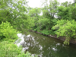
The First River, in the state of New Jersey in the United States, is a subterranean river and the first main tributary of the Passaic River encountered while travelling upstream from its mouth at Newark Bay.

New Jersey State of the United States of America

New Jersey is a state in the Mid-Atlantic and Northeastern regions of the United States. It is located on a peninsula, bordered on the north and east by the state of New York, particularly along the extent of the length of New York City on its western edge; on the east, southeast, and south by the Atlantic Ocean; on the west by the Delaware River and Pennsylvania; and on the southwest by the Delaware Bay and Delaware. New Jersey is the fourth-smallest state by area but the 11th-most populous, with 9 million residents as of 2017, and the most densely populated of the 50 U.S. states; its biggest city is Newark. New Jersey lies completely within the combined statistical areas of New York City and Philadelphia. New Jersey was the second-wealthiest U.S. state by median household income as of 2017.

United States Federal republic in North America

The United States of America (USA), commonly known as the United States or America, is a country composed of 50 states, a federal district, five major self-governing territories, and various possessions. At 3.8 million square miles, the United States is the world's third or fourth largest country by total area and is slightly smaller than the entire continent of Europe's 3.9 million square miles. With a population of over 327 million people, the U.S. is the third most populous country. The capital is Washington, D.C., and the largest city by population is New York City. Forty-eight states and the capital's federal district are contiguous in North America between Canada and Mexico. The State of Alaska is in the northwest corner of North America, bordered by Canada to the east and across the Bering Strait from Russia to the west. The State of Hawaii is an archipelago in the mid-Pacific Ocean. The U.S. territories are scattered about the Pacific Ocean and the Caribbean Sea, stretching across nine official time zones. The extremely diverse geography, climate, and wildlife of the United States make it one of the world's 17 megadiverse countries.

Subterranean river A river that runs wholly or partly beneath the ground surface

A subterranean river is a river that runs wholly or partly beneath the ground surface – one where the riverbed does not represent the surface of the Earth. It should also not be confused with an aquifer which may flow like a river but is contained within a permeable layer of rock or other unconsolidated materials.

Beginning at the confluence of Mill Brook and Branch Brook [1] (near the present Skating Center in Branch Brook Park), the First River flowed parallel to Seventh Avenue and Clay Street, discharging into the Passaic River in the vicinity of the Clay Street bridge.

Branch Brook Park

Branch Brook Park is a county park of Essex County, New Jersey in the United States, located in the North Ward of Newark, between the neighborhoods of Forest Hill and Roseville. A portion of the park is also located within the Township of Belleville. At 360 acres (150 ha), Branch Brook Park is the largest public park in the city of Newark. The park is noted for the largest collection of cherry blossom trees in the United States, having over 5,000 in more than eighteen different varieties collectively called Cherryblossomland, as well as its spectacular Cherry Blossom Festival each April.

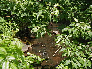
The First River was also known as Mill Brook, having supported several mills, including grist mills for the earliest settlers of Newark in the 17th century.

Watermill structure that uses a water wheel or turbine to drive a mechanical process

A watermill or water mill is a mill that uses hydropower. It is a structure that uses a water wheel or water turbine to drive a mechanical process such as milling (grinding), rolling, or hammering. Such processes are needed in the production of many material goods, including flour, lumber, paper, textiles, and many metal products. These watermills may comprise gristmills, sawmills, paper mills, textile mills, hammermills, trip hammering mills, rolling mills, wire drawing mills.

From 1863 to 1890 the brook was culvertised and now flows underground through two culverts, each six feet nine inches (206 cm) high by nine feet three inches (282 cm) wide until discharging into the Passaic. [2] The brook once flowed through, and now flows under, what is now Branch Brook Park in the city of Newark. [3]

Culvert Structure that allows the passage of water or organisms under an obstruction

A culvert is a structure that allows water to flow under a road, railroad, trail, or similar obstruction from one side to the other side. Typically embedded so as to be surrounded by soil, a culvert may be made from a pipe, reinforced concrete or other material. In the United Kingdom, the word can also be used for a longer artificially buried watercourse.

Newark, New Jersey City in New Jersey, United States

Newark is the most populous city in the U.S. state of New Jersey and the seat of Essex County. As one of the nation's major air, shipping, and rail hubs, the city had a population of 285,154 in 2017, making it the nation's 70th-most populous municipality, after being ranked 63rd in the nation in 2000.

See also

Related Research Articles

New Jersey Route 21 highway in New Jersey

Route 21 is a highway in Northern New Jersey, running 14.35 mi (23.09 km) from the Newark Airport Interchange with U.S. Route 1/9 and U.S. Route 22 in Newark, Essex County to an interchange with U.S. Route 46 in Clifton, Passaic County. The route is a four- to six-lane divided highway known as McCarter Highway on its southern portion in Newark that serves as a connector between the Newark and Paterson areas, following the west bank of the Passaic River for much of its length. It also serves as the main north–south highway through the central part of Newark, connecting attractions in Downtown Newark with Newark Airport. The portion of Route 21 through Newark is a surface arterial that runs alongside the elevated Northeast Corridor rail line through the southern part of the city and continues north through Downtown Newark while the portion north of Downtown Newark is a freeway. Route 21 intersects many major roads including Interstate 78, Route 27, and Interstate 280 in Newark, Route 7 in Belleville, and Route 3 in Clifton.

Passaic River river in New Jersey, United States

The Passaic River is a river, approximately 80 mi (129 km) long, in northern New Jersey in the United States. The river in its upper course flows in a highly circuitous route, meandering through the swamp lowlands between the ridge hills of rural and suburban northern New Jersey, called the Great Swamp, draining much of the northern portion of the state through its tributaries. In its lower portion, it flows through the most urbanized and industrialized areas of the state, including along downtown Newark. The lower river suffered from severe pollution and industrial abandonment in the 20th century. In April 2014, the U.S. Environmental Protection Agency announced a $1.7 billion plan to remove 4.3 million cubic yards of toxic mud from the bottom of lower eight miles of the river. It is considered one of the most polluted stretches of water in the nation and the project one of the largest clean-ups ever undertaken.

Hackensack River river in New Jersey

The Hackensack River is a river, approximately 45 miles (72 km) long, in the U.S. states of New York and New Jersey, emptying into Newark Bay, a back chamber of New York Harbor. The watershed of the river includes part of the suburban area outside New York City just west of the lower Hudson River, which it roughly parallels, separated from it by the New Jersey Palisades. It also flows through and drains the New Jersey Meadowlands. The lower river, which is navigable as far as the city of Hackensack, is heavily industrialized and forms a commercial extension of Newark Bay. Once believed to be among the most polluted water courses in the United States, it had staged a modest revival by the late 2000s.

Toneys Brook

Toney's Brook is a tributary of the Second River in Essex County, New Jersey in the United States.

Second River (New Jersey) river in United States of America

The Second River, or Watsessing River, in the state of New Jersey in the United States, is the second main tributary of the Passaic River encountered while travelling upstream from its mouth at Newark Bay.

Rockaway River river in the United States of America

The Rockaway River is a tributary of the Passaic River, approximately 35 mi (56 km) long, in northern New Jersey in the United States. The upper course of the river flows through a wooded mountainous valley, whereas the lower course flows through the populated New Jersey suburbs and former industrial area west of New York City. It drains an area of approximately 130 sq mi (340 km²).

Hatfield Swamp is a fresh water wetland area in the US state of New Jersey, forming what might be considered the "second bank" of the Passaic River between Morris and Essex counties.

Downtown Newark central business district in United States

Downtown Newark is the Central Business District of Newark in Essex County, New Jersey, United States.

Broadway, Newark human settlement in United States of America

Broadway is an unincorporated community and neighborhood within the city of Newark in Essex County, New Jersey, United States. It is located on the west bank of the Passaic River, in Newark's North Ward, east of Forest Hill and north of Seventh Avenue. The neighborhood extends from Interstate 280 to Belleville. The term "Broadway" has only come into use recently, most Broadway residents simply refer to their area as part of the North Ward. The street itself "Broadway" was called "Washington Avenue" until the early twentieth century. Today, the area is predominantly Italian American and Puerto Rican, with a growing population from other parts of Latin America. The New Jersey Historical Society was located here from the 1930s to 1997. The neo-classical Mutual Benefit building was constructed in the Broadway neighborhood in 1927. The district has many old brownstones in various states of repair. There are high-rise apartment buildings overlooking Branch Brook Park.

Saddle River (Passaic River tributary) river in the United States of America

The Saddle River flows south through much of Bergen County, New Jersey. The river runs through densely populated suburban areas for much of its course. The river takes its name from the river near Saddell in Argyll and Bute in Scotland.

Slough Brook is a tributary of the Passaic River in Essex County, New Jersey in the United States.

Canoe Brook is a tributary of the Passaic River in the U.S. state of New Jersey.

Stony Brook (Millstone River tributary) tributary of the Millstone River in Mercer County, New Jersey

Stony Brook, also known as Stoney Brook, is a tributary of the Millstone River in Hunterdon and Mercer counties, New Jersey, in the United States.

Passumpsic River river in the United States of America

The Passumpsic River is a 22.7-mile-long (36.5 km) tributary of the Connecticut River, in Vermont. Though primarily a Caledonia County river, it is the only river to flow through all three counties of the Northeast Kingdom.

The Lenape Trail is a trail connecting Newark, New Jersey with Roseland, New Jersey. It was established in 1982. It is the fifth longest trail in the state behind the Delaware and Raritan Canal Trail, the Appalachian Trail, the completed section of the Highlands Trail in the state and the Batona Trail. The Lenape trail traverses Newark and its suburbs, as well as the Watchung Mountains and Passaic Meadows. Because of the steepness of the Watchung Mountains and the flood-prone nature of the Passaic Meadows, the former basin of Glacial Lake Passaic, these areas have remained much less developed than the rest of the northeastern part of the state. This trail therefore offers hikers an opportunity to see cultural and historical sites of an urban trail, as well as large natural and undeveloped areas. The trail's proximity to New York City and the various ridges it traverses, including Forest Hill, Orange Mountain, and Second Watchung Mountain, offer many views of the skyline. The Lenape Trail forms a segment of the Liberty-Water Gap Trail and incorporates the West Essex Trail, the Lenape Trail's only rail-to-trail section. The Lenape Trail also connects with Morris County's Patriots Path trail system on its western terminus.

Goffle Hill mountain in United States of America

Goffle Hill, also referred to as Goffle Mountain and historically known as Totoway Mountain and Wagaraw Mountain, is a range of the trap rock Watchung Mountains on the western edge of the Newark Basin in northern New Jersey. The hill straddles part of the border of Bergen County and Passaic County, underlying a mostly suburban setting. While hosting patches of woodlands, perched wetlands, and traprock glades, the hill is largely unprotected from development. Extensive quarrying for trap rock has obliterated large tracts of the hill in North Haledon, and Prospect Park. Conservation efforts seeking to preserve undeveloped land, such as the local Save the Woods initiative (2007–present), are ongoing.

Newark and New York Railroad

The Newark and New York Railroad was a passenger rail line that ran between Downtown Newark and the Communipaw Terminal at the mouth of the North River in Jersey City, bridging the Hackensack River and Passaic River just north of their mouths at the Newark Bay in northeastern New Jersey. The Central Railroad of New Jersey operated it from its opening in 1869. Through operation ended in 1946; portions remained in use until 1967.

Middlebush Brook (New Jersey)

Middlebush Brook is a tributary of Six Mile Run in Somerset County, New Jersey in the United States.

Ten Mile Run (New Jersey)

Ten Mile Run is a tributary of the Millstone River, draining an area in southern South Brunswick and southern Franklin Park, New Jersey in the United States.

Weasel Brook is a tributary of the Passaic River in Passaic County, New Jersey, United States. Weasel Brook flows through Clifton and through Weasel Brook Park.

References

Coordinates: 39°35′52″N74°38′30″W / 39.597905°N 74.641703°W / 39.597905; -74.641703

Geographic coordinate system Coordinate system

A geographic coordinate system is a coordinate system that enables every location on Earth to be specified by a set of numbers, letters or symbols. The coordinates are often chosen such that one of the numbers represents a vertical position and two or three of the numbers represent a horizontal position; alternatively, a geographic position may be expressed in a combined three-dimensional Cartesian vector. A common choice of coordinates is latitude, longitude and elevation. To specify a location on a plane requires a map projection.