Related Research Articles

Arthur's Pass National Park is located in the South Island of New Zealand and covers 1,185 km2 of mostly mountainous terrain. Adjacent to it lies Craigieburn Forest Park.

Arthur's Pass, a mountain pass in the Southern Alps of the South Island of New Zealand, marks part of the boundary between the West Coast and Canterbury regions. Located 140 km from Christchurch and 95 km from Greymouth, the pass comprises part of a saddle between the valleys of the Otira River and of the Bealey River. Arthur's Pass lies on the border of the Selwyn and Westland districts.

The Waimakariri River is one of the largest rivers in Canterbury, on the eastern coast of New Zealand's South Island. It flows for 151 kilometres (94 mi) in a generally southeastward direction from the Southern Alps across the Canterbury Plains to the Pacific Ocean.
Craigieburn is the name of a settlement and several geographic features in northwest Canterbury, in New Zealand's South Island.

Selwyn District is a predominantly rural district in central Canterbury, on the east coast of New Zealand's South Island. It is named after the Selwyn River / Waikirikiri, which is in turn named after Bishop George Selwyn, the first Anglican bishop of New Zealand who, in 1843 and 1844, travelled the length of the country by horse, foot, boat and canoe, leaving in his wake a sprinkling of locations that now bear his name.

Waimakariri District is a local government district, located in the Canterbury Region of New Zealand's South Island. It is named after the Waimakariri River, which forms the district's southern boundary, separating it from Christchurch City and the Selwyn District. It is bounded in the north by the Hurunui District and in the east by the Pacific Ocean.

Castle Hill is a location and a high country station in New Zealand's South Island. It is located at an altitude of 700 metres, close to State Highway 73 between Springfield and Arthur's Pass. It is private property and located within the Kura Tawhiti Conservation Area.

The Hells Canyon Wilderness is a wilderness area in the western United States, in Idaho and Oregon. Created 48 years ago in 1975, the Wilderness is managed by both the U.S. Bureau of Land Management and the U.S. Forest Service and contains some of the most spectacular sections of the Snake River as it winds its way through Hells Canyon, North America's deepest river gorge and one of the deepest gorges on Earth. The Oregon Wilderness Act of 1984 added additional acreage and currently the area protects a total area of 217,927 acres (88,192 ha). It lies entirely within the Hells Canyon National Recreation Area except for a small 946-acre (383 ha) plot in southeastern Wallowa County, Oregon which is administered by the Bureau of Land Management. The area that is administered by the Forest Service consists of portions of the Wallowa, Nez Perce, Payette, and Whitman National Forests.
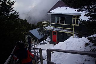
Broken River is a club skifield in South Island, New Zealand. Run by the Broken River Ski Club, it is located at about 110 km (68 mi) from Christchurch. The skifield claims to often have the longest ski season anywhere in Australasia. Also, by connecting with Craigieburn Valley, it claims to have the largest skiable area in New Zealand, at 900 hectares.
Porters, is a commercial ski resort just over an hour's drive (98km) west from Christchurch, in the South Island of New Zealand. Originally functioning as a club skifield, it has one beginner magic carpet, one platter tow, one chairlift and three t-bars. The difficulty of the slopes is distributed as 15% beginner, 35% intermediate and 50% advanced. Modern grooming equipment is used, and snowmaking facilities operate along the main pistes along the chairlift.

Eagle Cap Wilderness is a wilderness area located in the Wallowa Mountains of northeastern Oregon, within the Wallowa–Whitman National Forest. The wilderness was established in 1940. In 1964, it was included in the National Wilderness Preservation System. A boundary revision in 1972 added 73,000 acres (30,000 ha) and the Wilderness Act of 1964 added 66,100 acres (26,700 ha) resulting in a current total of 361,446 acres, making Eagle Cap by far Oregon's largest wilderness area.

Craigieburn Forest Park is a protected area in the South Island of New Zealand, adjacent to Arthur's Pass National Park to the north.
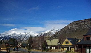
Castle Hill Village is an alpine village in Canterbury, New Zealand that started in 1982.
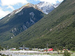
Arthur's Pass, previously called Camping Flat then Bealey Flats, and for some time officially Arthurs Pass, is a township in the Southern Alps of the South Island of New Zealand, located in the Selwyn district. It is a popular base for exploring Arthur's Pass National Park.

State Highway 73 is a major east-west South Island state highway in New Zealand connecting Christchurch on the east coast with Cass/Hokitika via the Southern Alps. It is mostly two lane, with some single-lane bridges north of Springfield but is mostly dual carriageway in Christchurch. The fourth and fifth-highest points of New Zealand's state highway network are on this road at Porters Pass and Arthur's Pass respectively.
John Charles Watts-Russell JP was a 19th-century New Zealand politician, a member of the Canterbury Provincial Council and a member of the Legislative Council. He was supposedly the wealthiest of the early settlers, and his homestead became the centre of entertainment in Christchurch. He was a significant runholder and, together with a business partner, was responsible for building up the Canterbury sheep stock.

The Cass River is an alpine river in the Canterbury region of the South Island of New Zealand. It rises near the Cass Saddle in the Craigieburn Forest Park and flows generally northeast alongside the Craigieburn Range before turning north to meet the Waimakariri River. State Highway 73 and the Midland Line both cross the lower reaches of the river near a farming locality named Cass.
Lake Hawdon is a small high country lake in Canterbury, New Zealand.

Korowai / Torlesse Tussocklands Park is a protected area in Canterbury, New Zealand. Covering around 21,000 hectares, it is located on both sides of State Highway 73, from east of Porters Pass to south of Castle Hill Village.
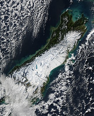
The South Island, with an area of 150,437 km2 (58,084 sq mi), is the largest landmass of New Zealand; it contains about one-quarter of the New Zealand population and is the world's 12th-largest island. It is divided along its length by the Southern Alps, the highest peak of which is Aoraki / Mount Cook at 3,724 metres (12,218 ft), making it 9th-highest island, with the high Kaikōura Ranges to the northeast. There are eighteen peaks of more than 3,000 metres (9,800 ft) in the South Island. The east side of the island is home to the Canterbury Plains while the West Coast is famous for its rough coastlines such as Fiordland, a very high proportion of native bush, and Fox and Franz Josef Glaciers. The dramatic landscape of the South Island has made it a popular location for the production of several films, including The Lord of the Rings trilogy and The Chronicles of Narnia: The Lion, the Witch and the Wardrobe. It lies at similar latitudes to Tasmania, and parts of Patagonia in South America.
References
- Cronshaw, Tim. "Juggling act: 18,000ha", The Press, Christchurch, Friday 20 February 2009.
Coordinates: 43°7′48.58″S171°46′20.37″E / 43.1301611°S 171.7723250°E