Flow control structure

Last updated
Weir on Lake Tecumseh, Virginia Weir installed at Lake Tecumseh (6424924031).jpg
Weir on Lake Tecumseh, Virginia

A flow control structure is a device that alters the flow of water in a stream, drainage channel or pipe. As a group these are passive structures since they operate without intervention under different amounts of water flow and their impact changes based on the quantity of water available. This includes weirs, flow splitters and proprietary-design devices that are used for stormwater management and in combined sewers. [1]

Stream A body of surface water flowing down a channel

A stream is a body of water with surface water flowing within the bed and banks of a channel. The stream encompasses surface and groundwater fluxes that respond to geological, geomorphological, hydrological and biotic controls.

Drainage natural or artificial removal of surface and sub-surface water from an area

Drainage is the natural or artificial removal of a surface's water and sub-surface water from an area with excess of water. The internal drainage of most agricultural soils is good enough to prevent severe waterlogging, but many soils need artificial drainage to improve production or to manage water supplies.

Weir barrier across a river designed to alter its flow characteristics

A weir or low head dam is a barrier across the width of a river that alters the flow characteristics of water and usually results in a change in the height of the river level. There are many designs of weir, but commonly water flows freely over the top of the weir crest before cascading down to a lower level.

Contents

Flow-control structures are known to have existed for thousands of years. Some built by the Chinese have been in continuous use for over 2,000 years. The Chinese used these structures to divert water to irrigate fields and to actually deposit silt in specific areas so that the channels were not blocked by silt build-up. Structures like this required yearly maintenance to remove the accumulated silt.

China Country in East Asia

China, officially the People's Republic of China (PRC), is a country in East Asia and the world's most populous country, with a population of around 1.404 billion. Covering approximately 9,600,000 square kilometers (3,700,000 sq mi), it is the third- or fourth-largest country by total area. Governed by the Communist Party of China, the state exercises jurisdiction over 22 provinces, five autonomous regions, four direct-controlled municipalities, and the special administrative regions of Hong Kong and Macau.

Silt is granular material of a size between sand and clay, whose mineral origin is quartz and feldspar. Silt may occur as a soil or as sediment mixed in suspension with water and soil in a body of water such as a river. It may also exist as soil deposited at the bottom of a water body, like mudflows from landslides. Silt has a moderate specific area with a typically non-sticky, plastic feel. Silt usually has a floury feel when dry, and a slippery feel when wet. Silt can be visually observed with a hand lens, exhibiting a sparkly appearance. It also can be felt by the tongue as granular when placed on the front teeth.

More modern structures add to these basic principles. In Hawaii, there are numerous flow-control structures that have been built to irrigate the pineapple and sugar cane fields. The purpose of these structures is to divert water into the various canals and to keep them full. When over full, they dump excess water back into either streams or other canals. Among the simplest is a low dam across a shallow stream, forcing all of the water to one side to allow it to be easily collected in a canal. This can keep a canal full even with very low flows in a stream.

Hawaii State of the United States of America

Hawaii is the 50th and most recent state to have joined the United States, having received statehood on August 21, 1959. Hawaii is the only U.S. state located in Oceania, the only U.S. state located outside North America, and the only one composed entirely of islands. It is the northernmost island group in Polynesia, occupying most of an archipelago in the central Pacific Ocean.

Pineapple species of plant

The pineapple is a tropical plant with an edible fruit, also called pineapples, and the most economically significant plant in the family Bromeliaceae.

Dam A barrier that stops or restricts the flow of surface or underground streams

A dam is a barrier that stops or restricts the flow of water or underground streams. Reservoirs created by dams not only suppress floods but also provide water for activities such as irrigation, human consumption, industrial use, aquaculture, and navigability. Hydropower is often used in conjunction with dams to generate electricity. A dam can also be used to collect water or for storage of water which can be evenly distributed between locations. Dams generally serve the primary purpose of retaining water, while other structures such as floodgates or levees are used to manage or prevent water flow into specific land regions. The earliest known dam is the Jawa Dam in Jordan, dating to 3,000 BC.

Another simple device is a series of concrete piers installed in a spillway to slow down the descending water so that it does not cause damage at the bottom of the spillway.

Concrete Composite construction material

Concrete, usually Portland cement concrete, is a composite material composed of fine and coarse aggregate bonded together with a fluid cement that hardens over time—most frequently a lime-based cement binder, such as Portland cement, but sometimes with other hydraulic cements, such as a calcium aluminate cement. It is distinguished from other, non-cementitious types of concrete all binding some form of aggregate together, including asphalt concrete with a bitumen binder, which is frequently used for road surfaces, and polymer concretes that use polymers as a binder.
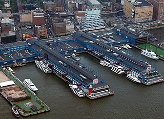
Pier Raised structure in a body of water, typically supported by well-spaced piles or pillars

A pier is a raised structure in a body of water, typically supported by well-spaced piles or pillars. Bridges, buildings, and walkways may all be supported by piers. Their open structure allows tides and currents to flow relatively unhindered, whereas the more solid foundations of a quay or the closely spaced piles of a wharf can act as a breakwater, and are consequently more liable to silting. Piers can range in size and complexity from a simple lightweight wooden structure to major structures extended over 1600 metres. In American English, a pier may be synonymous with a dock.

Spillway structure for controlled release of flows from a dam or levee

A spillway is a structure used to provide the controlled release of flows from a dam or levee into a downstream area, typically the riverbed of the dammed river itself. In the United Kingdom, they may be known as overflow channels. Spillways ensure that the water does not overflow and damage or destroy the dam.
Applications

Low-impact development (U.S. and Canada)

Low-impact development (LID) is a term used in Canada and the United States to describe a land planning and engineering design approach to manage stormwater runoff as part of green infrastructure. LID emphasizes conservation and use of on-site natural features to protect water quality. This approach implements engineered small-scale hydrologic controls to replicate the pre-development hydrologic regime of watersheds through infiltrating, filtering, storing, evaporating, and detaining runoff close to its source. Green infrastructure investments are one approach that often yields multiple benefits and builds city resilience.

Sustainable drainage system

Sustainable Drainage Systems are a collection of water management practices that aim to align modern drainage systems with natural water processes. SuDS efforts make urban drainage systems more compatible with components of the natural water cycle such as storm surge overflows, soil percolation, and bio-filtration. These efforts hope to mitigate the effect human development has had or may have on the natural water cycle, particularly surface runoff and water pollution trends. SuDS have become popular in recent decades as our understanding of how urban development affects natural environments, as well as concern for climate change and sustainability, have increased. SuDS often use built components that mimic natural features in order to integrate urban drainage systems into the natural drainage systems or a site as efficiently and quickly as possible.

Water-sensitive urban design (WSUD) is a land planning and engineering design approach which integrates the urban water cycle, including stormwater, groundwater and wastewater management and water supply, into urban design to minimise environmental degradation and improve aesthetic and recreational appeal. WSUD is a term used in the Middle East and Australia and is similar to low-impact development (LID), a term used in the United States; and Sustainable Drainage System (SuDS), a term used in the United Kingdom.

See also

Related Research Articles

Irrigation artificial application of water to the land

Irrigation is the application of controlled amounts of water to plants at needed intervals. Irrigation helps to grow agricultural crops, maintain landscapes, and revegetate disturbed soils in dry areas and during periods of less than average rainfall. Irrigation also has other uses in crop production, including frost protection, suppressing weed growth in grain fields and preventing soil consolidation. In contrast, agriculture that relies only on direct rainfall is referred to as rain-fed or dry land farming.

Flood Overflow of water that submerges land that is not normally submerged

A flood is an overflow of water that submerges land that is usually dry. In the sense of "flowing water", the word may also be applied to the inflow of the tide. Floods are an area of study of the discipline hydrology and are of significant concern in agriculture, civil engineering and public health.

Ditch small to moderate trench created to channel water

A ditch is a small to moderate depression created to channel water. A ditch can be used for drainage, to drain water from low-lying areas, alongside roadways or fields, or to channel water from a more distant source for plant irrigation. Ditches are commonly seen around farmland, especially in areas that have required drainage, such as The Fens in eastern England and much of the Netherlands.

Imperial Dam concrete slab and buttress, ogee weir structure across the California/Arizona border

The Imperial Diversion Dam is a concrete slab and buttress, ogee weir structure across the California/Arizona border, 18 miles (29 km) northeast of Yuma. Completed in 1938, the dam retains the waters of the Colorado River into the Imperial Reservoir before desilting and diversion into the All-American Canal, the Gila River, and the Yuma Project aqueduct. Between 1932 and 1940, the Imperial Irrigation District (IID) relied on the Inter-California Canal and the Imperial Canal and Alamo River.

Dujiangyan irrigation system in Dujiangyan City, Sichuan, China

The Dujiangyan is an ancient irrigation system in Dujiangyan City, Sichuan, China. Originally constructed around 256 BC by the State of Qin as an irrigation and flood control project, it is still in use today. The system's infrastructure develops on the Min River (Minjiang), the longest tributary of the Yangtze. The area is in the west part of the Chengdu Plain, between the Sichuan basin and the Tibetan plateau. Originally, the Min would rush down from the Min Mountains and slow down abruptly after reaching the Chengdu Plain, filling the watercourse with silt, thus making the nearby areas extremely prone to floods. Li Bing, then governor of Shu for the state of Qin, and his son headed the construction of the Dujiangyan, which harnessed the river using a new method of channeling and dividing the water rather than simply damming it. The water management scheme is still in use today to irrigate over 5,300 square kilometres (2,000 sq mi) of land in the region. The Dujiangyan, the Zhengguo Canal in Shaanxi and the Lingqu Canal in Guangxi are collectively known as the "three great hydraulic engineering projects of the Qin."

Tailwater refers to waters located immediately downstream from a hydraulic structure, such as a dam, spillway, bridge or culvert. Generally measured and reported as the average water depth downstream of an hydraulic structure, tailwater can vary based on the outlet from the structure as well as downstream influences that may restrict or advance the usual flow of water from the structure. Failure of a dam or hydraulic structure will dramatically increase the tailwater level.

Bonnet Carré Spillway

The Bonnet Carré Spillway is a flood control operation in the Lower Mississippi Valley. Located in St. Charles Parish, Louisiana – about 12 miles (19 km) west of New Orleans – it allows floodwaters from the Mississippi River to flow into Lake Pontchartrain and thence into the Gulf of Mexico. The construction of the Spillway was completed in 1931.

Reservoir A storage space for fluids

A reservoir is, most commonly, an enlarged natural or artificial lake, pond or impoundment created using a dam or lock to store water.

In hydraulic engineering, a nappe is a sheet or curtain of water that flows over a weir or dam. The upper and lower water surface have well-defined characteristics that are created by the crest of a dam or weir. Both structures have different features that characterize how a nappe might flow through or over impervious concrete structures. Hydraulic engineers distinguish these two water structures in characterizing and calculating the formation of a nappe. Engineers account for the bathymetry of standing bodies or moving bodies of water. An appropriate crest is built for the dam or weir so that dam failure is not caused by nappe vibration or air cavitation from free-overall structures.

A flow splitter, in hydraulic engineering, is any device designed to break up the flow of water or nappe over a dam wall or weir. Flow splitters are used to reduce the likelihood of nappe vibration that might cause the failure of a dam wall by aerating the water flow. They are also used to restrict large flows of stormwater, in situations where a stormwater management device is designed only to treat small storms.

Ujjani Dam dam in India

Ujjani Dam, also known as Bhima Dam or Bhima Irrigation Project, on the Bhima River, a tributary of the Krishna River, is an earthfill cum Masonry gravity dam located near Ujjani village of Madha Taluk in Solapur district of the state of Maharashtra in India.

Check dam small dam

A check dam is a small, sometimes temporary, dam constructed across a swale, drainage ditch, or waterway to counteract erosion by reducing water flow velocity. Check dams themselves are not a type of new technology; rather, they are an ancient technique dating from the second century A.D. Check dams are typically, though not always, implemented in a system of several dams situated at regular intervals across the area of interest.

Rio Grande Project

The Rio Grande Project is a United States Bureau of Reclamation irrigation, hydroelectricity, flood control, and interbasin water transfer project serving the upper Rio Grande basin in the southwestern United States. The project irrigates 193,000 acres (780 km2) along the river in the states of New Mexico and Texas. Approximately 60 percent of this land is in New Mexico. Some water is also allotted to Mexico to irrigate some 25,000 acres (100 km2) on the south side of the river. The project was authorized in 1905, but its final features were not implemented until the early 1950s.

Water resources management in modern Egypt is a complex process that involves multiple stakeholders who use water for irrigation, municipal and industrial water supply, hydropower generation and navigation. In addition, the waters of the Nile support aquatic ecosystems that are threatened by abstraction and pollution. Egypt also has substantial fossil groundwater resources in the Western Desert.

Carbon Canyon Dam

Carbon Canyon Dam is a dam at the northern edge of Orange County, California. The dam is approximately 4 miles (6.4 km) east of the city of Brea and approximately 12 miles (19 km) north of the city of Santa Ana. The drainage area above the dam is 19.3 square miles (50 km2) and is encompassed entirely within the Puente and Chino Hills. Carbon Canyon Creek flows in a generally southwesterly direction onto the coastal Orange County Plain, joins Coyote Creek, and then flows into the San Gabriel River.

Barrage (dam) type of dam

A barrage is a type of low-head, diversion dam which consists of a number of large gates that can be opened or closed to control the amount of water passing through. This allows the structure to regulate and stabilize river water elevation upstream for use in irrigation and other systems. The gates are set between flanking piers which are responsible for supporting the water load of the pool created. The term barrage is borrowed from the French word "barrer" meaning "to bar".

Isleta Diversion Dam

The Isleta Diversion Dam is a structure on the Rio Grande in the Albuquerque Basin near Isleta Village Proper, New Mexico that diverts water from the river into irrigation canals. There have been some negative environmental impacts due to changes in the river flow that affect the native fish and drying of the riverside land.

Gogeldrie Weir weir in New South Wales, Australia

The Gogeldrie Weir is a heritage-listed former weir and now recreation area and weir at Murrumbidgee River near Narrandera, Leeton Shire, New South Wales, Australia. It was designed and built by WC & IC from 1958 to 1959. It was added to the New South Wales State Heritage Register on 2 April 1999.

References

  1. Metropolitan Council, St. Paul, MN (2001). Urban Small Sites Best Management Practice Manual.
    Wayback Machine Web archive service

    The Wayback Machine is a digital archive of the World Wide Web and other information on the Internet. It was launched in 2001 by the Internet Archive, a nonprofit organization based in San Francisco, California, United States.