Forest of Marston Vale

Last updated
Forest of Marston Vale

MarstonValeForestCentre.JPG

Marston Vale Forest Centre
Geography
Bedfordshire UK location map.svg
Red pog.svg
Location Bedfordshire, England
Coordinates 52°03′48″N0°28′29″W / 52.06327°N 0.4747°W / 52.06327; -0.4747 Coordinates: 52°03′48″N0°28′29″W / 52.06327°N 0.4747°W / 52.06327; -0.4747
Status community forest
Established 2000
Website www.marstonvale.org

The Forest of Marston Vale is an evolving community forest in Marston Vale, which runs south west from the towns of Bedford and Kempston in Bedfordshire, England towards the M1 motorway. It is operated by a registered charity called the Forest of Marston Vale Trust.

Marston Vale is an area of Bedfordshire. It lies to the south west of Bedford and Kempston, near Junction 13 of the M1 motorway. Historically it was one of the main brickmaking districts in England, home of the London Brick Company, now a division of Hanson plc. The brickmaking activity left scars across the landscape of the Marston Vale as large tracts of land were dug for clay. Most of the claypits are now exhausted, and most of the brickmaking chimneys have been demolished. The legacy of the abandoned brickworks also adds to the impression that the Marston Vale has been despoiled by decades of industrial activity and it is now searching for a new identity. In more recent years the local authorities have taken the opportunity to reuse the clay pits for landfills at Stewartby and Brogborough, both of which are recently capped and closed down.

Bedford County town of Bedfordshire, England

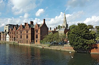
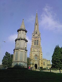
Bedford is the county town of Bedfordshire, England. The town has an estimated (2017) population of 87,590, whereas the Borough of Bedford had an estimated population of 169,912.

Kempston town and civil parish located in Bedfordshire, England

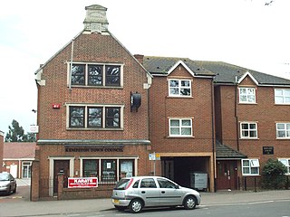
Kempston is a town and civil parish located in Bedfordshire, England. Once known as the largest village in England, Kempston is now a town with its own town council. It has a population of about 20,000, and together with Bedford, it forms an urban area with around 100,000 inhabitants, which is the sole significant urban area in the Borough of Bedford. Kempston serves principally as a dormitory town for Bedford.

Contents

The vale is traditionally a brickmaking area, but brickmaking industry has been running down since the 1970s. It has left a large amount of spoiled countryside containing several large empty pits some of which have now been converted into lakes. The Forest of Marston Vale is one of twelve of community forest projects in the United Kingdom. It was initiated by the Countryside Agency and the Forestry Commission, in partnership with Bedfordshire County Council, Mid Bedfordshire District Council, and Bedford Borough Council. The total area covered is 61 square miles (158 km2), but most of this land is in private ownership. There are incentives for landowners to plant trees, and the target for community forests in general is to reach 30% tree cover.

Countryside Agency

The Countryside Agency was a statutory body set up in England in 1999 with the task of improving the quality of the rural environment and the lives of those living in it. The Agency was formed by merging the Countryside Commission and the Rural Development Commission. Its powers were inherited from those bodies.

The Forestry Commission is a non-ministerial government department responsible for forestry in England and Scotland. It was set up in 1919 to expand Britain's forests and woodland after depletion during the First World War. To do this, the commission bought large amounts of former agricultural land, eventually becoming the largest land owner in Britain. The Commission is divided into three divisions: Forestry Commission England, Forestry Commission Scotland and Forest Research. Forestry Commission Scotland reports to the Scottish Government.

Bedfordshire County Council was the county council of the non-metropolitan county of Bedfordshire in England. It was established on 24 January 1889 and was abolished on 1 April 2009. The county council was based in Bedford.

The principal public open space in the Forest is Marston Vale is the Millennium Country Park which covers 2.5 km2 (1 mile2) and was opened in 2000. The park features several lakes including the large Stewartby Lake and extensive wetlands. There is a visitor centre called the Forest Centre, which has a Lakeside Cafe, shop, toilets and bike rental. According to the official website the park attracts around a quarter of a million visitors a year. There are plans to create a larger park of over 3 square miles (7.8 km2) to the east of Bedford, which will be called Bedford River Valley Park.

On 26 January 2018, the UK Environmental Agency granted a permit to Covanta Energy Limited to operate what will be the UK's largest waste incinerator, next to the Forest. [1] [2] The effect of this development remains to be seen.

See also

Related Research Articles

Rushden town and civil parish in Northamptonshire, England

Rushden is a town and civil parish located in the county of Northamptonshire, England.

Ocala National Forest A national forest located Florida

The Ocala National Forest ls the second largest nationally protected forest in the U.S. State of Florida. It covers 607 square miles (1,570 km2) of Central Florida. It is located three miles (5 km) east of Ocala and 16 miles (26 km) southeast of Gainesville. The Ocala National Forest, established in 1908, is the oldest national forest east of the Mississippi River and the southernmost national forest in the continental U.S. The word Ocala is thought to be a derivative of a Timucuan term meaning "fair land" or "big hammock". The forest is headquartered in Tallahassee, as are all three National Forests in Florida, but there are local ranger district offices located in Silver Springs and Umatilla.

Bedford railway station

Bedford railway station is the larger of two railway stations in the town of Bedford in Bedfordshire, England. It is on the Midland main line from London St Pancras to the East Midlands and the terminus of the Marston Vale line from Bletchley through Bedford St Johns.

Bletchley railway station

Bletchley is a railway station that serves the southern parts of Milton Keynes, England, and the north-eastern parts of the Buckinghamshire district of Aylesbury Vale. It is 47 miles (75 km) northwest of Euston, about 32 miles (51 km) east of Oxford and 17 miles (27 km) west of Bedford.

Lidlington village and civil parish in Central Bedfordshire, England

Lidlington is a small village and civil parish in Central Bedfordshire, England surrounded by farmland, in the Marston Vale. The hamlets of Boughton End and Thrupp End are also part of the parish.

Marston Moreteyne farm village in the United Kingdom

Marston Moreteyne is a large village and civil parish located on the A421 between Bedford and Milton Keynes. It has a population of 4,560, and is served by Millbrook railway station, which is about a mile away, on the Marston Vale Line. The population at the 2011 Census had decreased marginally to 4,556.

Stewartby farm village in the United Kingdom

Stewartby is a model village and civil parish in Bedfordshire, originally built for the workers of the London Brick Company. The village was designed and built to the plans of the company's architect Mr F W Walker, a later and more modern development than such better-known Victorian model villages as Saltaire. Started in 1926, Stewartby also is a later model than Woodlands which was first planned in 1905. The later retirement bungalow development of the 1950s and 1960s with the pavilion community centre in their midst was designed by the well known neo-Georgian architect Professor Sir Albert Richardson. Today, Stewartby parish also includes Kempston Hardwick.

Ridgmont railway station

Ridgmont railway station is a small unstaffed railway station that serves the villages of Ridgmont in Bedfordshire, Brogborough and Husborne Crawley. It also serves the large Amazon.com warehouse next door.

Delamere Forest

Delamere Forest or Delamere Forest Park is a large wood near the village of Delamere in Cheshire, England. The woodland, which is managed by the Forestry Commission, covers an area of 972 hectares making it the largest area of woodland in the county. It contains a mixture of deciduous and evergreen trees.

Millbrook railway station (Bedfordshire) railway station in Millbrooke, Bedfordshire, England

Millbrook railway station serves the villages of Millbrook and Marston Moretaine in Bedfordshire, England. It is on the Marston Vale Line, between Stewartby and Lidlington. Millbrook is also the principal stop for the Marston Vale Millennium Country Park.

Kempston Hardwick railway station

Kempston Hardwick railway station serves the village of Kempston Hardwick in Bedfordshire, England. It is not to be confused with the nearby town of Kempston. The station has two platforms next to a half-barrier level crossing.

Cosmeston Lakes Country Park lake in the United Kingdom

Cosmeston Lakes Country Park is a public country park in Britain, owned and managed by Vale of Glamorgan Council. It is situated between Penarth and Sully, Vale of Glamorgan, 7.3 miles from Cardiff. On 1 May 2013 the country park was designated a Local Nature Reserve LNR. Parts are Sites of Special Scientific Interest. The park, visitor centre and cafe are open all year round.

The London Brick Company is a leading British manufacturer of bricks owned by Forterra plc.

Center Parcs UK holiday village operator in the UK

Center Parcs UK is a short-break holiday company that operates five holiday villages in England, with each covering about 400 acres (1.6 km2) of woodland. The company's first village opened at Sherwood Forest, Nottinghamshire, in 1987 and its fifth, at Woburn Forest, Bedfordshire, opened in 2014.

Wixams a town in Bedford, United Kindom

Wixams is a new town and civil parish located in Bedfordshire, England, which has been under construction since early 2007. It is expected to become the third largest settlement in the Borough of Bedford after Bedford itself and Kempston, and one of the largest new settlements founded in England since the British new towns movement of the first twenty five years after World War II. Part of the site is also in Central Bedfordshire. At the 2011 Census the population of the new town was included in the civil parish of Wilstead.

Transport in Bedford provides links between the town and other parts of England. Road access to the town is provided by the A6 road & A421 road. The town is served by two railway stations and a network of bus services.

References

  1. "Permit No EPR/WP3234DY" (PDF). Retrieved 27 January 2018.
  2. "Decision Document" (PDF). Retrieved 27 January 2018.