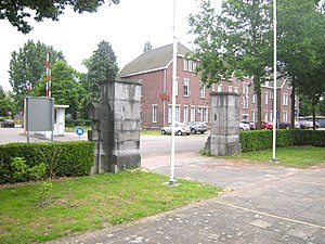
A citadel is the most fortified area of a town or city. It may be a castle, fortress, or fortified center. The term is a diminutive of city, meaning "little city", because it is a smaller part of the city of which it is the defensive core.
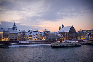
Maastricht is a city and a municipality in the southeastern Netherlands. It is the capital and largest city of the province of Limburg. Maastricht is located on both sides of the Meuse, at the point where the Jeker joins it. Mount Saint Peter (Sint-Pietersberg) is largely situated within the city's municipal borders. Maastricht is adjacent to the border with Belgium and is part of the Meuse-Rhine Euroregion, an international metropolis with a population of about 3.9 million, which includes the nearby German and Belgian cities of Aachen, Liège, and Hasselt.

The Netherlands began its colonization of the Americas with the establishment of trading posts and plantations, which preceded the much wider known colonization activities of the Dutch in Asia. While the first Dutch fort in Asia was built in 1600, the first forts and settlements along the Essequibo River in Guyana date from the 1590s. Actual colonization, with the Dutch settling in the new lands, was not as common as by other European nations.

Hulst is a municipality and city in southwestern Netherlands in the east of Zeelandic Flanders.

Frederick Henry was the sovereign prince of Orange and stadtholder of Holland, Zeeland, Utrecht, Guelders, Overijssel in the Dutch Republic from 1625 until his death in 1647. In the last seven years of his life, he was also the stadtholder of Groningen (1640-1647).

Sint Eustatius, known locally as Statia, is an island in the Caribbean. It is a special municipality of the Netherlands.

Fort Henry National Historic Site is located in Kingston, Ontario, Canada on Point Henry, a strategic, elevated point near the mouth of the Cataraqui River where it flows into the St. Lawrence River at the east end of Lake Ontario. The fort and the point on which the fort was built were named after Henry Hamilton, former Lieutenant-Governor of the Province of Quebec.

Dokkum is a Dutch fortified city in the municipality of Noardeast-Fryslân in the province of Friesland. It has 12,669 inhabitants. The fortifications of Dokkum are well preserved and are known as the bolwerken (bulwarks). It is the fifth most popular shopping city in Friesland. It also had the smallest hospital in the Netherlands.
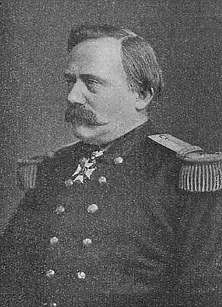
Henri-Alexis Brialmont, nicknamed The Belgian Vauban after the French military architect, was a Belgian army officer, politician and writer of the 19th century, best known as a military architect and designer of fortifications. Brialmont qualified as an officer in the Belgian army engineers in 1843 and quickly rose up the ranks. He served as a staff officer, and later was given command of the district of the key port of Antwerp. He finished his careers as Inspector-General of the Army. Brialmont was also an active pamphleteer and political campaigner and lobbied through his career for reform and expansion of the Belgian military and was also involved in the foundation of the Congo Free State.

The Fortress of Luxembourg is the former fortifications of Luxembourg City, the capital of the Grand Duchy of Luxembourg, which were mostly dismantled beginning in 1867. The fortress was of great strategic importance for the control of the Left Bank of the Rhine, the Low Countries, and the border area between France and Germany.

Echt is a city in the Dutch municipality of Echt-Susteren in the province of Limburg, Netherlands. It was a municipality itself until it merged with the municipality of Susteren on 1 January 2003.
The history of Curaçao starts with settlement by the Arawaks, an Amerindian people coming from the South American mainland. They are believed to have inhabited the island for many hundreds of years before the arrival of Europeans.

The Battle of Kallo was a major field battle fought from 20 to 21 June 1638 in and around the forts of Kallo and Verrebroek, located on the left bank of the Scheldt river, near Antwerp, during the second phase of the Eighty Years' War. Following the symbolic recovery of Breda during the 1637 campaign, the Dutch Republic agreed with the French Crown, with whom it had allied in 1635, to besiege a major city in the Spanish Netherlands during the 1638 campaign. The commander of the Dutch States Army, Frederick Henry of Orange, planned an approach over Antwerp from the two sides of the Scheldt. Count William of Nassau-Siegen was entrusted to land in the Spanish-controlled Waasland region, west of Antwerp, to seize the forts of Kallo and Verrebroek, along with several other key fortifications, to invest Antwerp from the west. In the meantime, Frederick Henry would advance on the opposite bank to complete the blockade of the city while the armies of France invaded the Spanish Netherlands from the south to oblige the Spanish Army of Flanders to divide its forces.

The siege of Maastricht was fought between 9 June and 22 August 1632, when the Dutch commander Frederick Henry, Prince of Orange, eventually captured the city from Habsburg forces.
Sir Bernard de Gomme was a Dutch military engineer. By some he is considered the most important figure in 17th-century English military engineering.
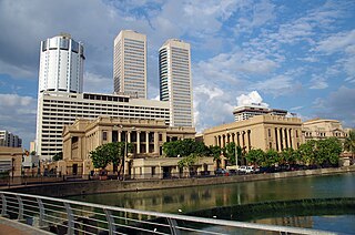
Fort (Colombo) (කොටුව; கோட்டை) is the central business district of Colombo in Sri Lanka. It is the financial district of Colombo and the location of the Colombo Stock Exchange (CSE) and the World Trade Centre of Colombo from which the CSE operates. It is also the location of the Bank of Ceylon headquarters. Along the foreshore of the Fort area is the Galle Face Green Promenade, built in 1859 under the governance of Sir Henry George Ward, the Governor of Ceylon (Sri Lanka) during British colonial era. Fort is also home to the General Post Office, hotels, government departments and offices.

The Bock is a promontory in the north-eastern corner of Luxembourg City's old historical district. Offering a natural fortification, its rocky cliffs tower above the River Alzette, which surrounds it on three sides. It was here that Count Siegfried built his Castle of Lucilinburhuc in 963, providing a basis for the development of the town that became Luxembourg. Over the centuries, the Bock and the surrounding defenses were reinforced, attacked, and rebuilt time and time again as the armies of the Burgundians, Habsburgs, Spaniards, Prussians, and French vied for victory over one of Europe's most strategic strongholds, the Fortress of Luxembourg. Warring did not stop until the Treaty of London was signed in 1867, calling for the demolition of the fortifications. Ruins of the old castle and the vast underground system of passages and galleries known as the casemates continue to be a major tourist attraction.

The siege of 's-Hertogenbosch of 1601(Sitio de Bolduque de 1601 in Spanish) was an unsuccessful Dutch attempt led by Prince Maurice of Nassau and William Louis of Nassau-Dillenburg to capture the city of 's-Hertogenbosch, North Brabant, Spanish Netherlands, garrisoned by about 1,500–2,000 Spanish soldiers led by Governor Anthonie Schetz, Baron of Grobbendonck, between 1 and 27 November 1601, during the Eighty Years' War and the Anglo-Spanish War (1585–1604), in the context of the long and bloodiest siege of Ostend.

The siege of San Andreas also known as the siege of Sint-Andries was a military event that took place during the Eighty Years' War and the Anglo–Spanish War from 28 January to 6 March 1600. The Spanish garrison of San Andreas was besieged by an Anglo-Dutch force led by Maurice of Nassau. A Spanish relief force under the command of Luis de Velasco failed to relieve the fort after having been turned back by the besiegers. The fort surrendered after the garrison mutinied and accepted payment from Maurice.

Waterfort is a fort in Willemstad, Curaçao located on the eastern side of the Sint Anna Bay. It was built in 1827 to protect Willemstad against attack. In 1858, marines were stationed in the fort. During World War II, the fort was put into operation again. In 1955, the marines were moved to Marinebasis Parera, and Plaza Hotel Curaçao, a luxury hotel, was built in the fort.