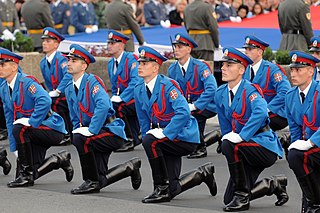
The economy of Gibraltar consists largely of the services sector. While part of the European Union until Brexit, the British overseas territory of Gibraltar has a separate legal jurisdiction from the United Kingdom and a different tax system. The role of the UK Ministry of Defence, which at one time was Gibraltar's main source of income, has declined, with today's economy mainly based on shipping, tourism, financial services, and the Internet.

The Royal Navy (RN) is the United Kingdom's naval warfare force and a component of His Majesty's Naval Service. Although warships were used by English and Scottish kings from the early medieval period, the first major maritime engagements were fought in the Hundred Years' War against France. The modern Royal Navy traces its origins to the early 16th century; the oldest of the UK's armed services, it is consequently known as the Senior Service.

The British Armed Forces, formally known as His Majesty's Armed Forces, are the military forces responsible for the defence of the United Kingdom, its Overseas Territories and the Crown Dependencies. They also promote the UK's wider interests, support international peacekeeping efforts and provide humanitarian aid.
A variety of measures of national income and output are used in economics to estimate total economic activity in a country or region, including gross domestic product (GDP), gross national product (GNP), net national income (NNI), and adjusted national income. All are specially concerned with counting the total amount of goods and services produced within the economy and by various sectors. The boundary is usually defined by geography or citizenship, and it is also defined as the total income of the nation and also restrict the goods and services that are counted. For instance, some measures count only goods & services that are exchanged for money, excluding bartered goods, while other measures may attempt to include bartered goods by imputing monetary values to them.

A weather station is a facility, either on land or sea, with instruments and equipment for measuring atmospheric conditions to provide information for weather forecasts and to study the weather and climate. The measurements taken include temperature, atmospheric pressure, humidity, wind speed, wind direction, and precipitation amounts. Wind measurements are taken with as few other obstructions as possible, while temperature and humidity measurements are kept free from direct solar radiation, or insolation. Manual observations are taken at least once daily, while automated measurements are taken at least once an hour. Weather conditions out at sea are taken by ships and buoys, which measure slightly different meteorological quantities such as sea surface temperature (SST), wave height, and wave period. Drifting weather buoys outnumber their moored versions by a significant amount.

Current good manufacturing practices (cGMP) are those conforming to the guidelines recommended by relevant agencies. Those agencies control the authorization and licensing of the manufacture and sale of food and beverages, cosmetics, pharmaceutical products, dietary supplements, and medical devices. These guidelines provide minimum requirements that a manufacturer must meet to assure that their products are consistently high in quality, from batch to batch, for their intended use. The rules that govern each industry may differ significantly; however, the main purpose of GMP is always to prevent harm from occurring to the end user. Additional tenets include ensuring the end product is free from contamination, that it is consistent in its manufacture, that its manufacture has been well documented, that personnel are well trained, and that the product has been checked for quality more than just at the end phase. GMP is typically ensured through the effective use of a quality management system (QMS).

A cadet is an officer trainee or candidate. The term is frequently used to refer to those training to become an officer in the military or maritime sector, often a person who is a junior trainee. Its meaning may vary between countries which can include youths in voluntary youth organisations.

The Indian Coast Guard (ICG) is a maritime law enforcement and search and rescue agency of India with jurisdiction over its territorial waters including its contiguous zone and exclusive economic zone. It was formally established on 1 February 1977 by the Coast Guard Act, 1978 of the Parliament of India. It operates under the Ministry of Defence.
GxP is a general abbreviation for the "good practice" quality guidelines and regulations. The "x" stands for the various fields, including the pharmaceutical and food industries, for example good agricultural practice, or GAP.

The Royal Gibraltar Police (RGP) is, along with His Majesty's Customs (Gibraltar), the principal civilian law enforcement agency in the British overseas territory of Gibraltar. It is the oldest police force in the Commonwealth of Nations outside the United Kingdom.

Gibraltar is a British Overseas Territory and city located at the southern tip of the Iberian Peninsula. It has an area of 6.7 km2 (2.6 sq mi) and is bordered to the north by Spain. The landscape is dominated by the Rock of Gibraltar, at the foot of which is a densely populated town area, home to some 32,688 people, primarily Gibraltarians.

British Forces Gibraltar is the British Armed Forces stationed in the British overseas territory of Gibraltar. Gibraltar is used primarily as a training area, thanks to its good climate and rocky terrain, and as a stopover for aircraft and ships en route to and from deployments East of Suez or in Africa.

The following outline is provided as an overview of and topical guide to Gibraltar:

The Ministry of Defence Police (MDP) is a civilian special police force which is part of the United Kingdom's Ministry of Defence. The MDP's primary responsibilities are to provide armed security and counter terrorism services to designated high-risk areas, as well as uniformed policing and limited investigative services to Ministry of Defence property, personnel, and installations throughout the United Kingdom. The MDP are not military police and should not be confused with the Royal Military Police or any other British Service Police. Service personnel often refer to the MDP by the nickname "MOD plod".

The Gibraltar peninsula, located at the far southern end of Iberia, has great strategic importance as a result of its position by the Strait of Gibraltar where the Mediterranean Sea meets the Atlantic Ocean. It has repeatedly been contested between European and North African powers and has endured fourteen sieges since it was first settled in the 11th century. The peninsula's occupants – Moors, Spanish, and British – have built successive layers of fortifications and defences including walls, bastions, casemates, gun batteries, magazines, tunnels and galleries. At their peak in 1865, the fortifications housed around 681 guns mounted in 110 batteries and positions, guarding all land and sea approaches to Gibraltar. The fortifications continued to be in military use until as late as the 1970s and by the time tunnelling ceased in the late 1960s, over 34 miles (55 km) of galleries had been dug in an area of only 2.6 square miles (6.7 km2).

Windmill Hill or Windmill Hill Flats is one of a pair of plateaux, known collectively as the Southern Plateaux, at the southern end of the British Overseas Territory of Gibraltar. It is located just to the south of the Rock of Gibraltar, which descends steeply to the plateau. Windmill Hill slopes down gently to the south with a height varying from 120 metres (390 ft) at the north end to 90 metres (300 ft) at the south end. It covers an area of about 19 hectares, though about 6 hectares at the north end is built over. The plateau is ringed to the south and east with a line of cliffs which descend to the second of the Southern Plateaux, Europa Flats, which is itself ringed by sea cliffs. Both plateaux are the product of marine erosion during the Quaternary period and subsequent tectonic uplift. Windmill Hill was originally on the shoreline and its cliffs were cut by the action of waves, before the ground was uplifted and the shoreline moved further out to the edge of what is now Europa Flats.

The Global Drifter Program (GDP) was conceived by Prof. Peter Niiler, with the objective of collecting measurements of surface ocean currents, sea surface temperature and sea-level atmospheric pressure using drifters. It is the principal component of the Global Surface Drifting Buoy Array, a branch of NOAA's Global Ocean Observations and a scientific project of the Data Buoy Cooperation Panel (DBCP). The project originated in February 1979 as part of the TOGA/Equatorial Pacific Ocean Circulation Experiment (EPOCS) and the first large-scale deployment of drifters was in 1988 with the goal of mapping the tropical Pacific Ocean's surface circulation. The current goal of the project is to use 1250 satellite-tracked surface drifting buoys to make accurate and globally dense in-situ observations of mixed layer currents, sea surface temperature, atmospheric pressure, winds and salinity, and to create a system to process the data. Horizontal transports in the oceanic mixed layer measured by the GDP are relevant to biological and chemical processes as well as physical ones.
The distribution of medications has special drug safety and security considerations. Some drugs require cold chain management in their distribution.


