
Flamborough Head is a promontory, 8 miles (13 km) long on the Yorkshire coast of England, between the Filey and Bridlington bays of the North Sea. It is a chalk headland, with sheer white cliffs. The cliff top has two standing lighthouse towers, the oldest dating from 1669 and Flamborough Head Lighthouse built in 1806. The older lighthouse was designated a Grade II* listed building in 1952 and is now recorded in the National Heritage List for England, maintained by Historic England. The cliffs provide nesting sites for many thousands of seabirds, and are of international significance for their geology.

The Dark Peak is the higher and wilder part of the Peak District in England, mostly forming the northern section but also extending south into its eastern and western margins. It is mainly in Derbyshire but parts are in Staffordshire, Cheshire, Greater Manchester, West Yorkshire and South Yorkshire.

Rainham Marshes is an RSPB nature reserve in the east of London, adjacent to the Thames Estuary in Purfleet, Thurrock and the London Borough of Havering. In 2000, the area of land was bought from the Ministry of Defence, who used it as a test firing range. With no activity for several years, the nature reserve was officially opened to the public in 2006. It has maintained much of its medieval landscape, and is the largest area of wetland on the upper parts of the Thames Estuary.

Otmoor or Ot Moor is an area of wetland and wet grassland in Oxfordshire, England, located halfway between Oxford and Bicester. It is about 60 metres (200 ft) above sea level, and has an area of nearly 400 hectares.

Abernethy Forest is a remnant of the Caledonian Forest in Strathspey, in the Highland council area of Scotland. It lies within the Cairngorms National Park, close to the villages of Nethy Bridge, Boat of Garten, and Aviemore. The forest is an RSPB reserve, close to Loch Garten Osprey Centre, which is also owned by the RSPB. It is popular with walkers, as there are various trails throughout the reserve. The forest forms part of the wider Abernethy National Nature Reserve.

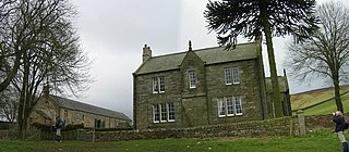
Hodbarrow RSPB Reserve is a nature reserve run by the Royal Society for the Protection of Birds on the edge of the Lake District National Park in Cumbria, England. It is on the Duddon Estuary near the town of Millom.

The River Hayle is a small river in West Cornwall, England, United Kingdom which issues into St Ives Bay at Hayle on Cornwall's Atlantic coast.

Warton Crag is a limestone hill in north west Lancashire, England. It lies to the north west of Warton village, in City of Lancaster district. At 163 metres (535 ft) it is the highest point in the Arnside and Silverdale Area of Outstanding Natural Beauty, and is listed as a "HuMP" or "Hundred Metre Prominence", having a "drop" or "prominence" of 126 metres (413 ft) with its parent being Hutton Roof Crags. Two areas are Local Nature Reserves, called Warton Crag and Warton Crag Quarry. Different sections are owned by Lancashire County Council, the Wildlife Trust for Lancashire, Manchester and North Merseyside, Lancaster City Council and the Royal Society for the Protection of Birds.

Rye Meads is a 58.5 hectare biological Site of Special Scientific Interest (SSSI) in Rye House, Hoddesdon, Hertfordshire. It is one of series of wetlands and reservoirs situated along the River Lea, to the north-east of London. It is part of the Lea Valley Ramsar site and a Special Protection Area.
Bollihope, Pikestone, Eggleston and Woodland Fells is a Site of Special Scientific Interest in the Teesdale district of west County Durham, England. It covers a broad expanse of moorland to the north and east of Middleton-in-Teesdale.

Upper Teesdale is a Site of Special Scientific Interest (SSSI) in the west County Durham, England. It encompasses an extensive upland area that includes the headwaters of the River Tees and the surrounding catchment area upstream of the village of Langdon Beck.

Moorhouse and Cross Fell is a Site of Special Scientific Interest covering an extensive area of moorland in the Wear Valley district of west County Durham and the Eden district of Cumbria, England. It is contiguous with Upper Teesdale SSSI to the east and Appleby Fells SSSI to the south. The area covered extends roughly from an arc through the villages of Gamblesby, Leadgate and Garrigill southward as far as Milburn in the west and Cow Green Reservoir in the east. It includes the whole of Cross Fell, the summit of which, at 893 metres asl, is the highest point in the Pennines and in England outside the Lake District.
Lune Forest is a Site of Special Scientific Interest covering an extensive area of moorland in the Teesdale district of west Durham, England. In the north, where it adjoins the Upper Teesdale and Appleby Fells SSSIs, it extends from Mickle Fell eastward almost as far as Harter Fell, above the hamlet of Thringarth. Its southern limit is marked by the River Balder, upstream from Balderhead Reservoir, where it shares a boundary with Cotherstone Moor SSSI to the south. Grains o' th' Beck Meadows and Close House Mine SSSIs are entirely surrounded by Lune Forest, but do not form part of it.

Ling Gill is a gill in the Yorkshire Dales in North Yorkshire, England. Cam Beck, a tributary of the River Ribble, flows through the gill.

Frays Farm Meadows is a 28.2-hectare (70-acre) biological Site of Special Scientific Interest near Denham in the London Borough of Hillingdon. It was notified as an SSSI in 1981, and has been managed by the London Wildlife Trust on behalf of Hillingdon Council since 1999. It is part of the Colne Valley Regional Park.

The North Norfolk Coast Site of Special Scientific Interest (SSSI) is an internationally important protected area in Norfolk, England. The SSSI is a long, narrow strip of coastal land that starts between Old Hunstanton and Holme-next-the-Sea, and runs east for about 43 km (27 mi) to Kelling. The southern boundary runs roughly west to east except where it detours around towns and villages, and never crosses the A149 coast road. It has an area of 7,700 ha (19,027 acres), and is additionally protected through Natura 2000, Special Protection Area (SPA) and Ramsar listings; it is also part of the Norfolk Coast Area of Outstanding Natural Beauty (AONB). Scolt Head Island and the coast from the Holkham National Nature Reserve to Salthouse are a Biosphere Reserve.

The North Norfolk Coast Site of Special Scientific Interest (SSSI) is an area of European importance for wildlife in Norfolk, England. It comprises 7,700 ha (19,027 acres) of the county's north coast from just west of Holme-next-the-Sea to Kelling, and is additionally protected through Natura 2000, Special Protection Area (SPA) listings; it is also part of the Norfolk Coast Area of Outstanding Natural Beauty (AONB). The North Norfolk Coast is also designated as a wetland of international importance on the Ramsar list and most of it is a Biosphere Reserve.
Geltsdale is a hamlet and former civil parish, now in the parish of Castle Carrock, in the Carlisle district, in the county of Cumbria, England, to the southeast of Castle Carrock village. In 2001 the parish had a population of 6. On 1 April 2003 the parish was abolished and merged with Castle Carrock.

St Bees Head RSPB Reserve at St Bees Head, Cumbria, England, is a coastal site which provides a home for thousands of seabirds under the care of the RSPB. The birds include kittiwakes, fulmars, guillemots, razorbills, cormorants, puffins, shags and herring gulls. It is the only breeding place in England for black guillemots. The rock pipit, which breeds on rocky coasts, is known to breed in only one other site in Cumbria.

Geltsdale RSPB reserve is a nature reserve in Geltsdale, Cumbria, England. The Royal Society for the Protection of Birds manages the site for upland birds such as the hen harrier and black grouse.
