This article needs additional citations for verification .(September 2017) |
The geology of Maine is part of the broader geology of New England and eastern North America.
This article needs additional citations for verification .(September 2017) |
The geology of Maine is part of the broader geology of New England and eastern North America.
Maine's geologic past is unknown prior to 650 million years ago, although some geologists have suggested that rocks over a billion years old may be present in units of the Chain Lakes in northwestern Maine. The state is made up of three distinct terranes, including Laurentia, Iapetus Ocean terranes and the former microcontinent of Avalonia.
With the breakup of the supercontinent Pannotia beginning 600 million years ago, the new continent of Laurentia—Proto-North America—began shedding eroded material out into the newly formed Iapetus Ocean. The region experienced limestone and marine sediment deposition, in connection with the erosion of a neighboring microcontinent. The region that is now northern Penobscot Bay, which then belonged to the microcontinent Avalonia, experienced an episode of pegmatite intrusion and metamorphism around 650 million years ago.
Throughout the early Paleozoic, from the Cambrian into the early Ordovician, Laurentia experienced limestone and shale deposition at its continental margin from a position near the equator. On the Iapetus terranes, a mix of sediment deposition and volcanism took place during the early Cambrian, after which a proposed microplate collision launched the Penobscottian mountain building event. This period of metamorphism and deformation is preserved in rocks in northwest and north-central Maine. The early Ordovician marked a return to sedimentation and volcanism on the Iapetus terranes. Simultaneously, while Avalonia was situated in the Southern Hemisphere, it experienced much less limestone formation, although it also experienced sedimentation and volcanism throughout the Cambrian that is now preserved in rocks near Penobscot Bay.
Beginning in the middle Ordovician, the offshore Iapetus terranes collided with Laurentia, launching the Taconic Orogeny mountain building event, which included uplift, deformation and igneous activity. Portions of the island arcs of the Iapetus terranes are preserved in the Boundary Mountains. Avalonia continued to experience sedimentation and volcanism and the intrusion of granite bodies in the Silurian, now found along the central coast of Maine. Avalonia and Laurentia collided in the early Devonian. The collision started the Acadian orogeny, a major mountain building event. As a result of the collision, sediments in what is today northern Maine were buried to a depth of nine miles and underwent metamorphism. The collision also brought about the formation of the northern Appalachian Mountains, numerous faults and widespread igneous activity. At the time the new composite continent was positioned south of the equator.
During the Carboniferous the intrusion of Sebago granite took place. Slight remnants of sandstone and other sedimentary rocks deposited during this period remain along the coast of Maine. The Carboniferous marked the end of regional deformation and metamorphism. During the Permian, North America shifted north of the equator while Maine experienced uplift and erosion, exposing deeper rocks.
The breakup of Pangaea during the early Mesozoic was marked with new faulting of bedrock in Maine and the intrusion of basalt dikes on southwest coast of Maine. Limited igneous activity continued into the late Mesozoic. During the Cenozoic, uplift and erosion continued in the northern Appalachians. Maine became extensively glaciated during the Pleistocene. Extensive erosion altered much of the region's surface while the ice weighted down the continental crust. The release of stress and the slow rebound of the land surface since the end of the Pleistocene has generated new uplift, fractures and erosion. Humans arrived in Maine beginning in the early Holocene and human activity has played an increasing role in the surficial geology of the region since the start of European colonization and statehood.
The northeast coast of Maine belongs to the Coastal Volcanic Belt, which extends into New Brunswick, while most of the state lies in the Central Maine Basin up to the Boundary Mountains in north-central Maine. North of the mountains the Connecticut Valley Basin stretches from Vermont into Quebec.
A belt of Ordovician-Silurian rocks extends from Kittery to northeast of Bangor, with sandstone and slate in the east and gneiss and schist in the southwest. From southwest of Augusta to just south of Houlton, extending to the Canadian border are Silurian rocks, also found in a small area near Machias along the coast and in smaller areas further north. The Silurian rocks trend from marine shale in the north to gneiss and schist in the south west. A large area of the state, in a narrow belt from the New Hampshire line widening around Greenville and Millinocket and extending across much of northern Maine to Fort Kent is Devonian rock, including shale and sandstone in the north and gneiss and schist in the southwest.
Northwest York County is Silurian-Devonian bedrock, with marine slate sandstone and slate in the east, grading to schist closer to New Hampshire. A small area of igneous syenite intrusions is also found in York County on the coast, northeast of Kittery. Parts of Oxford, Penobscot, Hancock, Piscataquis and other counties have Devonian age gabbro, slate, granite and granodiorite. Very small pockets of unmetamorphosed conglomerate and sandstone dating to the Devonian and Carboniferous are found slightly to the west of Presque Isle and northwest of Eastport. Franklin and western Somerset County contain Precambrian and Ordovician gneiss, breccia, limestone, marble, sandstone, slate, syenite and diorite. Mt. Desert Island, Calais and portions of Downeast Maine and the Mid-Coast are Silurian granite and gabbro.
Among metamorphosed rocks, central and northern Maine display decreasing levels of metamorphism further north. A belt of highly metamorphosed rocks extends from just of north of Casco Bay through Androscoggin and Oxford counties.
Soils are a part of the surficial geology of Maine, but are often considered and studied separately because of their role in construction and agriculture. Maine soils have formed since the retreat of the last ice sheet from the region 12,500 years before the present. Much of Oxford County and parts of Cumberland, York and Androscoggin County have loam soils, derived from granite, gneiss and schist with an average depth to bedrock of 5 feet, underlain by sandy till with a groundwater 30 inches below the surface in winter. Riverbeds in central and northeast Maine are lined with sandy glacial outwash made up of gneiss, limestone, phyllite, shale and granite. Much of coastal Maine has clay-loam soils from marine and lake sediments, with a water table at the surface or 12 inches below it and poor drainage throughout the year.
Much of northern Maine has poorly drained loam soils, basal till, with material derived from schist, phyllite slate and metastone. Similar soils are found across an additional 23% of Maine. Surface stones and boulders are common throughout most of Maine. Much of greater Portland, greater Augusta and coastal and river channels of southwest Maine feature clay-loam soils or sandy soils, with very few boulders and surface rocks.
The hydrogeology and water resources of Maine are closely related to the state's surficial geology, soils, climate, land use and environment. The Maine Geological Survey began a continuing process of mapping sand and gravel aquifers beginning in 1978. Statewide, Maine receives an annual rainfall total of 42 inches or 24 trillion gallons. Up to 50% of rainfall runs off the landscape in rivers and streams, while an additional 30–40% evaporates or is transpired through vegetation. Between 10% and 20% of precipitation (including rain and snow melt) recharges groundwater. Because of the state's rural and small town settlement pattern 40% of residents use private groundwater wells for household water.
Maine has extensive sand and gravel aquifers formed in sediments left behind after the last glaciation. Northwestern Maine is currently unmapped for these aquifers. Deeper, bedrock aquifers formed within cracks in the state's igneous and metamorphic basement rock are also present. For drilled wells, the average borehole depth is 250 feet. Groundwater is recharged in the springtime with rain and snow melt, but drops throughout the summer. Saltwater intrusion is a growing problem in heavily populated coastal locations.
In the 21st century, granite quarries and gravel pits continue to contribute to the economy of Maine. However, mining has a long history in the state, stretching back to the early 19th century. The Lubec Lead Mine was an early mine operating in the 1830s. Maine's first State Geologist, Charles T. Jackson, sketched a diagram of the site's limestone, greenstone trap-rock and veins of galena during an 1837 visit. The site is still open for amateur mineral collecting, although the State of Maine advises extreme caution as a result of potential flooding from high tides.
In surficial, udic soils, Maine had an extensive bog iron extraction industry in the 1800s, including smelters such as the Katahdin Iron Works, which operated in the 1840s. One of sixteen brick kilns for producing charcoal to smelt the iron remains at the site. Maine experienced a boom in metal mining between 1879 and 1882, centered in Lubec, Acton, Blue Hill and Sullivan. A dedicated publication, the Maine Mining Journal was published starting in 1880. Although the boom was partially an economic bubble, some mines such as the Douglass Copper Mine in Blue Hill produced viable quantities of copper and continued to do so until 1918 under the control of the American Smelting and Mining Company. High silver prices drove a short period of silver mining in Cherryfield between 1905 and 1907, but after 1890 little significant metal mining took place. Manganese ore, discovered in the 1840s, was extracted during World War II in Aroostook County for the US war effort.
Harborside Copper Mine in Brooksville first opened in the 1880s, but was acquired and reopened by Callahan Mining Corporation from New York in 1965. The company got permission from the state to drain the Goose Pond tidal inlet and opened an open pit copper mine that operated until reserves were depleted in 1972. The mine was equipped with a flotation mill and shipped zinc to Pennsylvania and copper to Quebec for smelting. A larger zinc, copper and lead mine was operated by Kerramerican next to Second Pond in Blue Hill. State Geologist John S. Cummings discovered a 35 million ton massive copper-zinc sulfide deposit in Aroostook County, estimated to be the third largest find in the US, in September, 1977, but the deposit has not been developed. The deposit stretches across 130 miles, between 50 and 60 miles in northern Maine. Historically, Rockport supported large limestone kilns to supply the East Coast cement industry and North Paris had a feldspar plant until 1988. The Central Maine Slate Belt from Waterville to Brownville was a site of widespread slate mining into the early 20th century.
Small scale slate mining continues in Monson and a small clay pit supplies the Morin Brick Company in Auburn. Between the 1940s and 1980s, Maine also had a small peat industry in Penobscot, Sullivan, Deblois, Franklin, Friendship and Centerville. Significant quantities of aggregate are extracted from locations such as the Whitefield and Topsham gravel pits, Blue Rock quarry as well as the large Dragon Cement plant in Thomaston. Deer Isle granite is still quarried in Stonington, 80 years after the Great Depression and the widespread adoption of concrete hobbled the Maine granite industry.

The Acadian orogeny is a long-lasting mountain building event which began in the Middle Devonian, reaching a climax in the early Late Devonian. It was active for approximately 50 million years, beginning roughly around 375 million years ago, with deformational, plutonic, and metamorphic events extending into the Early Mississippian. The Acadian orogeny is the third of the four orogenies that created the Appalachian orogen and subsequent basin. The preceding orogenies consisted of the Potomac and Taconic orogeny, which followed a rift/drift stage in the Late Neoproterozoic. The Acadian orogeny involved the collision of a series of Avalonian continental fragments with the Laurasian continent. Geographically, the Acadian orogeny extended from the Canadian Maritime provinces migrating in a southwesterly direction toward Alabama. However, the Northern Appalachian region, from New England northeastward into Gaspé region of Canada, was the most greatly affected region by the collision.

The Caledonian orogeny was a mountain-building era recorded in the northern parts of the British Isles, the Scandinavian Mountains, Svalbard, eastern Greenland and parts of north-central Europe. The Caledonian orogeny encompasses events that occurred from the Ordovician to Early Devonian, roughly 490–390 million years ago (Ma). It was caused by the closure of the Iapetus Ocean when the continents and terranes of Laurentia, Baltica and Avalonia collided.

The geology of the Australian Capital Territory includes rocks dating from the Ordovician around 480 million years ago, whilst most rocks are from the Silurian. During the Ordovician period the region—along with most of eastern Australia—was part of the ocean floor. The area contains the Pittman Formation consisting largely of Quartz-rich sandstone, siltstone and shale; the Adaminaby Beds and the Acton Shale.

The geology of England is mainly sedimentary. The youngest rocks are in the south east around London, progressing in age in a north westerly direction. The Tees–Exe line marks the division between younger, softer and low-lying rocks in the south east and the generally older and harder rocks of the north and west which give rise to higher relief in those regions. The geology of England is recognisable in the landscape of its counties, the building materials of its towns and its regional extractive industries.
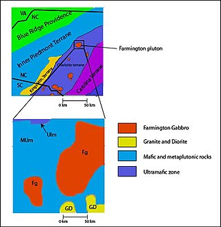
The Carolina Terrane, also called the Carolina Superterrane or Carolinia, is an exotic terrane running ~370 miles (600 km) approximately North-South from central Georgia to central Virginia in the United States. It constitutes a major part of the eastern Piedmont Province.

New England is a region in the North Eastern United States consisting of the states Rhode Island, Connecticut, Massachusetts, New Hampshire, Vermont, and Maine. Most of New England consists geologically of volcanic island arcs that accreted onto the eastern edge of the Laurentian Craton in prehistoric times. Much of the bedrock found in New England is heavily metamorphosed due to the numerous mountain building events that occurred in the region. These events culminated in the formation of Pangaea; the coastline as it exists today was created by rifting during the Jurassic and Cretaceous periods. The most recent rock layers are glacial conglomerates.

The geology of Massachusetts includes numerous units of volcanic, intrusive igneous, metamorphic and sedimentary rocks formed within the last 1.2 billion years. The oldest formations are gneiss rocks in the Berkshires, which were metamorphosed from older rocks during the Proterozoic Grenville orogeny as the proto-North American continent Laurentia collided against proto-South America. Throughout the Paleozoic, overlapping the rapid diversification of multi-cellular life, a series of six island arcs collided with the Laurentian continental margin. Also termed continental terranes, these sections of continental rock typically formed offshore or onshore of the proto-African continent Gondwana and in many cases had experienced volcanic events and faulting before joining the Laurentian continent. These sequential collisions metamorphosed new rocks from sediments, created uplands and faults and resulted in widespread volcanic activity. Simultaneously, the collisions raised the Appalachian Mountains to the height of the current day Himalayas.
The geology of the Isle of Man consists primarily of a thick pile of sedimentary rocks dating from the Ordovician period, together with smaller areas of later sedimentary and extrusive igneous strata. The older strata was folded and faulted during the Caledonian and Acadian orogenies The bedrock is overlain by a range of glacial and post-glacial deposits. Igneous intrusions in the form of dykes and plutons are common, some associated with mineralisation which spawned a minor metal mining industry.
Ganderia or Gander Terrane is a terrane in the northern Appalachians which broke off the supercontinent Gondwana c.570 million years ago (Ma) together with Avalonia, Megumia, and Carolinia.

The geology of England's Lake District is dominated by sedimentary and volcanic rocks of mainly Ordovician age underpinned by large granitic intrusions. Younger sedimentary sequences outcrop on the edges of the Lake District area, with Silurian to the south, Carboniferous to the north, east and west and Permo-Triassic to the west and east. The entire area was covered by a Mesozoic sequence that was eroded off during Paleogene uplift related to the opening of the North Atlantic. During the Quaternary the area was affected by repeated glaciations, which sculpted the current mountainous landscape.

The geology of Rhode Island is based on nearly one billion year old igneous crystalline basement rocks formed as part of the microcontinent Avalonia that collided with the supercontinent Gondwana. The region experienced substantial folding associated with its landlocked position during the Alleghanian orogeny mountain building event. The region accumulated sedimentary rocks, including small deposits of coal. The region was covered with thick Atlantic Coastal Plain sediments, with the erosion of the Appalachians and the creation of the Atlantic Ocean throughout the past 200 million years. These surficial sediments and soils were substantially reworked by the Pleistocene glaciations. The state's geology is part of the broader geology of New England.
The geology of Virginia began to form 1.8 billion years ago and potentially even earlier. The oldest rocks in the state were metamorphosed during the Grenville orogeny, a mountain building event beginning 1.2 billion years ago in the Proterozoic, which obscured older rocks. Throughout the Proterozoic and Paleozoic, Virginia experienced igneous intrusions, carbonate and sandstone deposition, and a series of other mountain building events which defined the terrain of the inland parts of the state. The closing of the Iapetus Ocean, to form the supercontinent Pangaea added additional small landmasses, some of which are now hidden beneath thick Atlantic Coastal Plain sediments. The region subsequently experienced the rifting open of the Atlantic Ocean in the Mesozoic, the development of the Coastal Plain, isolated volcanism and a series of marine transgressions that flooded much of the area. Virginia has extensive coal, deposits of oil and natural gas, as well as deposits of other minerals and metals, including vermiculite, kyanite and uranium.
The geology of Kentucky formed beginning more than one billion years ago, in the Proterozoic eon of the Precambrian. The oldest igneous and metamorphic crystalline basement rock is part of the Grenville Province, a small continent that collided with the early North American continent. The beginning of the Paleozoic is poorly attested and the oldest rocks in Kentucky, outcropping at the surface, are from the Ordovician. Throughout the Paleozoic, shallow seas covered the area, depositing marine sedimentary rocks such as limestone, dolomite and shale, as well as large numbers of fossils. By the Mississippian and the Pennsylvanian, massive coal swamps formed and generated the two large coal fields and the oil and gas which have played an important role in the state's economy. With interludes of terrestrial conditions, shallow marine conditions persisted throughout the Mesozoic and well into the Cenozoic. Unlike neighboring states, Kentucky was not significantly impacted by the Pleistocene glaciations. The state has extensive natural resources, including coal, oil and gas, sand, clay, fluorspar, limestone, dolomite and gravel. Kentucky is unique as the first state to be fully geologically mapped.

The geology of Sweden is the regional study of rocks, minerals, tectonics, natural resources and groundwater in the country. The oldest rocks in Sweden date to more than 2.5 billion years ago in the Precambrian. Complex orogeny mountain building events and other tectonic occurrences built up extensive metamorphic crystalline basement rock that often contains valuable metal deposits throughout much of the country. Metamorphism continued into the Paleozoic after the Snowball Earth glaciation as the continent Baltica collided with an island arc and then the continent Laurentia. Sedimentary rocks are most common in southern Sweden with thick sequences from the last 250 million years underlying Malmö and older marine sedimentary rocks forming the surface of Gotland.

The geology of North Macedonia includes the study of rocks dating to the Precambrian and a wide array of volcanic, sedimentary and metamorphic rocks formed in the last 539 million years.
The geology of Missouri includes deep Precambrian basement rocks formed within the last two billion years and overlain by thick sequences of marine sedimentary rocks, interspersed with igneous rocks by periods of volcanic activity. Missouri is a leading producer of lead from minerals formed in Paleozoic dolomite.
The geology of Alaska includes Precambrian igneous and metamorphic rocks formed in offshore terranes and added to the western margin of North America from the Paleozoic through modern times. The region was submerged for much of the Paleozoic and Mesozoic and formed extensive oil and gas reserves due to tectonic activity in the Arctic Ocean. Alaska was largely ice free during the Pleistocene, allowing humans to migrate into the Americas.
The geology of Newfoundland and Labrador includes basement rocks formed as part of the Grenville Province in the west and Labrador and the Avalonian microcontinent in the east. Extensive tectonic changes, metamorphism and volcanic activity have formed the region throughout Earth history.
The geology of Yukon includes sections of ancient Precambrian Proterozoic rock from the western edge of the proto-North American continent Laurentia, with several different island arc terranes added through the Paleozoic, Mesozoic and Cenozoic, driving volcanism, pluton formation and sedimentation.
The geology of Northumberland National Park in northeast England includes a mix of sedimentary, intrusive and extrusive igneous rocks from the Palaeozoic and Cenozoic eras. Devonian age volcanic rocks and a granite pluton form the Cheviot massif. The geology of the rest of the national park is characterised largely by a thick sequence of sedimentary rocks of Carboniferous age. These are intruded by Permian dykes and sills, of which the Whin Sill makes a significant impact in the south of the park. Further dykes were intruded during the Palaeogene period. The whole is overlain by unconsolidated sediments from the last ice age and the post-glacial period.
{{cite book}}: CS1 maint: multiple names: authors list (link)