Vänern is the largest lake in Sweden, the largest lake in the European Union and the third-largest lake entirely in Europe after Ladoga and Onega in Russia. It is located in the provinces of Västergötland, Dalsland, and Värmland in the southwest of the country.
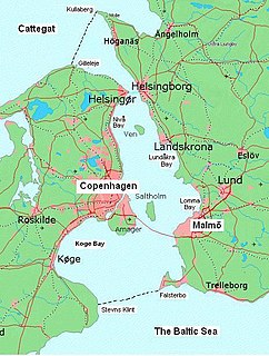
Øresund or Öresund, commonly known in English as the Sound, is a strait which forms the Danish–Swedish border, separating Zealand (Denmark) from Scania (Sweden). The strait has a length of 118 kilometres (73 mi) and the width varies from 4 kilometres (2.5 mi) to 28 kilometres (17 mi). It is 4 kilometres (2.5 mi) wide at its narrowest point between Helsingør in Denmark and Helsingborg in Sweden.
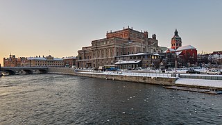
Stockholms ström, also known as Strömmen, in Stockholm is the innermost part of Saltsjön, a bay of the Baltic Sea. It continues into Lake Mälaren through Norrström and Söderström.

The Elbe–Lübeck Canal is an artificial waterway in eastern Schleswig-Holstein, Germany. It connects the rivers Elbe and Trave, creating an inland water route across the drainage divide from the North Sea to the Baltic Sea. The canal includes seven locks and runs for a length of 64 kilometres (40 mi) between the cities of Lübeck in the north and Lauenburg in the south by way of the Mölln lakes. The modern canal was built in the 1890s to replace the Stecknitz Canal, a medieval watercourse linking the same two rivers.

The Havel is a river in north-eastern Germany, flowing through the German states of Mecklenburg-Vorpommern, Brandenburg, Berlin and Saxony-Anhalt. It is a right tributary of the Elbe and 325 kilometres (202 mi) long. However, the direct distance from its source to its mouth is only 94 kilometres (58 mi).
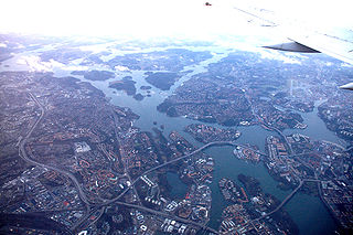
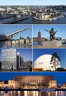
The City of Stockholm is situated on fourteen islands and on the banks to the archipelago where Lake Mälaren meets the Baltic Sea. The city centre is virtually situated on the water.
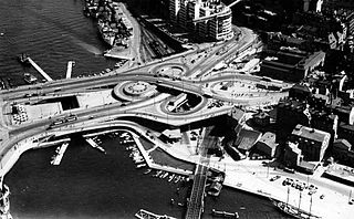
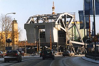
Slussenområdet is an area of central Stockholm, on the Söderström river connecting Södermalm and Gamla stan. The area is named after the locks between Lake Mälaren and the Baltic Sea. Called Karl Johanslussen, the locks themselves allow passage between these two bodies of water. Slussen also refers to the cloverleaf interchange and associated pedestrian passages and walkways opened on 15 October 1935.
The Strömsholm Canal runs from Smedjebacken to Lake Mälaren near Strömsholm. It is 62 miles long with 26 locks. It consists of a string of lakes connected by short manmade cuts.

The Volga–Baltic Waterway, formerly known as the Mariinsk Canal System, is a series of canals and rivers in Russia which link the Volga River with the Baltic Sea via the Neva River. Volga–Baltic Waterway connects the biggest lake on Earth, the Caspian Sea to the World Ocean. Its overall length between Cherepovets and Lake Onega is 368 kilometres (229 mi).
Södertörn is a roughly triangular peninsula and artificial island in eastern Södermanland, Sweden, which is bordered by:
Danviksbron or, alternatively, Danviksbro is a bascule bridge in central Stockholm, Sweden, connecting the eastern end of Södermalm to the eastern municipality Nacka. Under the bridge, the canal Hammarbykanalen carries the water of Hammarby Sjö over to Saltsjön. The bridge, actually two separate bridges, carries the railway Saltsjöbanan and a road.

Karl Johanslussen is a lock and a sluice, along the Söderström river connecting and controlling the flood discharge between Riddarfjärden, the easternmost part of Lake Mälaren, and Saltsjön, the section of the Baltic Sea reaching into central Stockholm, Sweden. The lock is 75 metres long, 10 metres wide and 3.90 metres deep. The maximum height is 3.8 metres. The lock is closed from 2016 to 2021 due to large reconstruction works in the area.

The Augustów Canal is a cross-border canal built in the 19th century in the present-day Podlaskie Voivodeship of northeastern Poland and the Grodno Region of north-western Belarus. From the time it was first built, the canal was described by experts as a technological marvel, with numerous sluices contributing to its aesthetic appeal.
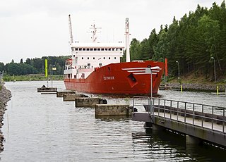
The Södertälje Canal is a canal connecting the lake Mälaren with the Baltic Sea, at the city of Södertälje. It is 5.2 km long, and it has one lock. The size of this lock is the largest in Scandinavia by allowed ship size. The lock is 135 m long and 17 m wide. The water level difference between Mälaren and the Baltic Sea is not large, on average 0.6 m (2 ft). This is the main shipping route into the lake Mälaren.

Norrström in central Stockholm connects Lake Mälaren with the Baltic Sea. It runs from Riddarfjärden, north of Gamla stan, to Stockholms ström. Two islands lie within it, Strömsborg and Helgeandsholmen. It is one of two natural waterways between Mälaren and the Baltic sea, the other being Söderström south of Gamla stan. Norrström is crossed by Centralbron and the adjacent pedestrian bridge, Vasabron, Riksbron north of Helgeandsholmen which continues into Riksgatan and Stallbron south of the island, Norrbro crossing Helgeandsholmen, and Strömbron.

The Eider Canal was an artificial waterway in southern Denmark which connected the North Sea with the Baltic Sea by way of the rivers Eider and Levensau. Constructed between 1777 and 1784, the Eider Canal was built to create a path for ships entering and exiting the Baltic that was shorter and less storm-prone than navigating around the Jutland peninsula. In the 1880s the canal was replaced by the enlarged Kiel Canal, which includes some of the Eider Canal's watercourse.
Söderström is a river in central Stockholm that connects Lake Mälaren with the Baltic Sea. It runs south of Gamla stan from Riddarfjärden to Stockholms ström. It is one of two natural waterways between Mälaren and the Baltic sea, the other being Norrström north of Gamla stan.