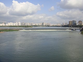
The Wanquan River is the third longest river in Hainan Province, China, and is 162 km long. It rises in the Wuzhi Mountain, and flows generally northeast turbulently in a narrow route through mountainous regions. About half way downstream, it enters Qionghai. Here the river bed widens and the water flows gently, and on the banks are mostly coconut trees and banana plantations. For its last 30 km, the river makes a southeast turn, and before it empties into the South China Sea at Bo'ao, where it joins the Longgun River and Jiuqu River in a common estuary.

Dongfang is one of the seven county-level cities of Hainan province, China. Although called a "city", Dongfang refers to a large land area in Hainan - an area which was once a county. Within this area is the main city, Dongfang City. It is located on the western coast of Hainan Island facing Vietnam across the Gulf of Tonkin, and in 2004 had a population of 435,000.

Dìng'ān is an administrative district in Hainan, the China. It is one of 4 counties of Hainan. In 1999 its population was 304,522 people.

Tunchang County is one of four counties of Hainan Province, People's Republic of China. Its postal code is 571600, and in 1999 its population was 250,059 people. The administrative seat lies at Tuncheng.

Hainan Normal University, is located in Haikou city and is the province's oldest institution for higher learning. Over 20,000 students are enrolled, including about 200 foreigners.
Changliu railway station is a railway station of Hainan Eastern Ring Railway, serving the Changliu township, located in Hainan, People's Republic of China. The station is currently not in operation.

Chengxi railway station is a railway station of Hainan Eastern Ring Railway, serving the Chengxi township, located in Hainan, People's Republic of China. The station is currently not in operation.

Meilan railway station is a railway station of Hainan Eastern Ring Railway located in Hainan, People's Republic of China. It is connected to the Haikou Meilan International Airport, which is the main airport of the Hainan island, and one of the busiest in China. Hence, travellers typically land in the Haikou Meilan International Airport, and then reach their final destination on the Hainan island thanks to the Hainan Eastern Ring Railway.
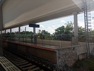
Wanning railway station is a railway station of Hainan East Ring Intercity Rail, serving the county-level city of Wanning, located in Hainan, People's Republic of China.
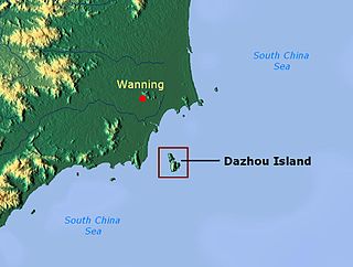
Dazhou Island is a state-level nature reserve located about 5 km off the coast of Wanning, Hainan, China. This protected area covers 4.36 square kilometres, and comprises three mountains spanning two islands. These mountains, the tallest of which is 289 metres above sea level, have been used as navigational markers by mariners since the Tang Dynasty.
Townships, formally township-level divisions, are the basic level of political divisions in China. They are similar to municipalities and communes in other countries and in turn may contain village committees and villages. In 1995 there were 29,502 townships and 17,532 towns in China.
Hele, Hélé, or Hèle may refer to:
Renmin Road Subdistrict is a subdistrict situated in Meilan District, Haikou, Hainan, China.
Yongxing is a township-level division situated in Xiuying District, Haikou, Hainan, China.
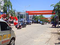
Baimajing is a township-level division in its own right situated in Hainan, China.
Zhongyuan is a town in Qionghai, Hainan, China.
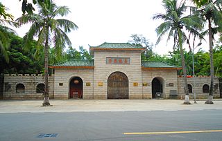
Xiuying Fort simplified Chinese: 秀英炮台; traditional Chinese: 秀英砲臺; pinyin: Xiùyīng Paòtaí) is located in Haikou City, Hainan Province, China. It was constructed in 1890 by the Qing government to counter the threat of the French. It was used to defend against the 1890 invasion by France, and in 1932 against the Japanese during the Cole attack.
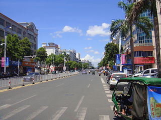
Huangliu town is a town in Ledong Li Autonomous County of Hainan Province of China. It is located near the southwestern coast of Hainan Island. The coastal highway runs through the town.
Boundary Island (Chinese:分界洲) is an island in Lingshui County, Hainan, China, located just off the south-east coast of Hainan Island, between Lingshui and Wanning, in Riyue Bay at 18.57864°N 110.195381°E.