
The Hoosier National Forest is a property managed by the United States Forest Service in the hills of southern Indiana. Composed of four separate sections, it has a total area of 202,814 acres. Hoosier National Forest's headquarters are located in Bedford, with a regional office in Tell City. Prominent places within the Forest include the Lick Creek Settlement, Potts Creek Rockshelter Archeological Site, and Jacob Rickenbaugh House.

Cloudland Canyon State Park is a 3,485 acres (14.10 km2) Georgia state park located near Trenton and Cooper Heights on the western edge of Lookout Mountain. One of the largest and most scenic parks in Georgia, it contains rugged geology, and offers visitors a range of vistas across the deep gorge cut through the mountain by Sitton Gulch Creek, where the elevation varies from 800 to over 1,800 feet. Views of the canyon can be seen from the picnic area parking lot, in addition to additional views located along the rim trail. At the bottom of the gorge, two waterfalls cascade across layers of sandstone and shale, ending in small pools below.
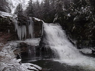
Swallow Falls State Park is a public recreation area located on the west bank of the Youghiogheny River nine miles (14 km) northwest of Oakland in Garrett County, Maryland, in the United States. The state park features Maryland's highest free-falling waterfall, the 53-foot (16 m) Muddy Creek Falls, as well as smaller waterfalls on the Youghiogheny River and Tolivar Creek. The park is notable for its stand of old hemlock trees, some more than 300 years old, "the last stand of its kind in Maryland."

Moccasin Creek State Park is a 32-acre (13 ha) state park located on the western shore of Lake Burton in Rabun County in the northeast corner of Georgia. The park features campgrounds; a fishing pier for the physically disabled, the elderly, and children; and walking trails. Even though the surrounding area is mountainous, the camping area is relatively flat.
The DeSoto Falls of Georgia are located in Lumpkin County, Georgia along Frogtown Creek. There are actually three waterfalls on Frogtown Creek, called Upper DeSoto Falls, Middle Desoto Falls and Lower DeSoto Falls. The upper waterfall drops 200 feet (61 m), the middle waterfall drops 67 feet (20 m) and the lower waterfall drops 35 feet (11 m). The overall height of the falls, as measured inclusive of non-vertical falls, cascades and steep stream bed, is 480 feet (150 m). DeSoto Falls are located at an elevation of 3,560-foot (1,090 m) on Rocky Mountain.

Salt Springs State Park is a Pennsylvania state park in Franklin Township, Susquehanna County, Pennsylvania, in the United States. The park is home to massive hemlock trees that are over 500 years old and are among the largest trees in all of Pennsylvania. The Fall Brook Natural Area within the park is recognized as a part of the Old-Growth Forest Network. The park also features a gorge with three waterfalls on Fall Brook. Salt Springs State Park is 7 miles (11 km) north of Montrose, just off Pennsylvania Route 29. The park is the only state park in Pennsylvania that is managed by a non-profit organization, the Friends of Salt Springs Park. The state owns 405 acres (164 ha) of land and the Friends own an additional 437 acres (177 ha) bringing the total amount of protected land to 842 acres (341 ha).

Douglas Falls are a 60-foot waterfall located in Buncombe County, North Carolina, United States. It is on a tributary of Waterfall Creek which flows into the Ivy River, and it is within the Big Ivy section of the Pisgah National Forest. The stream flows off the slope of Craggy Pinnacle, starting just below the Blue Ridge Parkway. It is surrounded by a forest of very large Eastern Hemlock trees, which are dead following attack by the Hemlock Wooly Adelgid. Visitors should be very careful when visiting this falls, as the dead Hemlocks will start to decay and fall within the next few years.
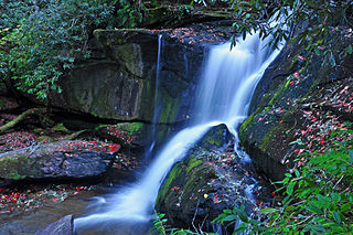
Roaring Fork Falls, also called Roaring Creek Falls, is a waterfall in the Pisgah National Forest, in North Carolina.

Santiam State Forest is one of six state forests managed by the Oregon Department of Forestry. The forest is located approximately 25 miles (40 km) southeast of Salem, Oregon, and includes 47,871 acres (193.73 km2) on the western slope of the Cascade Mountains in three Oregon counties: Clackamas, Linn, and Marion. It is bounded on the east by the Willamette National Forest and Mount Hood National Forest. Silver Falls State Park is located west of the forest. The rest of the land surrounding the forest belongs to the Bureau of Land Management or is privately owned. The forest is managed as part of the Department of Forestry's North Cascade District.
Citico Creek Wilderness is a 16,226-acre (66 km2) wilderness area within the Cherokee National Forest in the U.S. state of Tennessee. The wilderness contains the entire upper drainage of Citico Creek, which consists of the north and south forks and at least eight tributaries. Three steep-sided ridges descend west from the crest of the Unicoi Mountains — Brush Mountain, Pine Ridge, and Sassafras Ridge.

Marymere Falls is located in Olympic National Park near Lake Crescent in Washington, United States. The falls are accessed by a one-mile, well maintained, dirt trail through old-growth lowland forest consisting of fir, cedar, hemlock, and alder trees. Falls creek descends from Aurora Ridge and tumbles over Marymere Falls and then flows into Barnes Creek. It has a height of 90 feet. The falls is one of the more popular attractions in the area, due to ease of access and proximity to U.S. Highway 101.

Cascadia State Park is a state park in the U.S. state of Oregon near Sweet Home along the South Santiam River at Cascadia. The park includes a day use area, campsites, hiking trails and 150 foot Lower Soda Creek Falls.
Cedar Rock Falls is a waterfall in Transylvania County, North Carolina, USA.

Yakso Falls is a 70-foot (21 m) waterfall on Little River, in the Cascade Range east of Roseburg in the U.S. state of Oregon. The waterfall is about 27 miles (43 km) from the unincorporated community of Glide along Little River Road, which becomes Forest Road 27.
Final Falls, is a waterfall located on the Salmon River at the south skirt of the Mount Hood National Forest, in Clackamas County, in the U.S. state of Oregon. It is located in a privileged area where the river creates several waterfalls: Frustration Falls, Vanishing Falls, Little Niagara Falls, and Copper Creek Falls are within a mile from Final Falls; while Hideaway Falls, Split Falls, and Stein Falls are approximately two miles away.
Vanishing Falls, is a waterfall located on the Salmon River at the south skirt of the Mount Hood National Forest, in Clackamas County, in the U.S. state of Oregon. It is located in a privileged area where the river creates several waterfalls: Final Falls, Frustration Falls, Little Niagara Falls, and Copper Creek Falls are within a mile from Vanishing Falls; while Hideaway Falls, Split Falls, and Stein Falls are approximately two miles away.
Beaver Falls, is a waterfall located on Beaver Creek near the town of Clatskanie in Columbia County, in the U.S. state of Oregon.
Clover Falls, also known in the past as Upper Hemlock Falls, is a waterfall from the Hemlock Creek, in the heart of the Umpqua National Forest, just north of Hemlock Lake and its campground, in Douglas County, Oregon. Access to Clover Falls is from the Lake of the Woods campground. The waterfall is located in a privileged natural area where the river creates several waterfalls; Hemlock Falls, Yakso Falls, and Tributary Falls are within a mile distance.
Hemlock Falls is a waterfall from the Hemlock Creek, in the heart of the Umpqua National Forest, just north of Hemlock Lake and its campground, in Douglas County, Oregon. Access to Hemlock Falls is from the Lake in the Woods campground. The waterfall is located in a privileged natural area where the river creates several waterfalls: Clover Falls, Yakso Falls, and Tributary Falls are within a mile distance.

