
A hillfort is a type of earthworks used as a fortified refuge or defended settlement, located to exploit a rise in elevation for defensive advantage. They are typically European and of the Bronze and Iron Ages. Some were used in the post-Roman period. The fortification usually follows the contours of a hill, consisting of one or more lines of earthworks, with stockades or defensive walls, and external ditches. Hillforts developed in the Late Bronze and Early Iron Age, roughly the start of the first millennium BC, and were used in many Celtic areas of central and western Europe until the Roman conquest.

Maiden Castle is an Iron Age hill fort 1.6 miles (2.6 km) south west of Dorchester, in the English county of Dorset. Hill forts were fortified hill-top settlements constructed across Britain during the Iron Age.

There are three related types of Neolithic earthwork that are all sometimes loosely called henges. The essential characteristic of all three is that they feature a ring-shaped bank and ditch, with the ditch inside the bank. Because the internal ditches would have served defensive purposes poorly, henges are not considered to have been defensive constructions. The three henge types are as follows, with the figure in brackets being the approximate diameter of the central flat area:
- Henge (> 20 m). The word henge refers to a particular type of earthwork of the Neolithic period, typically consisting of a roughly circular or oval-shaped bank with an internal ditch surrounding a central flat area of more than 20 m (66 ft) in diameter. There is typically little if any evidence of occupation in a henge, although they may contain ritual structures such as stone circles, timber circles and coves. Henge monument is sometimes used as a synonym for henge. Henges sometimes, but by no means always, featured stone or timber circles, and circle henge is sometimes used to describe these structures. The three largest stone circles in Britain are each in a henge. Examples of henges without significant internal monuments are the three henges of Thornborough Henges. Although having given its name to the word henge, Stonehenge is atypical in that the ditch is outside the main earthwork bank.
- Hengiform monument (5 – 20 m). Like an ordinary henge except the central flat area is between 5 and 20 m (16–66 ft) in diameter, they comprise a modest earthwork with a fairly wide outer bank. Mini henge or Dorchester henge are sometimes used as synonyms for hengiform monument. An example is the Neolithic site at Wormy Hillock Henge.
- Henge enclosure (> 300 m). A Neolithic ring earthwork with the ditch inside the bank, with the central flat area having abundant evidence of occupation and usually being more than 300 m (980 ft) in diameter. Some true henges are as large as this, but lack evidence of domestic occupation. Super henge is sometimes used as a synonym for a henge enclosure. However, sometimes Super henge is used to indicate size alone rather than use, e.g. "Marden henge ... is the least understood of the four British 'superhenges' (the others being Avebury, Durrington Walls and Mount Pleasant Henge".
A causewayed enclosure is a type of large prehistoric earthwork common to the early Neolithic in Europe. More than 100 examples are recorded in France and 70 in England, while further sites are known in Scandinavia, Belgium, Germany, Italy, Ireland and Slovakia.
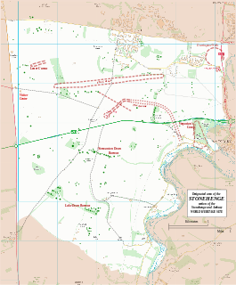
Durrington Walls is the site of a large Neolithic settlement and later henge enclosure located in the Stonehenge World Heritage Site. It lies 2 miles (3.2 km) north-east of Stonehenge in the parish of Durrington, just north of Amesbury.

Long Meg and Her Daughters is a Bronze Age stone circle near Penrith in Cumbria, North West England. One of around 1,300 stone circles in the British Isles and Brittany, it was constructed as a part of a megalithic tradition that lasted from 3,300 to 900 BCE, during the Late Neolithic and Early Bronze Age. The stone circle is the sixth-largest example known from this part of north-western Europe, being slightly smaller than the rings at Stanton Drew in Somerset, the Ring of Brodgar in Orkney and Newgrange in County Meath.

In archaeology, an enclosure is one of the most common types of archaeological site. It is any area of land separated from surrounding land by earthworks, walls or fencing. Such a simple feature is found all over the world and during almost all archaeological periods. They may be few metres across or be large enough to encompass whole cities.
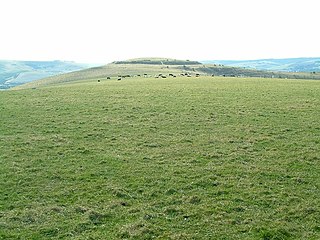
Mount Caburn is a 480-foot (146m) prominent landmark in East Sussex, England, about one mile (1.6 km) east of Lewes overlooking the village of Glynde. It is the highest part of an outlier of the South Downs, separated from the main range by Glynde Reach, a tributary of the River Ouse.

Carl Wark is a rocky promontory on Hathersage Moor in the Peak District National Park, just inside the boundary of Sheffield, England. The promontory is faced by vertical cliffs on all but one side, which is protected by a prehistoric embankment. The cliffs and embankment form an enclosure that has been interpreted as an Iron Age hill fort, though the date of construction and purpose of the fortifications remains unknown. The site is a scheduled monument.

Salthouse is a village and a civil parish in the English county of Norfolk. It is situated on the salt marshes of North Norfolk. It is 3.8 miles (6.1 km) north of Holt, 5.4 miles (8.7 km) west of Sheringham and 26.3 miles (42.3 km) north of Norwich. The village is on the A149 coast road between King's Lynn and Great Yarmouth. The nearest railway station is at Sheringham for the Bittern Line which runs between Sheringham, Cromer and Norwich. The nearest airport is Norwich International Airport. The landscape around Salthouse lies within the Norfolk Coast AONB and the North Norfolk Heritage Coast. The civil parish has an area of 6.22 km2 (2.40 sq mi) and in 2001 had a population of 196 in 88 households, the population increasing to 201 at the 2011 Census. For the purposes of local government, the parish falls within the district of North Norfolk.

Trendle Ring is a late prehistoric earthwork on the Quantock Hills near Bicknoller in Somerset, England. It is a Scheduled Ancient Monument. In 2013 it was added to the Heritage at Risk register due to vulnerability to plant growth.

Grange stone circle 300m west of Lough Gur in County Limerick, Ireland, is situated beside the Limerick-Kilmallock road, 4 km north of Bruff.

Rough Tor, or Roughtor, is a tor on Bodmin Moor, Cornwall, England, United Kingdom. The site is composed of the tor summit and logan stone, a neolithic tor enclosure, a large number of Bronze Age hut circles, and some contemporary monuments.
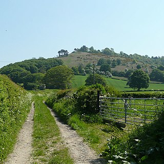
Croft Ambrey is a British Iron Age hill fort in northern Herefordshire, 10 kilometres (6 mi) north of Leominster close to the present day county border with South Shropshire.
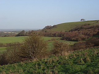
Ladle Hill lies on Great Litchfield Down, near the village of Burghclere and Watership Down, in north Hampshire. It is immediately to the east of Beacon Hill. Part of the hill is a 10.37 hectares biological SSSI, number 1000642, first notified in 1978. It is 232 metres high and has a hillfort and a tumulus on its slopes. The hill is easily accessed from the nearby cross county footpath, Wayfarer's Walk. The hill falls within the North Wessex Downs Area of Outstanding Natural Beauty.

Scratchbury Camp is the site of an Iron Age univallate hillfort located on Scratchbury Hill, near the village of Norton Bavant in Wiltshire, England. The fort covers an area of 37 acres (15 ha) and occupies the summit of the hill on the edge of Salisbury Plain, with its four-sided shape largely following the natural contours of the hill.

Chiselbury is the site of an Iron Age univallate hillfort located in Wiltshire. The hillfort is sub-circular in plan, and encloses an area of approximately 10.5 acres (460,000 sq ft). It is defined by an earthen rampart up to 3.6 metres (12 ft) in height and an external ditch, up to a maximum of 1.6 metres (5.2 ft) in depth. A gap in the southeastern side of the rampart, and a corresponding causeway across the ditch, is thought to be the original entrance and is associated with a small 'D' shaped embanked enclosure, which is apparently visible on aerial photographs. Although the enclosure has subsequently been degraded by ploughing, it is still apparent as a series of low earthworks.

Hillforts in Britain refers to the various hillforts within the island of Great Britain. Although the earliest such constructs fitting this description come from the Neolithic British Isles, with a few also dating to later Bronze Age Britain, British hillforts were primarily constructed during the British Iron Age. Some of these were apparently abandoned in the southern areas that were a part of Roman Britain, although at the same time, those areas of northern Britain that remained free from Roman occupation saw an increase in their construction. Some hillforts were reused in the Early Middle Ages, and in some rarer cases, into the Later Medieval period as well. By the early modern period, these had essentially all been abandoned, with many being excavated by archaeologists in the nineteenth century onward.
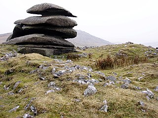
A ring cairn is a circular or slightly oval, ring-shaped, low embankment, several metres wide and from 8 to 20 metres in diameter. It is made of stone and earth and was originally empty in the centre. In several cases the middle of the ring was later used. The low profile of these cairns is not always possible to make out without conducting excavations.
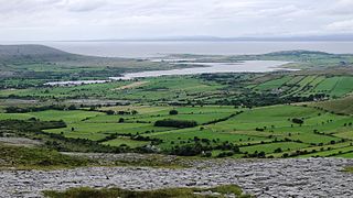
Oughtmama is a civil parish in County Clare. It lies in the Burren, a region in the northwest of the county. It contains a large number of antiquities, including three early-medieval Christian churches, ruined castles, prehistoric cairns and ring forts and two Martello Towers built in the early 19th century.


