Hudson Avenue Line (surface)

Last updated

The Hudson Avenue Line was a horse car street railway line in Brooklyn, New York City, United States, running mostly along Hudson Avenue in Vinegar Hill, near Downtown Brooklyn. It was short-lived, operating only from 1867 to 1871, but its trackage rights over the Brooklyn City Rail Road allowed the Atlantic Avenue Railroad to operate South Ferry-Prospect Park cars for many years.

Brooklyn Borough in New York City and county in New York state, United States

Brooklyn is the most populous borough of New York City, with an estimated 2,648,771 residents in 2017. Named after the Dutch village of Breukelen, it borders the borough of Queens at the western end of Long Island. Brooklyn has several bridge and tunnel connections to the borough of Manhattan across the East River, and the Verrazzano-Narrows Bridge connects Staten Island. Since 1896, Brooklyn has been coterminous with Kings County, the most populous county in the U.S. state of New York and the second-most densely populated county in the United States, after New York County.

New York City Largest city in the United States

The City of New York, usually called either New York City (NYC) or simply New York (NY), is the most populous city in the United States and in the U.S. state of New York. With an estimated 2017 population of 8,622,698 distributed over a land area of about 302.6 square miles (784 km2), New York is also the most densely populated major city in the United States. Located at the southern tip of the state of New York, the city is the center of the New York metropolitan area, the largest metropolitan area in the world by urban landmass and one of the world's most populous megacities, with an estimated 20,320,876 people in its 2017 Metropolitan Statistical Area and 23,876,155 residents in its Combined Statistical Area. A global power city, New York City has been described as the cultural, financial, and media capital of the world, and exerts a significant impact upon commerce, entertainment, research, technology, education, politics, tourism, art, fashion, and sports. The city's fast pace has inspired the term New York minute. Home to the headquarters of the United Nations, New York is an important center for international diplomacy.

United States Federal republic in North America

The United States of America (USA), commonly known as the United States or America, is a country composed of 50 states, a federal district, five major self-governing territories, and various possessions. At 3.8 million square miles, the United States is the world's third or fourth largest country by total area and is slightly smaller than the entire continent of Europe's 3.9 million square miles. With a population of over 327 million people, the U.S. is the third most populous country. The capital is Washington, D.C., and the largest city by population is New York City. Forty-eight states and the capital's federal district are contiguous in North America between Canada and Mexico. The State of Alaska is in the northwest corner of North America, bordered by Canada to the east and across the Bering Strait from Russia to the west. The State of Hawaii is an archipelago in the mid-Pacific Ocean. The U.S. territories are scattered about the Pacific Ocean and the Caribbean Sea, stretching across nine official time zones. The extremely diverse geography, climate, and wildlife of the United States make it one of the world's 17 megadiverse countries.

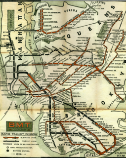
The Hudson Avenue Railroad opened the line in late 1867, [1] from the Hudson Avenue Ferry to Gouverneur Slip in Manhattan south along Hudson Avenue and the Brooklyn City Rail Road's Flatbush Avenue Line trackage [2] on Flatbush Avenue to Ninth Avenue at Prospect Park. The ferry stopped running in early June 1868, and the company asked the Common Council to lay track in John Street and Bridge Street to the Bridge Street Ferry to James Slip in Manhattan. [3] Consent was given later that month, [4] and the new line was opened by August 18, 1868. [5] However, this did not draw enough traffic from the Bridge Street Ferry to turn a profit, and it shut down for the winter. [6] In mid-1869, the Brooklyn and Jamaica Railway (Atlantic Avenue Line) leased the Hudson Avenue Railroad, [2] [7] in part to use its Brooklyn City Rail Road trackage rights to reach Prospect Park from South Ferry; [8] cars to the Bridge Street Ferry began operating again in August. [9] The track was removed by the city in 1871 to build a sewer, and was never relaid. [10]

Manhattan Borough in New York City and county in New York, United States

Manhattan, often referred to locally as the City, is the most densely populated of the five boroughs of New York City and its economic and administrative center, cultural identifier, and historical birthplace. The borough is coextensive with New York County, one of the original counties of the U.S. state of New York. The borough consists mostly of Manhattan Island, bounded by the Hudson, East, and Harlem rivers; several small adjacent islands; and Marble Hill, a small neighborhood now on the U.S. mainland, physically connected to the Bronx and separated from the rest of Manhattan by the Harlem River. Manhattan Island is divided into three informally bounded components, each aligned with the borough's long axis: Lower, Midtown, and Upper Manhattan.

Flatbush Avenue avenue in Brooklyn, New York

Flatbush Avenue is a major avenue in the New York City Borough of Brooklyn. It runs from the Manhattan Bridge south-southeastward to Jamaica Bay, where it joins the Marine Parkway–Gil Hodges Memorial Bridge, which connects Brooklyn to the Rockaway Peninsula in Queens. The north end was extended from Fulton Street to the Manhattan Bridge as "Flatbush Avenue Extension".

The Bridge Street Ferry was a ferry route connecting Manhattan and Williamsburg, Brooklyn, New York City, United States, joining James Slip (Manhattan) and Bridge Street (Brooklyn) across the East River.

Related Research Articles

BMT Lexington Avenue Line

The BMT Lexington Avenue Line was the first standard elevated railway in Brooklyn, New York, operated in its later days by the Brooklyn Rapid Transit Company, the Brooklyn–Manhattan Transit Corporation, and then the City of New York.

Brooklyn City Railroad

The Brooklyn City Railroad (BCRR) was the oldest and one of the largest operators of streetcars in the City of Brooklyn, New York, continuing in that role when Brooklyn became a borough of New York City in 1898.

Starting in 1899, the Brooklyn Rapid Transit Company and Brooklyn–Manhattan Transit Corporation operated rapid transit lines in New York City — at first only elevated railways and later also subways.

Atlantic Branch

The Atlantic Branch is an electrified rail line owned and operated by the Long Island Rail Road in the U.S. state of New York. It is the only LIRR line that runs in the borough of Brooklyn.

The Atlantic Avenue Railroad was a company in the U.S. state of New York, with a main line connecting downtown Brooklyn with Jamaica along Atlantic Avenue. It was largely a streetcar company that operated its own trains, but the Long Island Rail Road operated both streetcars and steam trains over its main line. It later became part of the Nassau Electric Railroad, but is now divided between the active Atlantic Branch of the LIRR and the unused Cobble Hill Tunnel, which is preserved in its original state, albeit without service tracks.

B38 (New York City bus) Bus route in Brooklyn, New York

The DeKalb Avenue Line is a public transit line in Brooklyn and Queens, New York City, United States, running mostly along DeKalb Avenue, as well as eastbound on Lafayette Avenue, between downtown Brooklyn and Ridgewood, Queens. Originally a streetcar line, it is now the B38 DeKalb/Lafayette Avenues bus route, operated by the New York City Transit Authority.

B65 (New York City bus) Bus route in Brooklyn, New York

The Bergen Street Line is a public transit line in Brooklyn, New York City, United States, running westbound mostly along Bergen Street, as well as eastbound on Dean Street, between Downtown Brooklyn and Ocean Hill. Originally a streetcar line, it is now the B65 bus route, operated by the New York City Transit Authority. The B65 is based out of the East New York Depot in East New York, Brooklyn.

The Bushwick Avenue Line or Bushwick Line was a public transit line in Brooklyn, New York City, United States, running mostly along Bushwick Avenue and Myrtle Avenue between Williamsburg and Ridgewood, Queens.

The Nassau Electric Railroad was an electric street railway company in the U.S. state of New York. The company operated throughout the borough of Brooklyn, as well as over the Brooklyn Bridge and Williamsburg Bridge into Manhattan.

The Vanderbilt Avenue Line is a public transit line in Brooklyn, New York City, running along 7th Avenue and Vanderbilt Avenue between Kensington and Dumbo. Originally a streetcar line, it is now the B69 bus route, operated by MTA New York City Bus' Jackie Gleason Depot in Sunset Park.

B45 (New York City bus) Bus route in Brooklyn, New York

The St. Johns Place Line is a public transit line in Brooklyn, New York, mainly along Atlantic Avenue, Washington Avenue, Sterling Place, and St. Johns Place between Downtown Brooklyn and Crown Heights. Originally a streetcar line, it is now the B45 bus route, operated by the New York City Transit Authority.

The Graham Avenue Line and Tompkins Avenue Line were two public transit lines in Brooklyn, New York City with the Graham Avenue Line running mainly along Graham Avenue and Manhattan Avenue and the Tompkins Avenue Line running mainly along Tompkins Avenue. The Graham Avenue line ran between Downtown Brooklyn and Greenpoint and the Tompkins Avenue Line ran between Prospect Lefferts Gardens and Williamsburg. Originally streetcar lines, they were replaced by the B47 and B62 bus routes which were then combined to form the B43 route which currently operates between Prospect-Lefferts Gardens and Greenpoint. The line is dispatched from Jackie Gleason Depot in Sunset Park, Brooklyn.

Fifth Avenue Line (Brooklyn elevated)

The Fifth Avenue Line, also called the Fifth Avenue elevated or Fifth Avenue–Bay Ridge line, was an elevated rail line in Brooklyn, New York City, United States. It ran above Hudson Avenue, Flatbush Avenue, Fifth Avenue, 38th Street, and Third Avenue from Downtown Brooklyn south to Bay Ridge. The portion on Third Avenue was called the Third Avenue elevated to distinguish service from the West End elevated; it was separate from the Third Avenue elevated in Manhattan and the Bronx.

The Union Avenue Line was a public transit line in Brooklyn, New York City, United States, running mostly along Myrtle Avenue, Knickerbocker Avenue, Flushing Avenue, Throop Avenue, and Union Avenue from Ridgewood, Queens northwest to Greenpoint, Brooklyn.

The B48 bus route constitutes a public transit line in Brooklyn, New York City, United States, running along Lorimer Street, Franklin Avenue, and Classon Avenue between Flatbush and Greenpoint. Originally the Lorimer Street streetcar line, it is now a bus route operated by MTA New York City Bus.

The Adams Street and Boerum Place Line was a public transit line in Downtown Brooklyn, New York City, United States, running along Boerum Place and Adams Street. It served as access for the Atlantic Avenue Railroad to the City Hall area.

The Brooklyn and North River Line, operated by the Brooklyn and North River Railroad, was a trolley line in Manhattan and Brooklyn, New York City, United States. Its route ran from the Desbrosses Street Ferry across Lower Manhattan via the Canal Street Crosstown Line, over a pair of tracks on the east side of the Manhattan Bridge, and to the intersection of Flatbush Avenue and Fulton Street in Downtown Brooklyn. Operation in Manhattan and over the bridge was with conduit electrification, while in Brooklyn it used overhead trolley wire, switching at a plow pit.

The Hicks Street Line was a public transit line in Brooklyn, New York City, United States, running from the Ninth Avenue Depot at Greenwood Cemetery to the Brooklyn Bridge.

Gouverneur Street Ferry

The Gouverneur Street Ferry was a ferry route connecting Manhattan, New York City, with the city of Brooklyn, by joining Manhattan's Gouverneur Street to Brooklyn's Bridge Street across the East River.

West End Line (Brooklyn surface)

The West End Line or New Utrecht Avenue Line was a surface transit line in Brooklyn, New York City, United States, running along New Utrecht Avenue and other streets between Coney Island and Sunset Park. Built by the Brooklyn, Bath and Coney Island Railroad as a steam line, it became a trolley line, along which elevated trains ran until the new elevated BMT West End Line opened. This route is no longer part of any bus line; its southern part was part of a bus route. In 2013, the B64 route to Coney Island was restored.

References

  1. Brooklyn Daily Eagle, December 12, 1867, page 2
  2. 1 2 Brooklyn Daily Eagle, About City Railroads, June 24, 1869, page 2
  3. Brooklyn Daily Eagle, Common Council Committees - Docks and Railroads, June 19, 1868, page 2
  4. Brooklyn Daily Eagle, June 30, 1868, page 2
  5. Brooklyn Daily Eagle, Travel, August 18, 1868, page 1
  6. Brooklyn Daily Eagle, Hudson Avenue Railroad, December 4, 1868, page 2
  7. Brooklyn Daily Eagle, The Railroad Trouble, July 21, 1869, page 3
  8. Brooklyn Daily Eagle, One Railroad Trouble Settled, July 24, 1869, page 3
  9. Brooklyn Daily Eagle, Hudson Avenue Railroad and Bridge Street Ferry, August 18, 1869, page 3
  10. Brooklyn Daily Eagle, The Hudson Avenue Railroad, July 3, 1872, page 2