Illulissuaq Peninsula

Last updated

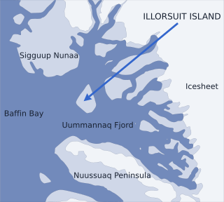
Illulissuaq Peninsula (old spelling: Igdluligssuaq) is a mainland peninsula in northwestern Greenland, located in the northern part of Upernavik Archipelago [1]

Peninsula A piece of land that is bordered by water on three sides but connected to mainland

A peninsula is a landform surrounded by water on the majority of its border while being connected to a mainland from which it extends. The surrounding water is usually understood to be continuous, though not necessarily named as a single body of water. Peninsulas are not always named as such; one can also be a headland, cape, island promontory, bill, point, or spit. A point is generally considered a tapering piece of land projecting into a body of water that is less prominent than a cape. A river which courses through a very tight meander is also sometimes said to form a "peninsula" within the loop of water. In English, the plural versions of peninsula are peninsulas and, less commonly, peninsulae.

Greenland autonomous country within the Kingdom of Denmark

Greenland is an autonomous constituent country of the Kingdom of Denmark between the Arctic and Atlantic oceans, east of the Canadian Arctic Archipelago. Though physiographically a part of the continent of North America, Greenland has been politically and culturally associated with Europe for more than a millennium. The majority of its residents are Inuit, whose ancestors began migrating from the Canadian mainland in the 13th century, gradually settling across the island.

Upernavik Archipelago

Upernavik Archipelago is a vast coastal archipelago in the Avannaata municipality in northwestern Greenland, off the shores of northeastern Baffin Bay. The archipelago extends from the northwestern coast of Sigguup Nunaa peninsula in the south at approximately 71°50′N56°00′W to the southern end of Melville Bay in the north at approximately 74°50′N57°30′W.

Contents

History

The peninsula was inhabited between 1908 and 1973, although not continuously. The Illulik settlement, perched on the western cape of the peninsula, was very small, and consisted of only several families. Illulik was temporarily abandoned for the first time in 1909, due to relative isolation from other settlements of the region in early 20th century. The settlement was repopulated in 1914, and unlike small, insular villages in Inussulik Bay and Sugar Loaf Bay to the south, it survived the post-war consolidation phase in northwestern Greenland. It was permanently abandoned in 1973. [2]

Illulik Place in Greenland, Kingdom of Denmark

Illulik is a former settlement in the Qaasuitsup municipality in northwestern Greenland.

Inussulik Bay is a bay in the Upernavik Archipelago in the Qaasuitsup municipality in northwestern Greenland.

Sugar Loaf Bay is a bay in the Upernavik Archipelago in the Qaasuitsup municipality in northwestern Greenland. It is an indentation of northeastern Baffin Bay. The name of the bay derives from the name of an island of the same name in the bay, Sugar Loaf Island.

Geography

Aerial view of Illulissuaq Peninsula from Inussulik Bay, from the west. Illulissuaq-Peninsula.jpg
Aerial view of Illulissuaq Peninsula from Inussulik Bay, from the west.

The base of the peninsula, shared with the neighboring Nuussuaq Peninsula, is a nunatak located at 74°22′30″N56°00′00″W / 74.37500°N 56.00000°W / 74.37500; -56.00000 , and rising to 280 m (920 ft) above the Greenland ice sheet (Greenlandic : Sermersuaq) reaching the sea level to the south and north of the nunatak. The peninsula has an east–west orientation, jutting westwards into Inussulik Bay. [1]

Nuussuaq Peninsula is a mainland peninsula in northwestern Greenland, located at the northern end of Upernavik Archipelago, approximately 70 km (43 mi) to the south of Melville Bay. It is much smaller than its namesake in western Greenland.

Nunatak Exposed, often rocky element of a ridge, mountain, or peak not covered with ice or snow within an ice field or glacier

A nunatak is an exposed, often rocky element of a ridge, mountain, or peak not covered with ice or snow within an ice field or glacier. They are also called glacial islands. Examples are natural pyramidal peaks. When rounded by glacial action, smaller rock promontories may be referred to as rognons.

Greenland ice sheet glacier in Greenland

The Greenland ice sheet is a vast body of ice covering 1,710,000 square kilometres (660,000 sq mi), roughly 80% of the surface of Greenland.

In the south, Illulissuaq Peninsula is separated from Nuussuaq Peninsula by the Kangerluarsuk Fjord, an inlet of Inussulik Bay. The fjord nearly splits the peninsula into two halves, with the western half separated from the nunatak in the east by a low, narrow isthmus. The western half of the peninsula forks into two, with a small rocky child Paattorfik Peninsula, pointing southwestwards and bounding Kangerluarsuk from the northwest. [1]

Kangerluarsuk Fjord is a fjord in northwestern Greenland, located at the northern end of Upernavik Archipelago.

Isthmus Narrow strip of land connecting two larger land areas

An isthmus is a narrow piece of land connecting two larger areas across an expanse of water by which they are otherwise separated. A tombolo is an isthmus that consists of a spit or bar, and a strait is the sea counterpart of an isthmus.

The peninsula is approximately 17.4 km (10.8 mi) long. It is mountainous, culminating in several summits, with the highest reaching 796 m (2,612 ft) on Paattofrik. [1]

Promontories

NameDirectionLatitude NLongitude W
Paatrorfiup NuuaSouthwestern Cape74°17′20″56°34′20″
IllulikWestern Cape74°20′40″56°43′00″

Related Research Articles

Nunavik Peninsula

Nunavik Peninsula is a large peninsula in northwestern Greenland. It separates two cultural and geographical regions of northwestern Greenland: Uummannaq Fjord region in the southeast, and Upernavik Archipelago in the north.

Ikerasak Fjord

Ikerasak Fjord is a fjord in the Qaasuitsup municipality in northwestern Greenland.

Kiatassuaq Island island in Greenland

Kiatassuaq Island is an uninhabited island in the northern Upernavik Archipelago in the Qaasuitsup municipality in northwestern Greenland. It marks the southern border of Melville Bay.

Illullip Sermia glacier in Greenland

Illullip Sermia is a tidewater glacier in the Qaasuitsup municipality on the northwestern shore of Greenland. It drains the Greenland ice sheet southwestwards into Inussulik Bay, an inlet of Baffin Bay. The glacier front is located between the Sanningassorsuaq Peninsula in the north, and the base of Illulissuaq Peninsula in the south. The glacier front is located at 74°22′40″N56°04′50″W.

Sanningassorsuaq Peninsula is a mainland peninsula in northwestern Greenland, located at the northern end of Upernavik Archipelago.

Ikerasaa Strait is a strait in the Upernavik Archipelago in the Qaasuitsup municipality in northwestern Greenland. The strait separates Kiatassuaq Island in the north from the mainland Sanningassorsuaq Peninsula in the south. The name of the strait is the local dialect version of ikerasak, a generic word for 'strait' in the Greenlandic language.

Amarortalik Island island in Greenland

Amarortalik Island is an uninhabited island in the Qaasuitsup municipality in northwestern Greenland. The name of the island means "the place of wolves" in the Greenlandic language.

Nuussuup Kangia is a fjord in northwestern Greenland, located at the northern end of Upernavik Archipelago.

Anoritooq is a nunatak in the Qaasuitsup municipality in northwestern Greenland.

Illoorfik Island

Illoorfik Island is a small, uninhabited island in the Qaasuitsup municipality in northwestern Greenland. The island is a single flooded mountain of 341 m (1,119 ft).

Ikermiut Island

Ikermiut Island is a small, uninhabited island in the Qaasuitsup municipality in northwestern Greenland, located in the center of Inussulik Bay in the northern part of Upernavik Archipelago, approximately halfway between Kiatassuaq Island in the north and Nuussuaq Peninsula in the south.

Tasiusaq Bay is a bay in the Upernavik Archipelago in the Qaasuitsup municipality in northwestern Greenland. It is an indentation of northeastern Baffin Bay. The name of the bay derives from the name of the settlement of the same name in the bay.

Nuussuup Nuua is a cape in the Qaasuitsup municipality in northwestern Greenland.

References

  1. 1 2 3 4 Upernavik Avannarleq, Saga Map, 1:250.000, Tage Schjøtt, 1992
  2. Petersen, Robert (2003). Settlements, kinship and hunting grounds in traditional Greenland: A comparative study of local experiences from Upernavik and Ammassalik. Danish Polar Center. pp. 107, 111, 133. ISBN   978-87-635-1261-9.

Coordinates: 74°20′N56°24′W / 74.333°N 56.400°W / 74.333; -56.400

Geographic coordinate system Coordinate system

A geographic coordinate system is a coordinate system that enables every location on Earth to be specified by a set of numbers, letters or symbols. The coordinates are often chosen such that one of the numbers represents a vertical position and two or three of the numbers represent a horizontal position; alternatively, a geographic position may be expressed in a combined three-dimensional Cartesian vector. A common choice of coordinates is latitude, longitude and elevation. To specify a location on a plane requires a map projection.