
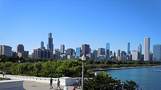
Illinois is a state in the Midwestern region of the United States. It has the fifth largest gross domestic product (GDP), the sixth largest population, and the 25th largest land area of all U.S. states. Illinois has been noted as a microcosm of the entire United States. With Chicago in northeastern Illinois, small industrial cities and immense agricultural productivity in the north and center of the state, and natural resources such as coal, timber, and petroleum in the south, Illinois has a diverse economic base, and is a major transportation hub. The Port of Chicago connects the state to international ports via two main routes: from the Great Lakes, via the Saint Lawrence Seaway, to the Atlantic Ocean and from the Great Lakes to the Mississippi River, via the Illinois River, through the Illinois Waterway. The Mississippi River, the Ohio River, and the Wabash River form parts of the boundaries of Illinois. For decades, Chicago's O'Hare International Airport has been ranked as one of the world's busiest airports. Illinois has long had a reputation as a bellwether both in social and cultural terms and, through the 1980s, in politics.

Missouri is a state in the Midwestern region of the United States. Ranking 21st in land area, it is bordered by eight states : Iowa to the north, Illinois, Kentucky and Tennessee to the east, Arkansas to the south and Oklahoma, Kansas and Nebraska to the west. In the south are the Ozarks, a forested highland, providing timber, minerals, and recreation. The Missouri River, after which the state is named, flows through the center into the Mississippi River, which makes up the eastern border. With more than six million residents, it is the 19th-most populous state of the country. The largest urban areas are St. Louis, Kansas City, Springfield and Columbia; the capital is Jefferson City.

Springfield is the capital of the U.S. state of Illinois and the county seat and largest city of Sangamon County. The city's population was 116,250 at the 2010 U.S. Census, which makes it the state's sixth most-populous city, the second largest outside of the Chicago metropolitan area, and the largest in central Illinois. As of 2019, the city's population was estimated to have decreased to 114,230, with just over 211,700 residents living in the Springfield Metropolitan Statistical Area, which includes Sangamon County and the adjacent Menard County.
Interstate 57 (I-57) is a north–south Interstate Highway in Missouri and Illinois that parallels the old Illinois Central Railroad for much of its route. It runs from Sikeston, Missouri, at Interstate 55 to Chicago, Illinois, at Interstate 94. I-57 essentially serves as a shortcut route for travelers headed between the south and Chicago, bypassing St. Louis, Missouri. Between the junction of I-55 and I-57 in Sikeston and the junction of I-55 and I-90/94 in Chicago, I-55 travels for 436 miles (702 km), while the combination of I-57 and I-94 is only 396 miles (637 km) long between the same two points. In fact, both the control cities on the overhead signs and the destination mileage signs reference Memphis along southbound I-57, even as far north as its northern origin at I-94 in Chicago. Likewise, at its southern end, Chicago is the control city listed for I-57 on signs on northbound I-55 south of Sikeston, even though I-55 also goes to Chicago.
Interstate 72 (I-72) is an Interstate Highway in the midwestern United States. Its western terminus is in Hannibal, Missouri, at an intersection with U.S. Route 61; its eastern terminus is at Country Fair Drive in Champaign, Illinois. The route runs through the major cities of Decatur, Illinois and Springfield, Illinois. In 2006, the Illinois General Assembly dedicated all of Interstate 72 as Purple Heart Memorial Highway. The stretch between Springfield and Decatur is also called Penny Severns Memorial Expressway, and the section between Mile 35 and the Mississippi River is known as the Free Frank McWorter Historic Highway.

Scouting in Illinois has served youth since 1909. The state was the home of the Boy Scouts of America (BSA) founder, William D. Boyce.

Missouri generally has a variety of seasonal humid subtropical climate, with cool winters and long, hot summers. In the southern part of the state, particularly in the Bootheel, the climate borders on a more mild-type humid subtropical climate, and in the northern third, the state transitions into a humid continental climate. Because of its location in the interior United States, Missouri often experiences extremes in temperatures. Lacking either large mountains or oceans nearby to moderate its temperature, its climate is alternately influenced by air from the cold Arctic and the hot and humid Gulf of Mexico.

Greater St. Louis is a bi-state metropolitan area that completely surrounds and includes the independent city of St. Louis, the principal city. It includes parts of both Missouri and Illinois. The city core is on the Mississippi Riverfront on the border with Illinois in the geographic center of the metro area. The Mississippi River bisects the metro area geographically between Illinois and Missouri; however, the Missouri half is much more populous. St. Louis is the focus of the largest metro area in Missouri and the Illinois portion known as Metro East is the second largest metropolitan area in that state. St. Louis County is independent of the City of St. Louis and their two populations are generally tabulated separately.
Trans States Airlines was a regional airline owned by Trans States Holdings and headquartered in Bridgeton, Missouri.

The Central United States is sometimes conceived as between the Eastern and Western as part of a three-region model, roughly coincident with the U.S. Census' definition of the Midwestern United States plus the western and central portions of the U.S. Census' definition of the Southern United States. The Central States are typically considered to consist of North Dakota, South Dakota, Nebraska, Kansas, Oklahoma, Texas, Minnesota, Iowa, Missouri, Arkansas, Louisiana, Wisconsin, Illinois, Michigan, Indiana, Ohio, Kentucky, Tennessee, West Virginia, Mississippi and Alabama.

The Illinois Terminal Railroad Company, known as the Illinois Traction System until 1937, was a heavy duty interurban electric railroad with extensive passenger and freight business in central and southern Illinois from 1896 to 1956. When Depression era Illinois Traction was in financial distress and had to reorganize, the Illinois Terminal name was adopted to reflect the line's primary money making role as a freight interchange link to major steam railroads at its terminal ends, Peoria, Danville, and St. Louis. Interurban passenger service slowly was reduced, ending in 1956. Freight operation continued but was hobbled by tight street running in some towns requiring very sharp radius turns. In 1956, ITC was absorbed by a consortium of connecting railroads.
U.S. Route 41 (US 41) in the state of Indiana is a north–south US Highway that is parallel to the Illinois state line. It enters the state south of Evansville as a four-lane divided highway passing around Vincennes and traveling north to Terre Haute. In Terre Haute, it is known as 3rd Street. North of Terre Haute, it hooks east and becomes a two-lane surface road. Those wanting to stay on a four-lane divided highway can use State Road 63 to the west. It passes through Rockville, Veedersburg, and Attica before returning to a four-lane divided highway when SR 63 terminates in Warren County. It remains a four-lane divided highway until Lake County where it becomes a main road known as Indianapolis Boulevard. It overlaps US 12 and US 20 in Hammond and exits Indiana into the South Side of Chicago.

Uptown Station is an intermodal transportation center in Normal, Illinois, United States. It is served by Amtrak, the national railroad passenger system, and is the major intercity rail station in north-central Illinois. It appears on Amtrak timetables as Bloomington-Normal.
Interstate 55 (I-55) is a major north–south Interstate Highway in the U.S. state of Illinois that connects the St. Louis, Missouri, and Chicago metropolitan areas. It enters the state from Missouri on the Poplar Street Bridge near East St. Louis and runs to U.S. Route 41 near downtown Chicago where the highway ends, a distance of 294.38 miles (473.76 km). The Road also runs through the cities of Springfield, Bloomington, and Joliet. The section in DuPage County is officially named Joliet Freeway or Will Rogers Freeway and in Cook County is officially named the Stevenson Expressway.

Britt Airways was a United States airline established as Vercoa Air Service in 1964 and renamed to Britt Airlines when it was purchased by William and Marilyn Britt in 1975 later on Britt Airways. It was based in Terre Haute, Indiana until 1996. It began as a commuter airline. It primarily operated turboprop aircraft but also flew British Aircraft Corporation BAC One-Eleven twinjets as an independent air carrier at one point as well. The airline evolved into a regional air carrier operating code share flights primarily for Continental Airlines.
NACADA: The Global Community for Academic Advising is a 501(c)(3) non-profit organization. It is an international, educational association of individuals engaged in the work of academic advising. Its membership of over 10,000 international individuals is reported to include representatives from more than 2,400 institutions and organizations related to higher education; individuals are classified by status as a faculty member, professional advisor, graduate student, student support personnel, peer advisors, and administrators. Its stated goal is to serve staff and faculty who provide academic advising to post-secondary students. The NACADA Executive Office has been housed in Manhattan, Kansas on the campus of Kansas State University since 1990.
The Great Lakes Megalopolis consists of the group of metropolitan areas in North America largely in the Great Lakes region and along the Saint Lawrence River. It extends from the Midwestern United States in the south and west to western Pennsylvania and Western New York in the east and northward through Southern Ontario into southwestern Quebec in Canada. It is the most populated and largest megalopolis in North America.

National Weather Service Lincoln, Illinois also known as National Weather Service Central Illinois is a weather forecast office responsible for monitoring weather conditions for 35 counties in Central and Southeastern Illinois. The Central Illinois office initially consisted of two forecast offices in Peoria and Springfield until the current location in Lincoln became the sole local forecast office in 1995. Federal meteorology offices and stations in the region date back to the 19th century when the Army Signal Service began taking weather observations using weather equipment at the Springer Building in Springfield. Since that time the presence of the National Weather Service greatly increased with the installation of new weather radars, stations and forecast offices. The current office in Lincoln maintains a WSR-88D (NEXRAD) radar system, and Advanced Weather Interactive Processing System (AWIPS) that greatly improve forecasting in the region. Lincoln is in charge of weather forecasts, warnings and local statements as well as aviation weather.
National Weather Service St. Louis is the National Weather Service office located in St. Charles, Missouri, just outside St. Louis, Missouri. There are 46 counties in its County Warning Area (CWA). Some of the cities in its CWA are Columbia, Farmington, Hannibal and Jefferson City in Missouri, and Belleville, Centralia, Edwardsville, and Quincy in Illinois.

The 1900 Illinois gubernatorial election was held on November 6, 1900.