Kamabai

Last updated
Kamabai
Sierra Leone adm location map.svg
Red pog.svg
Kamabai
Location in Sierra Leone
Coordinates: 9°09′N11°58′W / 9.150°N 11.967°W / 9.150; -11.967
Country Flag of Sierra Leone.svg Sierra Leone
Province Northern Province
District Bombali District
Chiefdom Biriwa
Time zone GMT (UTC-5)

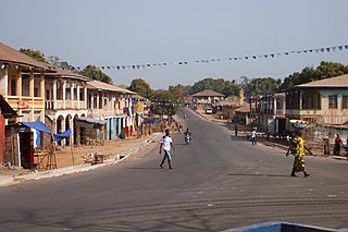
Kamabai is a small town in Bombali District in the Northern Province of Sierra Leone, with a population of about 4000 within a 7-kilometre (4.3 mi) radius (including the villages of Kagbumbo, Bonaia, Manlokoko, Kawere, Masasa, Makombon, Matunko, Mateli, Mabunko, Karim, Mankorokoro, Kamaron and Katanta). The town is about 41 kilometres (25 mi) northeast of Makeni. The town has several secondary schools, including the Kamabai secondary school, which is one of the largest secondary schools in Northern Sierra Leone, a government hospital and a nightclub.

Bombali District Place in Northern Province, Sierra Leone

Bombali District is a district in the Northern Province of Sierra Leone. Its capital and largest city is Makeni, which is also the largest city in the north. Bombali District is one of the fourteen districts of Sierra Leone. Bombali is the second largest district in Sierra Leone by geographical area, after Koinadugu District, and is the second most populous district in the North, after Port Loko District. In the 2015 Sierra Leone national census, the population of Bombali district was 606,183. Other major towns in Bombali District include Kamabai, Karina and Binkolo.

Northern Province, Sierra Leone province in Sierra Leone

The Northern Province is one of the five provincial divisions of Sierra Leone. It is located in the Northern geographic region of Sierra Leone. It comprises the following four Districts: Bombali, Falaba, Koinadugu and Tonkolili. The Northern Province covers an area of 35,936 km2 (13,875 sq mi) with a population of 2,502,865, based on the 2015 Sierra Leone national census. Its administrative and economic center is Makeni. The North borders the Western Area to the West, the Republic of Guinea to the north-east, the Eastern Province and Southern Province to the south-east.

Sierra Leone republic in West Africa

Sierra Leone, officially the Republic of Sierra Leone, informally Salone, is a country on the southwest coast of West Africa. It has a tropical climate, with a diverse environment ranging from savanna to rainforests. The country has a total area of 71,740 km2 (27,699 sq mi) and a population of 7,075,641 as of the 2015 census. Sierra Leone is a constitutional republic with a directly elected president and a unicameral legislature. The country's capital and largest city is Freetown. Sierra Leone is made up of five administrative regions: the Northern Province, North West Province, Eastern Province, Southern Province and the Western Area. These regions are subdivided into sixteen districts.

The town is largely populated by the Limba people who are descendants from the Biriwa Heritage. Other significant minority ethnic groups in the town include the Mandingo, Fula and Temne. The Limba language along with the Krio language are widely spoken.

Limba people (Sierra Leone) major ethnic group in the Sierra Leone

The Limba people are the third largest ethnic group in Sierra Leone. They represent over 8% of Sierra Leone's total population.

Mandinka people West African ethnic group

The Mandinka or Malinke are a West African ethnic group with an estimated global population of 32 million. The Mandinka are one ethnic group within the larger linguistic family of the Mandé peoples, who account for more than 87 million people..

Fula people A large ethnic group in Sahel and West Africa

The Fula people or Fulani or Fulɓe, numbering between 38 and 40 million people in total, are one of the largest ethnic groups in the Sahel and West Africa, widely dispersed across the region. Inhabiting many countries, they live mainly in West Africa and northern parts of Central Africa but also in, South Sudan, Sudan and regions near the Red Sea coast.

Kamabai is the birthplace of Almamy Suluku, who was one of Sierra Leone's most powerful rulers during the colonial era. The town is also the birthplace of Sierra Leone President Ernest Bai Koroma's mother, Alice Evelyn Sesay, who was married by a Koroma in Makeni. She was brought-up successfully in Kamabai town and then moved to Makeni where she gave birth to the future-president.

Almamy Suluku was a Limba ruler from Sierra Leone who maintained his independence as long as possible through political strategy.

Ernest Bai Koroma Sierra Leonean President

Ernest Bai Koroma is a Sierra Leonean politician who served as the 4th President of Sierra Leone from 17 September 2007 to 4 April 2018.

Makeni Place in Northern Province, Sierra Leone

Makeni is the largest city in the Northern Province of Sierra Leone. The city is the capital of Bombali District, and is the economic center of the Northern Province. Makeni is the fifth largest city in Sierra Leone by population. The city of Makeni had a population of 80,840 in the 2004 census and a 2015 estimate of 125,970. Makeni lies approximately 137 kilometers east of Freetown.

Related Research Articles

Kabala, Sierra Leone Place in Northern Province, Sierra Leone

Kabala is the capital and largest town of Koinadugu District in the Northern Province of Sierra Leone. Kabala is one of the main towns in Northern Sierra Leone and is set in a rural landscape, surrounded by mountains.

Koidu Place in Eastern Province, Sierra Leone

Koidu Town is the capital and largest city of the diamond-rich Kono District in the Eastern Province of Sierra Leone. The population of Koidu Town is 124,662 based on the 2015 Sierra Leone Census. Koidu Town is the fifth largest city in Sierra Leone by population, after Freetown, Kenema, Bo and Makeni. Koidu Town is a major urban, business, commercial and diamond trade center. Koidu Town lies approximately 270 miles east of Freetown, and about 54 miles north of Kenema.

Julius Maada Bio President of Sierra Leone

Julius Maada Bio is a Sierra Leonean politician, and the 5th and current president of Sierra Leone since April 4, 2018. He is a retired Brigadier General in the Sierra Leone Army and he was the military Head of State of Sierra Leone from January 16, 1996 to March 29, 1996 under a military Junta government. As the candidate of the main opposition Sierra Leone People's Party, Bio defeated Samura Kamara of the ruling All People's Congress in the runoff vote of the 2018 Sierra Leone presidential election with 51.8% of the votes to Kamara"s 48.2%. International and local observers declared the election free, fair and credible. Bio succeeded Ernest Bai Koroma as president, who was constitutionally ineligible to run for the presidency, having served the maximum two five-year terms.

Magburaka Place in Northern Province, Sierra Leone

Magburaka is the capital and largest city of Tonkolili District in the Northern Province of Sierra Leone. Its population was 16,313 in the 2004 census. and a current estimate of 40,313. It is located at around 8°43′1″N11°56′36″W, along the Rokel River. Magburaka lies just about 26 miles (42 km) drive south-west of Makeni, the economic center of Northern Sierra Leone and about 80 miles (135 km) drive east of the country's capital Freetown. Magburaka is a trade center and is one of the main cities in Northern Sierra Leone.

Sorie Ibrahim Koroma commonly known as S.I. Koroma is a former Sierra Leonean politician, labor activist, and one of the founding members of the All People's Congress political party. He served as first Vice President of Sierra Leone from April 19, 1971 to retirement on November 28, 1985 under president Siaka Stevens.

Gbinti Place in Northern Province, Sierra Leone

Gbinti is a rural town in Dibia chiefdom, Port Loko District in the Northern Province of Sierra Leone. The town is the chieftaincy seat of Dibia chiefdom. Gbinti lies about 20 miles from the district capital Port Loko and approximately 52 miles from Freetown.

Brima Archa Kamara was the former Inspector General of Sierra Leone Police (SLP), The professional head of the Sierra Leone Police forces who is appointed by the president of Sierra Leone. He was appointed to the position by former president Ahmad Tejan Kabbah. Kamara is a member of the Limba ethnic group. Kamara also has relation to the town Kamabai situated in the Northern Province of Sierra Leone, 15 miles away from the capital of Bombali, Makeni as well as Mabokeni and Binkolo.

Yonibana town in Northern Province, Sierra Leone

Yonibana is a small rural town in Tonkolili District in the Northern Province of Sierra Leone. It is the centre of the Yoni Chiefdom The vast majority of its population are from the Temne ethnic group and the Temne language is widely spoken in the town. Yonibana lies approximately 28.2 miles to the district capital Magburaka and approximately 90 miles north-east of Freetown.

Joseph Sam Sesay is a Sierra Leonean politician and currently serves as Sierra Leone Minister of Agriculture. He was appointed to the position in October 2007 by president Ernest Bai Koroma.

Alhaji Ibrahim Ben Kargbo, commonly known as I.B. Kargbo, is a Sierra Leonean journalist and politician. He currently the MP of constituency 030(Bombali District) Ernest Bai Koroma. I.B Kargbo is a close personal friend of president Ernest Bai Koroma and former president Ahmad Tejan Kabbah. I.B. Kargbo is one of the most trusted aides to president Koroma. He has a Bachelor's degree in journalism from Fourah Bay College and a Diploma in Journalism from John New Homes School of Journalism, 1979.

Alhaji Alpha Sahid Bakar Kanu is a Sierra Leonean politician and the current Sierra Leone minister of Presidential and Public Affairs. He is also the official spokesman of the All People's Congress (APC) political party, a position he has held even before the APC came to power. In January 2012, Kanu was chosen by Sierra Leone president Ernest Bai Koroma to serve as Minister of Information and Communication in Koroma's new second term cabinet.

Alice Rosalyn Koroma was the mother of Sierra Leone's president, Ernest Bai Koroma, and a longtime primary school teacher in Makeni. She was a longtime member of the Wesleyan Church congregation in Makeni, and in the 1960s she was a member of the Makeni city council from the All People's Congress (APC) party. Koroma, whose political career stems back to the 1960s, "was a strong supporter" and "advocate of women's rights". She was very active in the political scene of Sierra Leone and was a former leader of the All People's Congress (APC) Women's Congress in Bombali District in the later half of the 1960s.

Sunkarie Kabba-Kamara is a Sierra Leonean politician and the current mayor of the city of Makeni. She is currently the only female mayor in Sierra Leone's six City Council municipalities. She is a member of the ruling All People's Congress (APC) political party.

Ethnic groups in Sierra Leone

Sierra Leone is home to about sixteen ethnic groups, each with its own language. In Sierra Leone, membership of an ethnic group often overlaps with a shared religious identity.

Sylvanus Fornah Koroma was the father of Sierra Leone's president, Ernest Bai Koroma.

References

    Coordinates: 9°09′N11°58′W / 9.150°N 11.967°W / 9.150; -11.967

    Geographic coordinate system Coordinate system

    A geographic coordinate system is a coordinate system that enables every location on Earth to be specified by a set of numbers, letters or symbols. The coordinates are often chosen such that one of the numbers represents a vertical position and two or three of the numbers represent a horizontal position; alternatively, a geographic position may be expressed in a combined three-dimensional Cartesian vector. A common choice of coordinates is latitude, longitude and elevation. To specify a location on a plane requires a map projection.