This article is missing information about 2010 census demographics. Please expand the article to include this information. Further details may exist on the talk page.(July 2016)
Kansas's 1st congressional district
Interactive map of district boundaries since January 3, 2023
Kansas's 1st congressional district is a congressional district in the U.S. state of Kansas. Commonly known as "The Big First", the district encompasses all or part of 60 counties spanning more than half of the state, making it the seventh-largest district in the nation that does not cover an entire state.
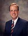
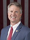
Marshall won re-election in 2018, then he was elected to the United States Senate in 2020. He was replaced in the House by former Lieutenant Governor Tracey Mann of Salina. Mann will become the first representative for the district to reside east of US Highway 281 since the district assumed its current configuration in the 88th Congress.
With a Cook Partisan Voting Index rating of R+18, it is the most Republican district in Kansas.[3] Republicans dominate every level of government, often winning by over 65 percent of the vote on the occasion that they face any opposition at all. Since its creation in 1875, it has elected a Democrat once. In general, Riley County and Douglas County are the only counties in the district where Democrats are competitive, due to the sizable presence of the University of Kansas and Kansas State University. It covers two time zones (it includes all of Kansas's share of the Mountain Time Zone) and parts of three television markets (Topeka and Wichita, as well as Lincoln, Nebraska). Due to its size, its congressman usually becomes a statewide political figure.[citation needed] Proving this, since it assumed its present configuration in 1963, four of the district's former congressmen were later elected to the U.S. Senate: Bob Dole, Pat Roberts, Jerry Moran and Roger Marshall.
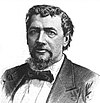
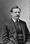
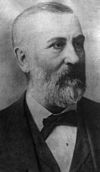
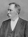
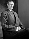
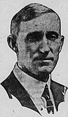
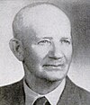
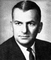
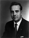
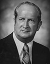
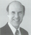
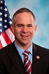
The district typically gives its congressmen very long tenures in Washington. From 1963 until 2011, it was held by just four members: Bob Dole, Keith Sebelius, Roberts and Moran.
History
Kansas had a single representative in the U.S. House of Representatives until after the 1870 U.S. census, which showed that the state was entitled to three members of the lower chamber of the national legislature. In 1872 three representatives-at-large were elected, but by the act of March 2, 1874, the legislature divided the state into three districts. The 1st congressional district was composed of the counties of Leavenworth, Doniphan, Brown, Nemaha, Marshall, Washington, Republic, Jewell, Smith, Phillips, Norton, Graham, Rooks, Osborne, Mitchell, Cloud, Clay, Ottawa, Ellis, Ellsworth, Russell, Saline, Dickinson, Lincoln, Riley, Pottawatomie, Jackson, Jefferson, Atchison, Davis (Geary), "and all that territory lying north of the second standard parallel".
No changes were made in until after the 1880 U.S. census, which gave the state seven representatives. On March 5, 1883, GovernorGeorge Washington Glick approved an act of the legislature which reduced the 1st congressional district to only include the counties of Nemaha, Brown, Doniphan, Pottawatomie, Jackson, Atchison, Jefferson and Leavenworth. The apportionment was amended by the act of March 13, 1897, which placed Shawnee County in the 1st congressional district and Pottawatomie County in the 4th congressional district.
Although the 1890 U.S. census showed the population of Kansas to be large enough to entitle the state to eight representatives, no additional district was created until 1905. By the act of March 9, 1905, the state was divided into eight districts with the 1st congressional district being composed of the counties of Nemaha, Brown, Doniphan, Jackson, Atchison, Jefferson, Leavenworth and Shawnee.[5]
The district's current configuration dates from the 1960 U.S. census, when Kansas was reduced from six districts to five. The old 2nd congressional district was eliminated, and most of its territory was merged with the old 6th congressional district—represented by Bob Dole—to form the new 1st district. It has remained more or less the same since then, and has been considerably enlarged due to the state's population shifts to the eastern side of the state bordering Missouri.
The state's current districting dates from the 1990 U.S. census, when Kansas was reduced from five districts to four. The current borders were established in 2012 by a panel of three federal judges, after the Kansas Legislature failed to pass new district maps.[6]
Following redistricting after the U.S. census in 2000,[7] there were 672,091 people, 260,490 households, and 177,858 families residing in the district. The population density was 11.7 per square mile (4.5/km2) over a land area of 57,373 square miles (148,595km2) (roughly the same size as the state of Illinois). There were 292,436 housing units at an average density of 5.1 per square mile (2.0/km2). The racial makeup of the district is 89.02% White, 2.14% Black or African American, 0.95% Asian, 0.52% Native American, 0.05% Pacific Islander, 5.62% from other races, and 1.70% from two or more races. Hispanic or Latino of any race were 10.85% of the population.
There were 260,490 households, out of which 34.52% had children under the age of 18 living with them, 57.30% were married couples living together, 7.65% had a female householder with no husband present, and 31.72% were non-families. 27.58% of all households were made up of individuals, and 12.75% had someone living alone who was 65 years of age or older. The average household size was 2.49 and the average family size was 3.05.
In the district the population distribution by age was 26.46% under the age of 18, 9.50% from 18 to 24, 26.27% from 25 to 44, 21.41% from 45 to 64, and 16.36% who were 65 years of age or older. The median age was 36.9 years. For every 100 females there were 98.60 males. For every 100 females age 18 and over, there were 95.80 males.
The median income for a household in the district is $34,869, and the median income for a family was $42,292. Males had a median income of $29,662 versus $20,851 for females. The per capita income for the district was $17,255. About 7.8% of families and 11.0% of the population were below the poverty line, including 13.4% of those under age 18 and 9.0% of those age 65 or over.
Among the population aged 16 years and older, 65.1% was in the civilian labor force and 0.4% were in the armed forces. Of the employed civilian workers, 16.3% were government workers and 11.4% were self-employed. Management, professional, and related occupations employed 29.4% of the work force and sales and office occupations an additional 23.4%. Only 2.7% were employed in farming, fishing, and forestry occupations. The largest employment by industry was: educational, health and social services, 22.7%; manufacturing, 13.8%; retail trade, 11.7%; and agriculture, forestry, fishing and hunting, and mining, 10.1%.
Richardson County is the easternmost county in the U.S. state of Nebraska. As of the 2020 census, the population was 7,871. Its county seat is Falls City.
Pawnee County is a county in the U.S. state of Nebraska. As of the 2020 United States Census, the population was 2,544. Its county seat is Pawnee City.
Ripley County is a county in the Ozarks of Missouri. At the 2020 census, it had a population of 10,679. The largest city and county seat is Doniphan. The county was officially organized on January 5, 1833, and is named after Brigadier General Eleazer Wheelock Ripley, a soldier who served with distinction in the War of 1812.
Platte County is a county located in the northwestern portion of the U.S. state of Missouri and is part of the Kansas City metropolitan area. As of the 2020 census, the population was 106,718. Its county seat is Platte City. The county was organized December 31, 1838, from the Platte Purchase, named for the Platte River. The Kansas City International Airport is located in the county, approximately one mile west of Interstate 29 between mile markers 12 and 15. The land for the airport was originally in an unincorporated portion of Platte County before being annexed by Platte City, and eventually Kansas City.
Holt County is a county located in the northwestern portion of the U.S. state of Missouri. As of the 2020 census, the population was 4,223. It's county seat is Oregon. The county was organized February 15, 1841. Originally named Nodaway County, it was soon renamed for David Rice Holt (1803–1840), a Missouri state legislator from Platte County.
Buchanan County is located in the U.S. state of Missouri. As of the 2020 United States Census, the population was 84,793. Its county seat is St. Joseph. When originally formed in 1838, the county was named Roberts County, after settler Hiram Roberts. It was renamed in 1839 for James Buchanan, then a U.S. Senator and later President of the United States. The county was formed from land annexed to Missouri, as were five other counties.
Atchison County is the northwesternmost county in the U.S. state of Missouri. As of the 2020 census, the county had a population of 5,305. Its county seat is Rock Port. It was originally known as Allen County when it was detached from Holt County in 1843. The county was officially organized on February 14, 1845, and named for U.S. Senator David Rice Atchison from Missouri.
Pottawatomie County is a county located in the U.S. state of Kansas. Its county seat is Westmoreland. As of the 2020 census, the county population was 25,348. The county was named for the Potawatomi tribe.
Nemaha County is a county located in the northeastern part of the U.S. state of Kansas. Its county seat is Seneca. As of the 2020 census, the county population was 10,273. The county was named for the Nemaha River.
Jackson County is a county in the U.S. state of Kansas. Its county seat and most populous city is Holton. As of the 2020 census, the county population was 13,232. The county, first named Calhoun County for pro-slavery South Carolina Senator John C. Calhoun, was renamed in 1859 for President Andrew Jackson. The Prairie Band Potawatomi Indian Reservation, near the center of the county, comprises about 18.5% of the county's area.
Doniphan County is the most northeastern county in the U.S. state of Kansas. Its county seat is Troy, and its most populous city is Wathena. As of the 2020 census, the county population was 7,510. The county was named after Alexander Doniphan, a Mexican–American War hero. It is bounded on the east by the Missouri river, south by Atchison county, and west by Brown county.
Brown County is a county located in the northeast portion of the U.S. state of Kansas. Its county seat and most populous city is Hiawatha. As of the 2020 census, the county population was 9,508. The county was named after Albert G. Brown, a U.S. Senator from Mississippi and Kansas statehood advocate. The Kickapoo Indian Reservation of Kansas, the majority of the Sac and Fox Reservation, and the majority of the Iowa Reservation of Kansas and Nebraska are located within the county.
Atchison County is a county located in the northeast portion of the U.S. state of Kansas. Its county seat and most populous city is Atchison. As of the 2020 census, the county population was 16,348. The county was named in honor of David Atchison, a U.S. Senator from Missouri and border ruffian during the "Bleeding Kansas" era.
Atchison is a city and county seat of Atchison County, Kansas, United States, along the Missouri River. As of the 2020 census, the population of the city was 10,885. The city is named in honor of US Senator David Rice Atchison from Missouri and was the original eastern terminus of the Atchison, Topeka and Santa Fe Railway. Atchison is also the home of Benedictine College.
Kansas' 2nd congressional district is a congressional district in the U.S. state of Kansas that covers most of the eastern part of the state, except for the core of the Kansas City Metropolitan Area. The district encompasses less than a quarter of the state. The state capital of Topeka, the cities of Emporia, Junction City and Leavenworth and most of Kansas City are located within this district. The district is currently represented by Republican Jake LaTurner.
Kansas's 3rd congressional district is a congressional district in the U.S. state of Kansas. Located in eastern Kansas, the district encompasses all of Anderson, Franklin, Johnson and Miami counties and parts of Wyandotte County. The district includes most of the Kansas side of the Kansas City metropolitan area, including all of Overland Park, Leawood, Lenexa, Shawnee, Gardner, and Olathe and parts of Kansas City.
Bendena is an unincorporated community in Doniphan County, Kansas, United States. As of the 2020 census, the population of the community and nearby areas was 117.
The Kansas District Courts are the state trial courts of general jurisdiction in the U.S. state of Kansas. The Courts have original jurisdiction over all civil and criminal cases, and jury trials are held in the Courts. Among the cases litigated in the District Courts are domestic relations, lawsuits for damages, probate and administration of estates, legal guardianship, conservatorship, the mentally ill, juvenile justice, and small claims. It is here that the criminal and civil jury trials are held.
The 2012 United States House of Representatives elections in Kansas were held on Tuesday, November 6, 2012, to elect the four U.S. representatives from the state of Kansas. The elections coincided with the elections of other federal and state offices, including a quadrennial presidential election.
Kansas's 1st Senate district is one of 40 districts in the Kansas Senate. It has been represented by Independent Dennis Pyle since 2005.
↑ Frank W. Blackmar, ed. (1912). "Congressional Districts". Kansas: a cyclopedia of state history, embracing events, institutions, industries, counties, cities, towns, prominent persons, etc ... Vol.I. Chicago: Standard Pub Co. pp.400–401. Archived from the original on October 10, 2006. Retrieved September 6, 2006.
This page is based on this Wikipedia article Text is available under the CC BY-SA 4.0 license; additional terms may apply. Images, videos and audio are available under their respective licenses.