Related Research Articles

The Scottish Borders is one of 32 council areas of Scotland. It is bordered by West Lothian, Edinburgh, Midlothian, and East Lothian to the north, the North Sea to the east, Dumfries and Galloway to the south-west, South Lanarkshire to the west, and the English ceremonial counties of Cumbria and Northumberland to the south. The largest settlement is Galashiels, and the administrative centre is Newtown St Boswells.

Traquair House, approximately 7 miles southeast of Peebles, is claimed to be the oldest continually inhabited house in Scotland. Whilst not strictly a castle, it is built in the style of a fortified mansion. It pre-dates the Scottish Baronial style of architecture, and may have been one of the influences on this style. The estate contains the famous Traquair Brewery.

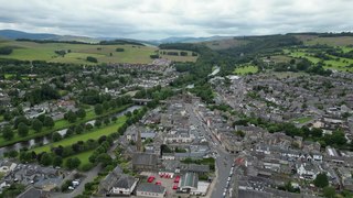
Peebles is a town in the Scottish Borders, Scotland. It was historically a royal burgh and the county town of Peeblesshire. According to the 2011 census, the population was 8,376 and the estimated population in June 2018 was 9,000.

Peeblesshire, the County of Peebles or Tweeddale is a historic county of Scotland. Its county town is Peebles, and it borders Midlothian to the north, Selkirkshire to the east, Dumfriesshire to the south, and Lanarkshire to the west.

Tweeddale is a committee area and lieutenancy area in the Scottish Borders council area in south-eastern Scotland. It had also been a province in the Middle Ages. From 1975 to 1996 it was a local government district. Its boundaries correspond to the historic county of Peeblesshire.

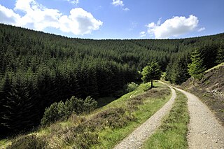
Glentress Forest is located near Peebles in the Scottish Borders, about 30 miles south of Edinburgh. Part of the Tweed Valley Forest Park along with Traquair Forest in Innerleithen, it is the home of a mountain biking centre which is one of the 7stanes mountain bike trails operated throughout southern Scotland by Forestry and Land Scotland. It is at the southern end of the Moorfoot Hills and is accessed from the A72 road.

Eddleston is a small village and civil parish in the Scottish Borders area of Scotland. It lies 4 miles (6.4 km) north of Peebles and 9 miles (14 km) south of Penicuik on the A703, which passes through the centre of the village. Nearby is the Great Polish Map of Scotland, a large terrain map. The Eddleston Water runs through the village.
Venlaw Castle, also known as Smithfield Castle, lies north of Peebles on the Edinburgh Road in the Borders of Scotland. Since 1949, it has been operated as a hotel. It was designated in 1971 as a Category A listed building.

Traquair is a small village and civil parish in the Scottish Borders; until 1975 it was in the county of Peeblesshire. The village is situated on the B709 road 2.0 miles (3.2 km) south of Innerleithen at grid reference NT330346.

Lyne is a small village and civil parish in the Scottish Borders area of Scotland, 4 miles (6.4 km) west of the market town of Peebles; it lies off the A72, in the old county of Peeblesshire and has an area of about 4 square miles (10 km2).

Manor Water is a river in the parish of Manor, Peeblesshire in the Scottish Borders. It rises in the Ettrick Forest and flows down through the Maynor valley, passing the various farms and hamlets of Maynor as well as Kirkton Manynor, where the Maynor kirk and village hall are flowing into the River Tweed one mile south of Peebles at Olde Maynor Brig, which is closed to traffic for the foreseeable future.

Kailzie Gardens is a walled garden near Kirkburn in the Scottish Borders area of Scotland, in the Tweed valley, 2.5 miles (4 km) east of Peebles, off the B7062.

Caddonfoot is a village on the River Tweed, in the Scottish Borders area of Scotland, on the A707, near Galashiels.

Cardrona is a village on the A72 and B7062, between Peebles and Innerleithen, in the Scottish Borders area of Scotland.

The Cardrona Forest is a forest in the Scottish Borders area of Scotland, on in Tweed Vally, near Peebles. A nearby forest is Glentress Forest. The forest contains 2,000 years of Scottish history, and is home to ruins.It is popular among cyclists and hikers, for it has a network of trails, many of which have names.

Horsburgh Castle, also known as Horsbrugh Castle or Horsbrugh Tower, is a ruined tower house castle by the River Tweed, on the A72 road from Peebles to Galashiels, near Glentress in the Scottish Borders area of Scotland. The ruins date from the 16th century and was built by the Horsburghs.

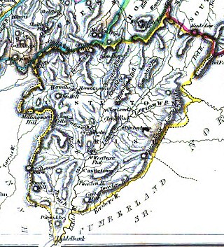
Castleton is a civil parish in the Scottish Borders area of Scotland, in the former Roxburghshire, in the extreme south of the Borders area. It is bounded by Northumberland (England), Dumfries and Galloway, and the parishes of Hobkirk, Southdean and Teviothead. The village of Castleton was commenced in 1793. It was built as a result of the land clearances in the 1790s when people were forced to move from Old Castleton village. While the parish retained the name Castleton, the village later became identified as New Castleton or Newcastleton. The parish is also known by its older name Liddesdale
Darnhall Mains is a farm and settlement off the A703, near Eddleston and the Eddleston Water in the Scottish Borders area of Scotland, in the former Peeblesshire.
References
- Toolis, R (2005) 'Kirkburn, Peebles, Scottish Borders (Traquair parish), watching brief.
55°38′05″N3°07′33″W / 55.6346°N 3.1258°W