
Knight's Hill is a hill in the Tulse Hill and West Dulwich area of the London Borough of Lambeth.
Knight's Hill is a hill in the Tulse Hill and West Dulwich area of the London Borough of Lambeth.
Knight's Hill is the northernmost of two hills in Lambeth with the same name. Both have the same origin, referring to the 16th century Knight family who owned land in Lambeth and Streatham. [1] The other hill is located in West Norwood.
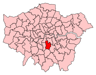
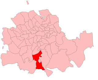
Knight's Hill was an exclave of the parish of Streatham and a detached portion of the Manor of Leigham Court. [2] The area was amalgamated with the parish of Lambeth in 1901, at which time the population was 3,453. [3] Today, Knight's Hill is in West Dulwich ward in the London Borough of Lambeth.
The Knight's Hill Tunnel of the railway between North Dulwich and Tulse Hill stations goes through the hill. It was built between 1866 and 1868 by the London, Brighton and South Coast Railway.
It is the location of the Peabody Hill Wood. [4]

Tulse Hill is a district in the London Borough of Lambeth in South London that sits on Brockwell Park. It is approximately five miles from Charing Cross and is bordered by Brixton, Dulwich, Herne Hill, Streatham and West Norwood.

Lambeth is a London borough in South London, England, which forms part of Inner London. Its name was recorded in 1062 as Lambehitha and in 1255 as Lambeth. The geographical centre of London is at Frazier Street near Lambeth North tube station, though nearby Charing Cross on the other side of the Thames in the City of Westminster is traditionally considered the centre of London.
West Norwood is a largely residential area of south London within the London Borough of Lambeth, located 5.4 miles (8.7 km) south south-east of Charing Cross. The centre of West Norwood sits in a bowl surrounded by hillsides on its east, west and south sides. From many parts of the area, distant views can be seen, of places such as the City of London, Canary Wharf and Crystal Palace.

Lambeth is a district in South London, England, in the London Borough of Lambeth, historically in the County of Surrey. It is situated 1 mile (1.6 km) south of Charing Cross. The population of the London Borough of Lambeth was 303,086 in 2011. The area experienced some slight growth in the medieval period as part of the manor of Lambeth Palace. By the Victorian era the area had seen significant development as London expanded, with dense industrial, commercial and residential buildings located adjacent to one another. The changes brought by World War II altered much of the fabric of Lambeth. Subsequent development in the late 20th and early 21st centuries has seen an increase in the number of high-rise buildings. The area is home to the International Maritime Organization. Lambeth is home to one of the largest Portuguese-speaking communities in the UK, and is the second most commonly spoken language in Lambeth after English.

Upper Norwood is an area of south London, England, within the London Boroughs of Bromley, Croydon, Lambeth and Southwark. It is north of Croydon and the eastern part of it is better known as the Crystal Palace area.

Lambeth was a civil parish and metropolitan borough in south London, England. It was an ancient parish in the county of Surrey. The parish was included in the area of responsibility of the Metropolitan Board of Works in 1855 and became part of the County of London in 1889. The parish of Lambeth became a metropolitan borough in 1900, following the London Government Act 1899, with the parish vestry replaced by a borough council.

Streatham Common is a large open space on the southern edge of Streatham in the London Borough of Lambeth. The shallow sloping lower (western) half of the common is mostly mowed grass, and the upper (eastern) half is mostly woodland with some small areas of gorse scrub and acid grassland. The eastern half has been designated a Local Nature Reserve.
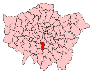
Dulwich and West Norwood is a constituency in South London created in 1997. It has been represented by Helen Hayes of Labour since her election in 2015.
Streatham is a constituency represented in the House of Commons of the UK Parliament since 2019 by Bell Ribeiro-Addy of the Labour Party.

Gipsy Hill in south London is a hilly neighbourhood spanning the southern parts of the London Boroughs of Lambeth and Southwark characterised for its great views of the City of London and Dulwich.
Norwood was a parliamentary constituency in south London which returned one Member of Parliament (MP) to the House of Commons of the Parliament of the United Kingdom by the first past the post system.

West Dulwich is a neighbourhood in South London on the southern boundary of Brockwell Park, which straddles the London Borough of Lambeth and the London Borough of Southwark. Croxted Road and South Croxted Road mark the boundary between Southwark to the east and Lambeth to the west. The suburb of West Dulwich dates back to the 17th century when the often flooded land known as Dulwich Common was acquired and drained by Edward Alleyn's estate.

The Norwood Ridge is a 10-square-mile (26 km2) rectangular upland which occupies the geographical centre of south London, centred 5 miles (8 km) south of London Bridge. Beneath its topsoil it is a ridge of London Clay that is capped on all sides with remaining natural gravel deposits mixed with some sandy soil, which in the South Thames basin is a material known as the Claygate Beds.

The Great North Wood was a natural oak woodland that started three miles (4.8 km) south-east of central London and scaled the Norwood Ridge. At its full extent, the wood's boundaries stretched almost as far as Croydon and as far north as Camberwell. It had occasional landownings as large clearings, well-established by the Middle Ages such as the hamlets of Penge and Dulwich.

All Saints' Church is a Church of England parish church in West Dulwich, South London. It is a red brick building designed in a Gothic Revival style by George Fellowes Prynne and built 1888–91. It is Grade I listed.
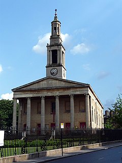
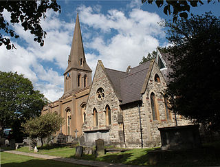
St Luke's Church in West Norwood is an Anglican church that worships in a Grade II* listed building. It stands on a prominent triangular site at the south end of Norwood Road, where the highway forks to become Knights Hill and Norwood High Street.
West Dulwich ward, formerly known as Thurlow Park is an administrative division of the London Borough of Lambeth, England. It is located in the constituency of Dulwich and West Norwood.
Knight's Hill ward is an administrative division of the London Borough of Lambeth, United Kingdom, roughly covering the West Norwood area.
St Leonard's Church is a Church of England parish church in the London Borough of Lambeth. It is a Grade II listed building and occupies a prominent position on the west side of Streatham High Road, at its junction with Tooting Bec Gardens and Mitcham Lane.
Coordinates: 51°26′38″N0°06′00″W / 51.4439°N 0.1°W
| | This London location article is a stub. You can help Wikipedia by expanding it. |