The GLG Grand building is a 186-meter (609-foot) tall skyscraper in Midtown Atlanta. The Art Deco-inspired, pyramid-capped tower is 53 stories tall and was finished in 1992. The bottom third of it is the Four Seasons Hotel Atlanta, which includes 244 guest rooms and is the only 5-star hotel in Midtown. It is the eleventh-tallest skyscraper in Atlanta. The building was designed by Rabun Hogan Ota Rasche Architects, and built by Beers Construction of Atlanta.

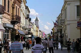
Little Five Points is a district on the east side of Atlanta, Georgia, United States, 2 1⁄2 miles (4.0 km) east of downtown. It was established in the early 20th century as the commercial district for the adjacent Inman Park and Candler Park neighborhoods, and has since become famous for the alternative culture it brings to Atlanta. It has been described as Atlanta's version of Haight-Ashbury, a melting pot of sub-cultures, and the Bohemian center of the Southern United States.

Inman Park is an intown neighborhood on the east side of Atlanta, Georgia, and its first planned suburb. It was named for Samuel M. Inman.
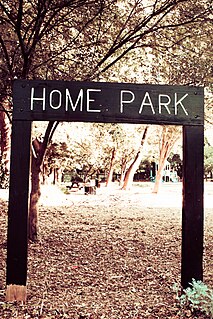
Home Park is a neighborhood of Atlanta in Georgia, USA. It is bordered on the south by Georgia Tech, on the west by the railroad yards adjacent to Marietta Street and Brady Avenue, on the north by 16th Street at Atlantic Station, and on the east by Techwood Drive at I-75/85.

Poncey–Highland is an intown neighborhood on the east side of Atlanta, Georgia, located south of Virginia–Highland. It is so named because it is near the intersection of east/west Ponce de Leon Avenue and north/southwest North Highland Avenue. This Atlanta neighborhood was established between 1905 and 1930, and is bordered by Druid Hills and Candler Park across Moreland Avenue to the east, the Old Fourth Ward across the BeltLine Eastside Trail to the west, Inman Park across the eastern branch of Freedom Parkway to the south, and Virginia Highland to the north across Ponce de Leon Avenue. The Little Five Points area sits on the border of Poncey–Highland, Inman Park, and Candler Park.

Reynoldstown is a historic district and intown neighborhood on the near east side of Atlanta, Georgia located only 2 miles from downtown. The neighborhood is gentrifying and attracting new families, empty-nesters, Atlantans opposed to long commutes; as well as diverse culture of first-time homebuyers, single professionals, artist and students due to its close proximity to other nearby intown neighborhoods, high walkability index, urban amenities and nearby bohemian hotspots on Carroll Street in the adjoined-at-the-hip also historic Cabbagetown neighborhood and in other surrounding communities.

Westview is a historic intown neighborhood located in southwest Atlanta, Georgia. It is named for the Westview Cemetery that borders the neighborhood to the northwest. The neighborhood is made up of a mixture of architectural styles including Arts & Crafts bungalows, Four-Squares, Tudors, Minimal Traditional houses, and Ranch style houses.
West Midtown, also known as Westside, is a colloquial area, comprising many historical neighborhoods located in Atlanta, Georgia. Once largely industrial, West Midtown is now the location of urban lofts, art galleries, live music venues, retail and restaurants.
Copenhill, Copenhill Park, or Copen Hill was a neighborhood of Atlanta, Georgia which was located largely where the Carter Center now sits, and which now forms part of the Poncey-Highland neighborhood.

The General Pipe and Foundry Company foundry and machine shop was located on the north side of Highland Avenue between Elizabeth Street and the BeltLine in Inman Park, Atlanta, Georgia. Coca-Cola executive Robert W. Woodruff worked here when he was 19 years old.
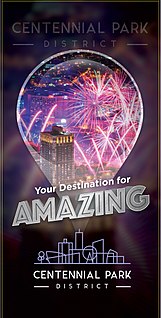
The Centennial Park District, formerly the Luckie-Marietta District, is a district of Downtown Atlanta named after the walkable neighborhood and entertainment district that surround Centennial Olympic Park. The district was originally created in 2007 by Legacy Properties, in support of their redevelopment projects in the district. However, "Luckie Marietta" was used by a wide range of Atlanta media to refer to the district. The district was rebranded the Centennial Park District and is now under the management of Central Atlanta Progress.
Blandtown is a neighborhood of the West Midtown area of Atlanta, Georgia. It is located along either side of Huff Road from Howell Mill Road west to Marietta Blvd. It was one of the first black settlements around Atlanta after the Civil War. As a community it declined from the 1950s through 1990s and now forms part of the West Midtown area, a rapidly developing part of Atlanta known for its home furnishings stores, new apartment and condo complexes, restaurants and bars.
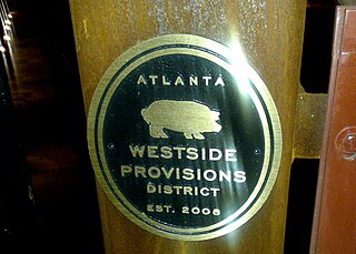
Westside Provisions is a mixed use neighborhood located in the West Midtown area of Atlanta, Georgia, United States.
Washington–Rawson was a neighborhood of Atlanta, Georgia. It included what is now Georgia State Stadium and the large parking lot to its north, until 1997 the site of Atlanta–Fulton County Stadium, as well as the I-20-Downtown Connector interchange. Washington and Rawson streets intersected where the interchange is today. To the northwest was Downtown Atlanta, to the west Mechanicsville, to the east Summerhill, and to the south Washington Heights, now called Peoplestown.
The Krog Street Tunnel is a tunnel in Atlanta known for its street art. The tunnel links the Cabbagetown, Reynoldstown, and Inman Park neighborhoods. It is very popular among cyclists, and is proposed to be used as part of the BeltLine, for bicyclists and pedestrians to cross Hulsey Yard.
Greenbriar is a middle-class neighborhood of southwestern Atlanta, Georgia. Greenbriar is a long strip along the east side of the Perimeter (I-285) stretching from Langford Parkway to just south of Stone Road. It is bordered by Atlanta's "Southwest" neighborhood across Langford Parkway to the north, Ben Hill Forest across the Perimeter to the west, and by the city of East Point on the east and south.
The Eastside Trail is a walking and biking trail stretching northwest to southeast on the Eastside of Atlanta, part of the BeltLine ring of trails and parks. It is lined with numerous notable industrial buildings adapted for into restaurants, shops, apartments, condos, and two major food halls and mixed-use developments.