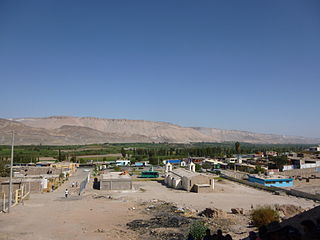
La Capilla District

Last updated
La Capilla
District
Country Flag of Peru.svg  Peru
Region Moquegua
Province General Sánchez Cerro
Founded September 30, 1942
Capital La Capilla
Government
   Mayor Renato Olin Apaza
Area
  Total 776.04 km2 (299.63 sq mi)
Elevation 1,800 m (5,900 ft)
Population (2005 census)
  Total 1,525
  Density 2.0/km2 (5.1/sq mi)
Time zone PET (UTC-5)
UBIGEO 180205

La Capilla District is one of eleven districts of the province General Sánchez Cerro in Peru. [1]

Districts of Peru third level administrative subdivision of Peru

The districts of Peru are the third-level country subdivisions of Peru. They are subdivisions of the provinces, which in turn are subdivisions of the larger regions or departments. There are 1,838 districts in total.

General Sánchez Cerro Province Province in Moquegua, Peru

The General Sánchez Cerro Province is the smallest of three provinces in the Moquegua Region of Peru. The capital of the province is Omate. The province was named after the former Peruvian army officer and president Luis Miguel Sánchez Cerro.

Peru republic in South America

Peru, officially the Republic of Peru, is a country in western South America. It is bordered in the north by Ecuador and Colombia, in the east by Brazil, in the southeast by Bolivia, in the south by Chile, and in the west by the Pacific Ocean. Peru is a megadiverse country with habitats ranging from the arid plains of the Pacific coastal region in the west to the peaks of the Andes mountains vertically extending from the north to the southeast of the country to the tropical Amazon Basin rainforest in the east with the Amazon river.

Related Research Articles

Beauport, Quebec City Borough of Quebec City in Canada

Beauport is a borough of Quebec City, Quebec, Canada on the Saint Lawrence River.

Tiabaya District is one of the twenty-nine districts of the Arequipa Province in Peru.

Sabandía District is one of the twenty-nine districts of the Arequipa Province in Peru.

Ocuviri District is one of ten districts of the province Lampa in Peru.

Pomacanchi District is one of seven districts of the Acomayo Province in Peru.

San Pedro District is one of eight districts of the province Canchis in Peru.

Sicuani District is one of eight districts of the province Canchis in Peru.

Pichigua District is one of eight districts of the Espinar Province in Peru.

Accha District is one of nine districts of the province Paruro in Peru.

La Joya District District in Arequipa, Peru

La Joya District is one of twenty-nine districts of the province Arequipa in Peru.

Mollebaya District is one of twenty-nine districts of the province Arequipa in Peru.

Pocsi District is one of twenty-nine districts of the province of Arequipa in Peru.

Polobaya District District in Arequipa, Peru

Polobaya District is one of twenty-nine districts of the province Arequipa in Peru. The village of Chapi with the sanctuary of Our Lady of Chapi is located in this district.

Quequeña District is one of twenty-nine districts of the province Arequipa in Peru.

Sachaca District is one of twenty-nine districts of the province Arequipa in Peru.

Uchumayo District District in Arequipa, Peru

Uchumayo or Uchumayu is one of twenty-nine districts of the province Arequipa in Peru.

Vitor District District in Arequipa, Peru

Vitor District is one of twenty-nine districts of the province Arequipa in Peru.

Yarabamba District is one of twenty-nine districts of the province Arequipa in Peru.

Yura District is one of twenty-nine districts of the Arequipa Province in Peru.

Huanca District is one of twenty districts of the province Caylloma in Peru. 1450 people live in Huanca District to status data as June 30, 2015.

References

Coordinates: 16°45′25″S71°10′46″W / 16.7570°S 71.1794°W / -16.7570; -71.1794

Geographic coordinate system Coordinate system

A geographic coordinate system is a coordinate system that enables every location on Earth to be specified by a set of numbers, letters or symbols. The coordinates are often chosen such that one of the numbers represents a vertical position and two or three of the numbers represent a horizontal position; alternatively, a geographic position may be expressed in a combined three-dimensional Cartesian vector. A common choice of coordinates is latitude, longitude and elevation. To specify a location on a plane requires a map projection.