Lah-Toh County, Idaho Territory

Last updated

Lah-Toh County was a county in Idaho Territory from 1864 to 1867.

County (United States) Subdivision used by most states in the United States of America

In the United States, an administrative or political subdivision of a state is a county, which is a region having specific boundaries and usually some level of governmental authority. The term "county" is used in 48 U.S. states, while Louisiana and Alaska have functionally equivalent subdivisions called parishes and boroughs respectively.

Idaho Territory territory of the USA between 1863–1890

The Territory of Idaho was an organized incorporated territory of the United States that existed from March 3, 1863, until July 3, 1890, when the final extent of the territory was admitted to the Union as Idaho.

Lah-Toh County was created by the Idaho Territorial Legislature in 1864 with Coeur d'Alene as its county seat. The name is Nez Perce for "the place of pine trees and pestle". The county was abolished in 1867. The portion of the county located south of the present Latah County line was transferred to Nez Perce County while the portion of the county north of Latah County joined Kootenai County. [1]

Coeur dAlene, Idaho City in Idaho, United States

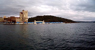
Coeur d'Alene is the largest city and county seat of Kootenai County, Idaho, United States. It is the principal city of the Coeur d'Alene Metropolitan Statistical Area. As of the 2010 census, the population of Coeur d'Alene was 44,137. The city is a satellite city of Spokane, which is located about 30 miles (48 km) to the west, in the state of Washington. The two cities are the key components of the Spokane–Coeur d'Alene combined statistical area, of which Coeur d'Alene is the third-largest city. Coeur d'Alene is the largest city in North Idaho. The city is situated on the north shore of Lake Coeur d'Alene, 25 miles (40 km) in length. Locally, Coeur d'Alene is known as the "Lake City", or simply called by its initials: "CDA".

Nez Perce, also spelled Nez Percé or called Niimi'ipuutímt, is a Sahaptian language related to the several dialects of Sahaptin. Nez Perce comes from the French phrase nez percé, "pierced nose"; however, Nez Perce, who call themeselves Nimipu, meaning "the people", did not pierce their noses. This misnomer may have occurred as a result of confusion on the part of the French, as it was surrounding tribes who did so.

Kootenai County, Idaho County in the United States

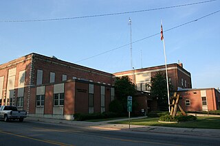
Kootenai County is a county located in the U.S. state of Idaho. As of the 2010 census, the population was 138,494, making it the third-most populous county in Idaho. The county seat and largest city is Coeur d'Alene. The county was established in 1864 and named after the Kootenai tribe.

The county was re-established in 1888 with different boundaries as Latah County.

Latah County, Idaho County in the United States

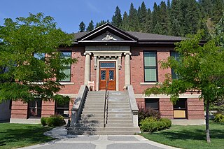
Latah County is a county located in the north central region of the U.S. state of Idaho. As of the 2010 census, the population was 37,244. The county seat and largest city is Moscow, the home of the University of Idaho, the state's flagship and land-grant university.

See also

Related Research Articles

Nez Perce County, Idaho County in the United States

Nez Perce County is a county located in the U.S. state of Idaho. As of the 2010 census, the population was 39,265. The county seat is Lewiston. The county is named after the Nez Percé tribe.

Shoshone County, Idaho County in the United States

Shoshone County is a county in the U.S. state of Idaho. As of the 2010 census, the population was 12,765. The county seat is Wallace, and the largest city is Kellogg. The county was established in 1864, named for the Native American Shoshone tribe.

Lewis County, Idaho County in the United States

Lewis County is a county located in the north central region of the U.S. state of Idaho. As of the 2010 census, the population was 3,821, making it the fourth-least populous county in Idaho. The county seat is Nezperce, and Kamiah is the largest city. Partitioned from Nez Perce County and established in 1911, it was named after the explorer Meriwether Lewis.

Idaho County, Idaho County in the United States

Idaho County is a county in the U.S. state of Idaho, and the largest by area in the state. As of the 2010 census, the population was 16,267. The county seat is Grangeville. Previous county seats of the area were Florence (1864–68), Washington (1868–75), and Mount Idaho (1875–1902).

Clearwater County, Idaho County in the United States

Clearwater County is a county located in the U.S. state of Idaho. As of the 2010 census, the population was 8,761. The county seat is Orofino. Established in 1911, the county was named after the Clearwater River.

Bonner County, Idaho County in the United States

Bonner County is a county in the northern part of the U.S. state of Idaho. As of the 2010 census, the population was 40,877. The county seat and largest city is Sandpoint. Partitioned from Kootenai County and established in 1907, it was named for Edwin L. Bonner, a ferry operator.

North Central Idaho

North Central Idaho is an area which spans the central part of the state of Idaho and borders Oregon, Montana, and Washington. It is the southern half of the Idaho Panhandle region and is rich in agriculture and natural resources. Lewis and Clark travelled through this area on their journey to the Pacific Ocean in 1805-06. The primary cities in this region are Lewiston and Moscow, home of the University of Idaho.

Nez Perce National Historical Park

The Nez Perce National Historical Park is a United States National Historical Park comprising 38 sites located throughout the states of Idaho, Montana, Oregon, and Washington, which included traditional aboriginal lands of the Nez Perce people. The sites are strongly associated with the resistance of Chief Joseph and his band, who in June 1877 took off from Oregon in an attempt to reach freedom in Canada and avoid being forced on to a reservation. They were pursued by U.S. Army cavalry forces and fought numerous skirmishes against them.

Clearwater National Forest

Clearwater National Forest with headquarters on the Nez Perce Reservation at Kamiah is located in North Central Idaho in the northwestern United States. The forest is bounded on the east by the state of Montana, on the north by the Idaho Panhandle National Forest, and on the south and west by the Nez Perce National Forest and Palouse Prairie.

National Register of Historic Places listings in Idaho Wikimedia list article

This is a directory of properties and districts included among the National Register of Historic Places listings in Idaho. There are approximately 1,000 sites in Idaho listed on the National Register. Each of the state's 44 counties has at least one listing on the National Register.

Idaho State Highway 3 highway in Idaho

Idaho State Highway 3 (SH-3) is a state highway in northern Idaho, connecting U.S. Route 12 near Spalding, east of Lewiston, with Interstate 90 near Rose Lake, east of Coeur d'Alene. It is 117.68 miles (189.4 km) in length and runs north–south, east of and generally parallel to Idaho's primary north–south highway, U.S. Route 95.

Florence, Idaho Ghost town in Idaho, United States

Florence is a ghost town in Idaho County, Idaho, United States. About 14 air miles (22 km) east-northeast of present-day Riggins in remote north central Idaho at an elevation of 6,080 feet (1,850 m). It was settled as a mining camp in the winter of 1861. Almost concurrent with its settlement, Washington Territory established Idaho County on December 20, 1861 in anticipation of a gold rush that brought over 9,000 residents within the first year., The town quickly became the seat with the first district court taking place at Florence on 22 September 1862. While the rich placer gold fields in the Florence Basin brought thousands of prospectors and contributed to the establishment of Idaho Territory in 1863, the rush to Florence was short-lived as intensive mining depleted the richest ground. At the first census of Idaho Territory, only 575 residents remained. By the territorial census of 1864, the population dwindled further to 254 residents. Even in its decline, Florence continued as the county seat until 1 June 1869 when the territorial legislature moved the county seat to the Warren's Camp settlement of Washington. The town thrived again from 1895–1900, based more on lode mining. Then the town slowly faded away, having only ten inhabitants in 1940, and was totally abandoned sometime after 1951.

Time in Idaho

The U.S. state of Idaho is covered by two time zones, as described below. All locations observe daylight saving time.

Caroline Nilsson Troy is a Republican Idaho State Representative since 2014, representing District 5 in seat B in northern Idaho.

Idaho Legislative District 6 is one of 35 districts of the Idaho Legislature. It is currently represented by Dan Johnson, Republican of Lewiston, Thyra Stevenson, Republican of Lewiston, and Mike Kingsley, Republican of Lewiston.

Idaho Legislative District 7 is one of 35 districts of the Idaho Legislature. It is currently represented by Carl Crabtree, Republican of Grangeville, Priscilla Giddings, Republican of White Bird, and Paul Shepherd, Republican of Riggins.

References

  1. Idaho Atlas of Historical County Boundaries. Chicago: The Newberry Library. 2010. pp. 119, 154, 197.