The Holocene is the current geological epoch. It began approximately 9,700 years before the Common Era (BCE). It follows the Last Glacial Period, which concluded with the Holocene glacial retreat. The Holocene and the preceding Pleistocene together form the Quaternary period. The Holocene has been identified with the current warm period, known as MIS 1. It is considered by some to be an interglacial period within the Pleistocene Epoch, called the Flandrian interglacial.

The Samoan archipelago is a chain of 16 islands and numerous seamounts covering 3,123 km2 (1,206 sq mi) in the central South Pacific, south of the equator, about halfway between Hawaii and New Zealand, forming part of Polynesia and of the wider region of Oceania. The islands are Savaiʻi, Upolu, Tutuila, ’Uvea, Taʻū, Ofu, Olosega, Apolima, Manono, Nuʻutele, Niulakita, Nuʻulua, Namua, Fanuatapu, Rose Atoll, Nu'ulopa, as well as the submerged Vailuluʻu, Pasco banks, and Alexa Bank.

A megatsunami is a very large wave created by a large, sudden displacement of material into a body of water.

Tonlé Sap is a lake in the northwest of Cambodia. Belonging to the Mekong River system, Tonlé is the largest freshwater lake in Southeast Asia and one of the most diverse and productive ecosystems in the world. It has been designated as a Biosphere Reserve by UNESCO in 1997 due to its high biodiversity. In the 21st century, the lake and its surrounding ecosystems are under increasing pressure from deforestation, infrastructure development and climate change.
Polynesians are an ethnolinguistic group of closely related ethnic groups who are native to Polynesia, an expansive region of Oceania in the Pacific Ocean. They trace their early prehistoric origins to Island Southeast Asia and form part of the larger Austronesian ethnolinguistic group with an Urheimat in Taiwan. They speak the Polynesian languages, a branch of the Oceanic subfamily of the Austronesian language family. The Indigenous Māori people constitute the largest Polynesian population, followed by Samoans, Native Hawaiians, Tahitians, Tongans and Cook Islands Māori

The Lapita culture is the name given to a Neolithic Austronesian people and their distinct material culture, who settled Island Melanesia via a seaborne migration at around 1600 to 500 BCE. They are believed to have originated from the northern Philippines, either directly, via the Mariana Islands, or both. They were notable for their distinctive geometric designs on dentate-stamped pottery, which closely resemble the pottery recovered from the Nagsabaran archaeological site in northern Luzon. The Lapita intermarried with the Papuan populations to various degrees, and are the direct ancestors of the Austronesian peoples of Polynesia, eastern Micronesia, and Island Melanesia.

The Samoan Islands are an archipelago covering 3,030 km2 (1,170 sq mi) in the central South Pacific, forming part of Polynesia and of the wider region of Oceania. Administratively, the archipelago comprises all of the Independent State of Samoa and most of American Samoa. The land masses of the two Samoan jurisdictions are separated by 64 km (40 mi) of ocean at their closest points.

Savaiʻi is the largest and highest island both in Samoa and in the Samoan Islands chain. The island is also the sixth largest in Polynesia, behind the three main islands of New Zealand and the Hawaiian Islands of Hawaii and Maui. While it is larger than the second main island, Upolu, it is significantly less populated.

Apolima is the smallest of the four inhabited islands of Samoa, in central South Pacific Ocean. It lies in the Apolima Strait, between the country's two largest islands: Upolu to the east, and Savai'i to the west.

Ātiu, also known as ʻEnuamanu, is an island of the Cook Islands archipelago, lying in the central-southern Pacific Ocean. Part of the Nga-pu-Toru, it is 214 km (133 mi) northeast of Rarotonga. The population of the 26.9 square kilometres (10.4 sq mi) island has dropped by two-thirds in the last 50 years.

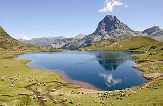
A lake is a naturally occurring, relatively large and fixed body of water on the earth's surface. It is localized in a basin or interconnected basins surrounded by dry land. Lakes lie completely on land and are separate from the ocean, although, like the much larger oceans, they form part of the Earth's water cycle by serving as large standing pools of storage water. Most lakes are freshwater and account for almost all the world's surface freshwater, but some are salt lakes with salinities even higher than that of seawater. Lakes vary significantly in surface area and volume.

Polynesia is a subregion of Oceania, made up of more than 1,000 islands scattered over the central and southern Pacific Ocean. The indigenous people who inhabit the islands of Polynesia are called Polynesians. They have many things in common, including language relatedness, cultural practices, and traditional beliefs. In centuries past, they had a strong shared tradition of sailing and using stars to navigate at night.
The 2009 Samoa earthquake and tsunami took place on 29 September 2009 in the southern Pacific Ocean adjacent to the Kermadec-Tonga subduction zone. The submarine earthquake occurred in an extensional environment and had a moment magnitude of 8.1 and a maximum Mercalli intensity of VI (Strong). It was the largest earthquake of 2009. The earthquake initiated with a normal-faulting event with a magnitude of 8.1. Within two minutes of the earthquake rupture, two large magnitude 7.8 earthquakes occurred on the subduction zone interface. The two magnitude 7.8 earthquakes had a combined magnitude equivalent to 8.0. The event can be considered a doublet earthquake.

Mt Matavanu is an active volcano on the island of Savai'i in Samoa. The volcano was formed during an eruption in 1905. Lava flows from the eruption covered a large area of land in the Gaga'emauga district, leading to the relocation of several villages.

Archaeology of Samoa began with the first systematic survey of archaeological remains on Savai'i island by Jack Golson in 1957. Since then, surveys and studies in the rest of Samoa have uncovered major findings of settlements, stone and earth mounds including star mounds, Lapita pottery remains and pre-historic artifacts.
Le'auva'a is a village on the island of Upolu in Samoa. The population is 3274.
Ian Croudace is a British geochemist, academic, researcher and entrepreneur. He is Emeritus Professor of Environmental Radioactivity and Environmental Geochemistry at the University of Southampton and is a Fellow of the Royal Society of Chemistry. Croudace has published over 200 research articles and has supervised 32 PhD projects over his career. He is director at Raddec International Limited. He is the author of the book Micro-XRF Studies of Sediment Cores: Applications of a non-destructive tool for the environmental sciences and Executive Editor for the Quaternary International Special Issue entitled "Advances in Data Quantification and Application of High Resolution XRF Core Scanners". He specializes in analytical, environmental and isotope geochemistry and radioactivity. His research interests range from Micro-XRF analysis of sediments to Forensic Geochemistry to Radio-analytical developments.

O Le Pupu-Puʿe National Park is the oldest national park in Samoa. Established in 1978, the park covers 5019 hectares of the southern-central portion of the island of Upolu on the border of the Atua and Tuamasaga districts. The park extends from Mount Fito, the highest mountain on Uplou, to the coast, and includes uplands, valleys, marshes, the O Le Pupu lava field, and coastal cliffs. In 2016 it was designated as a wetland of international importance under the Ramsar Convention.

Lake Lanoto'o National Park is a national park in Samoa. Established in 2003, the park covers 470 hectares of the central portion of the Tuamasaga district of Upolu and includes three volcanic crater-lakes: Lake Lanoto'o, Lanoata’ata and Lanoanea. In 2004 it was designated as a wetland of international importance under the Ramsar Convention.

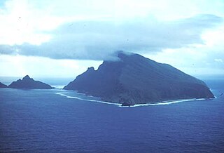
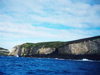
Macauley Island is a volcanic island in New Zealand's Kermadec Islands, approximately halfway between New Zealand's North Island and Tonga in the southwest Pacific Ocean. It is part of a larger submarine volcano that features a 10.5 by 7 kilometres wide underwater caldera northwest of Macauley Island. Two islets, Haszard Island and Newcome Rock, lie east offshore of Macauley Island. The island is mostly surrounded by high cliffs that make accessing it difficult; the inland parts are mostly gently sloping terrain covered with ferns and grasses.


