Lalithadripura

Last updated

Coordinates: 12°16′34″N76°41′56″E / 12.276023°N 76.698762°E / 12.276023; 76.698762

Geographic coordinate system Coordinate system

A geographic coordinate system is a coordinate system that enables every location on Earth to be specified by a set of numbers, letters or symbols. The coordinates are often chosen such that one of the numbers represents a vertical position and two or three of the numbers represent a horizontal position; alternatively, a geographic position may be expressed in a combined three-dimensional Cartesian vector. A common choice of coordinates is latitude, longitude and elevation. To specify a location on a plane requires a map projection.

Contents

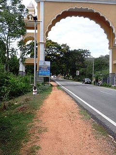
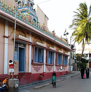
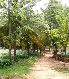
Lalithadripura is a suburb of Mysore city in Karnataka state of India.

Karnataka State in southern India

Karnataka is a state in the south western region of India. It was formed on 1 November 1956, with the passage of the States Reorganisation Act. Originally known as the State of Mysore, it was renamed Karnataka in 1973. The state corresponds to the Carnatic region. The capital and largest city is Bangalore (Bengaluru).

Location

Lalithadripura is located on the eastern side of Mysore city near the Chamundi Hills.[ citation needed ] It has a post office and the PIN code is 570027. [1]

Mysore Metropolis in Karnataka, India

Mysore, officially Mysuru, is a city in the state of Karnataka, India. It is located in the foothills of the Chamundi Hills about 145.2 km (90 mi) towards the southwest of Bangalore and spread across an area of 152 km2 (59 sq mi). Mysore City Corporation is responsible for the civic administration of the city, which is also the headquarters of the Mysore district and the Mysore division.

Chamundi Hills

Chamundi Hills is located 13 km east of Mysore, the Palace City, in Karnataka, India. Its average elevation is 1,000 metres (3,300 ft).

Demographics

There are 4124 people in Lalithadripura village according to 2011 census.

See also

Related Research Articles

Ramakrishna Nagar, Mysore Place in Karnataka, India

Rama Krishna Nagar is a residential locality in southern Mysuru. The nucleus of the area is called the 'Rama Krishna Circle' or the Andolana intersection. This area is very near to Kuvempunagar and Vivekananda nagar.

Mysore South Place in Karnataka, India


Mysore South or South Mysore is a cluster of suburbs lying on the southern side of Mysore city in Karnataka province in India.

Manasagangotri Place in Karnataka, India

Manasagangotri is a suburb of Mysore city in Mysore district of Karnataka state, India. Mysore University and its various departments are located in this area.

Sutturu Place in Karnataka, India

Sutturu is a village on the banks of river Kabini, in the state of Karnataka, India. It is located in the Nanjangud taluk in the district of Mysore. It is famous for the Suttur Mutt which is one of most prominent spiritual centers of India.

Sujathapuram

Sujathapuram is a village in Mysore district of Karnataka state, India.

Chinnadagudihundi Place in Karnataka, India

Chinnada Gudi Hundi or C.G.Hundi is a village in Mysore district of Karnataka state, India.

Raghavendra Nagar

Raghavendra Nagar is a suburb of Mysore city in Karnataka state of India.

Naganahalli is a small village in Mysuru district of Karnataka state, India.

Byadarahalli

Byadara Halli is a village in Mandya district of Karnataka state, India.

Yelwala, Mysore

Yelwala or Ilvala is a suburb of Mysore city in Karnataka state, India.

Kallahalli

Kallahalli is a village in Mysore district of Karnataka state, India.

Keralapura

Keralapura is a village in Hassan district of Karnataka state, India.

Kodagahalli

Kodagahalli is a small village in Mysore district of Karnataka state, India.

Chinakurali

Chinakurali is a village in Pandavapura taluk, Mandya district of Karnataka state, India.

Mandi Mohalla

Mandi Mohalla, K.T.Street or Ashoka Road is a suburb of Mysore city in Karnataka state of India.

Krishnamurthypuram

Krishna Murthy Puram is an urban commercial and residential suburb of Mysore city in Karnataka state of India.

Gandasi is a "hobli" in Hassan district of India.

Mududi

Mududi is a village in Arsikere taluk of Hassan district in India.

Bannimantap is an historical place in the Indian city of Mysore, Karnataka, India.

Dudda, Hassan human settlement in India

Dudda is a small village in Hassan district of Karnataka state in India.

References