Ashburton is a large town in the Canterbury Region, on the east coast of the South Island of New Zealand. The town is the seat of the Ashburton District, a territorial authority encompassing the town and a number of small settlements within its surrounding rural area, roughly coterminous with the subregion of Mid Canterbury. It is 85 kilometres (53 mi) south west of Christchurch and is sometimes regarded as a satellite town of Christchurch.

Mount Hutt rises to the west of the Canterbury Plains in the South Island of New Zealand, above the braided upper reaches of the Rakaia River, and 80 kilometres west of Christchurch. Its summit is 2190 metres above sea level.
The Avoca River is a river in the Canterbury Region of New Zealand. It is a minor tributary of the Rakaia River via the Harper and Wilberforce Rivers, south of Arthur's Pass in Canterbury.

The Canterbury Plains is an area in New Zealand centred in the Mid Canterbury, to the south of the city of Christchurch in the Canterbury region. Their northern extremes are at the foot of the Hundalee Hills in the Hurunui District, and in the south they merge into the plains of North Otago beyond the Waitaki River.

Selwyn is a village in the Selwyn District of Canterbury, New Zealand. It was laid out in the 1860s for a population of 2,000 people, but it currently has very few houses.
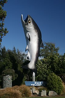
Rakaia is a town seated close to the southern banks of the Rakaia River on the Canterbury Plains in New Zealand's South Island, approximately 57 km south of Christchurch on State Highway 1 and the Main South Line. Immediately north of the township are New Zealand's longest road bridge and longest rail bridge, both of which cross the wide shingle beds of the braided river at this point. Both bridges are approximately 1750 metres in length.

The Rakaia River is in the Canterbury Plains in New Zealand's South Island. The Rakaia River is one of the largest braided rivers in New Zealand. The Rakaia River has a mean flow of 203 cubic metres per second (7,200 cu ft/s) and a mean annual seven-day low flow of 87 m3/s (3,100 cu ft/s). In the 1850s, European settlers named it the Cholmondeley River, but this name lapsed into disuse.

The Rakaia Gorge is located on the Rakaia River in inland Canterbury in New Zealand's South Island.

The Wilberforce River is a river in the Southern Alps of New Zealand. It is located in western Canterbury and is naturally a tributary of the Rakaia River, but like the Harper River, it has had some of its flow diverted into Lake Coleridge as part of a hydroelectricity project. This diversion boosted the output of the Coleridge Power Station and was established in 1977.
The Harper River is a tributary of the Wilberforce River which itself flows into the Rakaia River in New Zealand's Canterbury region. It is located in the Southern Alps and a pass in the Harper River headwaters leads into the Waimakariri River catchment. One of the most popular tramping routes in Canterbury enters the East Harper via Cass Saddle and exits via Lagoon Saddle at the head of the West Harper.

Coalgate is a locality in the Selwyn District of the Canterbury region of New Zealand's South Island. The 2001 New Zealand census gave Coalgate's population as 276, and it is located roughly an hour west of Christchurch on State Highway 77. The town's name stems from it being the "gateway" to the lignite coal fields around Whitecliffs, the Rakaia Gorge, and Acheron River. Coal mining declined in the 20th century and has now ceased, but since the 1950s, commercial processing of nontronite has taken place in Coalgate.

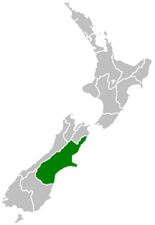
Mid Canterbury is a traditional, semi-official subregion of New Zealand's Canterbury Region extending inland from the Pacific coast to the Southern Alps. It is one of four traditional sub-regions of Canterbury, along with South Canterbury, North Canterbury, and Christchurch City.
Longbeach is a lowly populated locality in the Canterbury region of New Zealand's South Island. It is located in a rural area of the Canterbury Plains on the shore of the Pacific Ocean on the northern side of the Hinds River's mouth.
Waimate Creek is a natural watercourse in the southern Canterbury region of New Zealand's South Island. Its original Māori name was Te Waimatemate, which means "slowly moving waters".
The Acheron River is a river in Canterbury, New Zealand and flows from Lake Lyndon south into the Rakaia River.
The Mathias River is a river of the Canterbury Region of New Zealand's South Island. It flows from its origins in three rivers in the Southern Alps. Of these, the North Mathias River is the longest, flowing predominantly southwards from its source northeast of Mount Williams. After 18 kilometres (11 mi) its waters combine with those of the West Mathias River, which flows predominantly southwest for 13 kilometres (8 mi) from its sources 10 kilometres (6 mi) west of Mount Williams. The South Mathias River, a tributary of the West Mathias River, is a 6-kilometre (4 mi) long easterly-flowing river which meets the West Mathias 5 kilometres (3 mi) from its confluence with the North Mathias.

The Mungo River is a river of the West Coast Region of New Zealand's South Island. The major source of the Hokitika River, it flows generally west from the Southern Alps, becoming the Hokitika River at the point where it turns north as it flows through a gap in the Diedrichs Range. The Hokitika Saddle separates the headwaters of the Mungo from those of the Rakaia River system which flows to the island's east coast.
The Smite River is a river of the Canterbury Region of New Zealand's South Island. It flows west from the Taylor Range to feed Lake Stream, the outflow of Lake Heron, which is an upper part of the Rakaia River system.
The Ashburton River / Hakatere is a river in the Canterbury Region of New Zealand, flowing across Mid Canterbury from the Southern Alps to the Pacific Ocean. The official name of the river was amended to become a dual name by the Ngai Tahu Claims Settlement Act 1998. It has been identified as an Important Bird Area by BirdLife International because it supports breeding colonies of the endangered black-billed gull.
The Little River is a tributary of Rakaia River, about 7 km (4.3 mi) long, in the Canterbury Plains of New Zealand's South Island. It rises on the 2,185 m (7,169 ft) Mount Hutt and enters the Rakaia 314 m (1,030 ft) above sea level.