
Luton North is a constituency represented in the House of Commons of the UK Parliament since 2019 by Sarah Owen, elected as a member of the Labour Party.
Limbury is a suburb of Luton, and was formerly a village in Bedfordshire before Luton expanded around it. The area is roughly bounded by Bramingham Road to the north, Marsh Road to the south, Bramingham Road to the west, and Catsbrook Road, Runfold Avenue, Grosvenor Road, Bancroft Road and Blundell Road to the east.
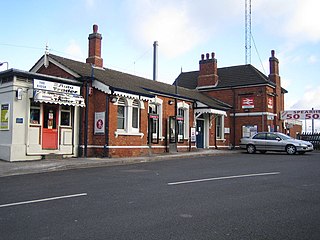
Leagrave railway station is located in Leagrave, a suburb in the north of Luton in Bedfordshire, England. Leagrave station is situated on the Midland Main Line 33¾ miles (54 km) north of London St Pancras International. The station is managed by Thameslink, and is served by the Thameslink route.
Luton West is a former United Kingdom Parliamentary constituency. It was created in 1974 partly from abolished Luton constituency and partly from the County Constituency of South Bedfordshire. It was abolished in 1983 when it was largely absorbed into the new County Constituency of Luton North.

Leagrave is a former village and now a suburb of Luton in Bedfordshire in the northwest of the town. The area is roughly bounded by Vincent Road, Torquay Drive and High Street to the north, Roman Road and Stoneygate Road to the south, the M1 to the west, and Marsh Road and Leagrave Park to the east.
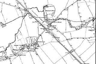
Waulud's Bank is a possible Neolithic henge in Leagrave, Luton dating from 3,000BC.
Lewsey is a suburb of Luton, England. Situated in the north-west of the town, the area is roughly bounded by Leagrave High Street to the north, Dunstable Road to the south, Poynters Road to the west, and the M1 to the east.
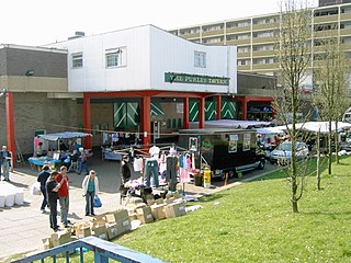
Marsh Farm is a suburb of Luton near to Leagrave and Limbury, mainly of council and social housing. The area is bounded by the edge of Luton to the north, Bramingham Road to the south, Spinney Wood and the path from the wood to the edge of Luton to the west, and Great Bramingham wood to the east.
Hockwell Ring is a suburb of Luton in the north-west of the town. The area is roughly bounded by Brickly Road to the north, High Street and Torquay Drive to the south, the M1 motorway to the west, and Vincent Road to the east.
Sundon Park is a suburb of north Luton in Bedfordshire. The area is roughly bounded by the edge of Luton to the north, Leagrave Park to the south, the Midland Main Line to the west, and Spinney Woods and the footpath from the woods to the edge of town to the east.

South Bedfordshire was a county constituency in Bedfordshire. It returned one Member of Parliament to the House of Commons of the Parliament of the United Kingdom, elected by the first past the post system.

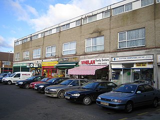
Bury Park is an area of Luton located one mile north west of the town centre on the road to Dunstable. The area is roughly bounded by Claremont Road and Highfield Road to the north, Telford Way to the south, Hatters Way to the west, and the Midland Main Line to the east.

Luton Borough Council is the local authority of Luton in Bedfordshire, England. It is a unitary authority, having the powers of a non-metropolitan county and district council combined. It is a member of the East of England Local Government Association.
Hewlett & Blondeau was a manufacturer of aeroplanes and other equipment based in Leagrave, Luton, England which produced more than 800 aeroplanes and employed up to 700 people.
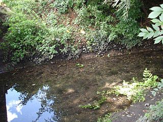
Knapps Brook is a minor tributary of the River Lea in Bedfordshire, England. The source of the river Lea is on Leagrave Common in Luton. It forms from a combination of brooks from East End, Houghton Regis and from the Lewsey Estate near the old Lewsey Farm. It joins the River Lea from culverts under the railway embankment and Toddington Road in Leagrave.

Lewsey Brook is a minor tributary of the River Lea. Lewsey Brook is a temporal water course, supplied by surface water from farmland and the nearby Luton suburbs of Lewsey, Lewsey Farm, and Lewsey Park, that enters the channel through a culvert. During periods of heavy rain, water floods areas of the nearby Lewsey Park.

Houghton Brook is a minor tributary of the River Lea. Houghton Brook starts in Houghton Regis and is fed by a number of smaller brooks in the area, mostly supplied by surface water from farmland and the various local villages and housing estates.
Tophill is a suburb of Luton in the north-west of the town, centred on Toddington Road. It is roughly bounded by the edge of Luton to the north, Brickly Road to the south, the M1 to the west, and the Midland Main Line to the east.
Lewsey Farm is a suburb of Luton, England. Situated in the north-west of the town, the area is roughly bounded by the Woodside Link to the north, Leagrave High Street to the south, Poynters Road to the west, and Pastures Way to the east. The wider area including nearby Lewsey Park is sometimes referred to as Lewsey Farm.