Thimphu is the capital and largest city of Bhutan. It is situated in the western central part of Bhutan, and the surrounding valley is one of Bhutan's dzongkhags, the Thimphu District. The ancient capital city of Punakha was replaced as capital by Thimphu in 1955, and in 1961 Thimphu was declared as the capital of the Kingdom of Bhutan by the 3rd Druk Gyalpo Jigme Dorji Wangchuck.

Tamworth is a city and the administrative centre of the North Western region of New South Wales, Australia. Situated on the Peel River within the local government area of Tamworth Regional Council, it is the largest and most populated city in the North Western region, with a population of 42,872 in June 2018, making it the second largest inland city in New South Wales. Tamworth is 318 km (198 mi) from the Queensland border, and it is located almost midway between Brisbane and Sydney.
Awdal is an administrative region (gobol) in western Somaliland. It was separated from Woqooyi Galbeed and became a province in 1984 and is the most northwesterly province of Somaliland. To the east it borders Maroodi Jeex and to its north-west it borders Djibouti, to its south and south-west lies Ethiopia and the Gulf of Aden to its north. The province has an estimated population of 673,263. The region comprises the four districts of Borama, the regional capital, Baki, Lughaya, and Zeila.

Public sector organisations in New Zealand comprise the state sector organisations plus those of local government.

Jigme Singye Wangchuck is a member of the House of Wangchuck who was the king of Bhutan from 1972 until his abdication in favour of his eldest son, Jigme Khesar Namgyel Wangchuck, in 2006.

The Latrobe Valley is an inland geographical district and urban area of the Gippsland region in the state of Victoria, Australia. The traditional owners are the Brayakaulung of the Gunai nation. The district lies east of Melbourne and nestled between the Strzelecki Ranges to the south and the Baw Baw Ranges, part of the Great Dividing Range, to the north. Mount St Phillack is the highest peak to the north of the Latrobe Valley, due north of Moe. The highest peak to the south is Mt Tassie, south of Traralgon.

Werribee is a suburb of Melbourne, Victoria, Australia, 32 km south-west of Melbourne's Central Business District, located within the City of Wyndham local government area. Werribee recorded a population of 40,345 at the 2016 Census.

Couva is an urban town in west-central Trinidad, south of Port of Spain and Chaguanas and north of San Fernando and Point Fortin. It is the capital and main urban centre of Couva–Tabaquite–Talparo, and the Greater Couva area includes the Point Lisas Industrial Estate and the Port of Point Lisas. It is one of the fastest growing towns in the country. Couva's southern boundary is at the village of California & Point Lisas, and to the north Couva stretches to McBean. To the east of Couva is Preysal. To the west of Couva is the road to Waterloo and Carli Bay, which are located on the Gulf of Paria. Couva was part of the Caroni County. Couva is considered a major power base for the United National Congress (UNC), whose headquarters were previously located here.

Mongar is a town and the seat of Mongar District in eastern Bhutan. As of 2005 it had a population of 3502. Mongar is on the road from Thimphu to Trashigang. It is one of the oldest educational hubs of the country. It has a regional hospital and a good standard hotel, among other facilities. The important Yagang Lhakhang monastery is on the outskirts of the town. The post code for Mongar post office is 43001.

The Council of Ministers is the highest executive body in Bhutan. It was created in 1999 by Jigme Singye Wangchuck, the fourth King of Bhutan.
Gyalpozhing or Gyelpozhing is a town in Mongar District in southeastern-central Bhutan.It is located to the west of Mongar and east of Lingmethang.
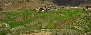
Agriculture in Bhutan has a dominant role in the Bhutan's economy. In 2000, agriculture accounted for 35.9% of GDP of the nation. The share of the agricultural sector in GDP declined from approximately 55% in 1985 to 33% in 2003. Despite this, agriculture remains the primary source of livelihood for the majority of the population.
Health in Bhutan is one of the government's highest priorities in its scheme of development and modernization. Health and related issues are overseen by the Ministry of Health, itself represented on the executive Lhengye Zhungtshog (cabinet) by the Minister of Health. As a component of Gross National Happiness, affordable and accessible health care is central to the public policy of Bhutan.

The Kouga Local Municipality is located in the Eastern Cape of South Africa, approximately 80 km west of Port Elizabeth, and forms part of the Sarah Baartman District Municipality. Its territory includes the coastal zone between the Van Stadens River in the east and the Tsitsikamma River in the west, and stretches inland towards the Baviaanskloof Mountains in the north.

Barshong Gewog is a gewog of Tsirang District, Bhutan.
The Kingdom of Bumthang was one of several small kingdoms within the territory of modern Bhutan before the first consolidation under Zhabdrung Ngawang Namgyal in 1616. After initial consolidation, the Bumthang Kingdom became Bumthang Province, one of the nine Provinces of Bhutan. The region was roughly analogous to modern day Bumthang District. It was again consolidated into the modern Kingdom of Bhutan in 1907.

There are a number of environmental issues in Bhutan. Among Bhutan's most pressing issues are traditional firewood collection, crop and flock protection, and waste disposal, as well as modern concerns such as industrial pollution, wildlife conservation, and climate change that threaten Bhutan's population and biodiversity. Land and water use have also become matters of environmental concern in both rural and urban settings. In addition to these general issues, others such as landfill availability and air and noise pollution are particularly prevalent in relatively urbanized and industrialized areas of Bhutan. In many cases, the least financially and politically empowered find themselves the most affected by environmental issues.

The COVID-19 pandemic in Bhutan is part of the worldwide pandemic of coronavirus disease 2019 caused by severe acute respiratory syndrome coronavirus 2.