Most of the transport system in Ireland is in public hands, either side of the Irish border. The Irish road network has evolved separately in the two jurisdictions into which Ireland is divided, while the Irish rail network was mostly created prior to the partition of Ireland.

The River Shannon is the major river on the island of Ireland, and at 360 km in length, is the longest river in the British Isles. It drains the Shannon River Basin, which has an area of 16,900 km2 (6,525 sq mi), – approximately one fifth of the area of Ireland.

The Grand Canal is the southernmost of a pair of canals that connect Dublin, in the east of Ireland, with the River Shannon in the west, via Tullamore and a number of other villages and towns, the two canals nearly encircling Dublin's inner city. Its sister canal on the Northside of Dublin is the Royal Canal. The last working cargo barge passed through the Grand Canal in 1960.

The Royal Canal is a canal originally built for freight and passenger transportation from Dublin to Longford in Ireland. It is one of two canals from Dublin to the River Shannon and was built in direct competition to the Grand Canal. The canal fell into disrepair in the late 20th century, but much of it has since been restored for navigation. The length of the canal to the River Shannon was reopened on 1 October 2010, but a final spur branch, to Longford Town, remains closed.
The Office of Public Works (OPW) is a major Irish Government agency, which manages most of the Irish State's property portfolio, including hundreds of owned and rented Government offices and police properties, oversees National Monuments and directly manages some heritage properties, and is the lead State engineering agency, with a special focus on flood risk management. It lies within the remit of the Minister for Public Expenditure, National Development Plan Delivery and Reform, with functions largely delegated to a Minister of State at the Department of Public Expenditure, National Development Plan Delivery and Reform with special responsibility for the Office. The OPW has a central role in driving the Government's property asset management reform process, both in respect of its own portfolio and that of the wider public service. The agency was initially known as Board of Works, a title inherited from a preceding body, and this term is still sometimes encountered.

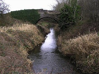
The River Lagan is a major river in Northern Ireland which runs 53.5 mi (86.1 km) from the Slieve Croob mountain in County Down to Belfast where it enters Belfast Lough, an inlet of the Irish Sea. The Lagan forms much of the border between County Antrim and County Down in the east of Ulster. It rises as a tiny, fast-moving stream near to the summit of Slieve Croob; Transmitter Road runs nearby. It runs to Belfast through Dromara, Donaghcloney and Dromore. On the lower slopes of the mountain, it combines with a branch from Legananny Mountain, just opposite Slieve Croob. The river then turns east to Magheralin into a broad plain between the plateaus of Antrim and Down.

The River Bann is the longest river in Northern Ireland, its length, Upper and Lower Bann combined, being 129 km (80 mi). However, the total length of the River Bann, including its path through the 30 km (19 mi) long Lough Neagh is 159 km (99 mi). Another length of the River Bann given is 90 mi. The river winds its way from the southeast corner of Ulster to the northwest coast, pausing in the middle to widen into Lough Neagh. The River Bann catchment has an area of 5,775 km2. The River Bann has a mean discharge rate of 92 m3/s. According to C. Michael Hogan, the Bann River Valley is a settlement area for some of the first human arrivals in Ireland after the most recent glacial retreat.

The Newry Canal is an abandoned canal in Northern Ireland. Opened in 1742, it was built to link the Tyrone coalfields to the Irish Sea. The navigable route ran from Lough Neagh via the Upper Bann river to Portadown, then approximately 20 miles from Portadown via the canal proper to Newry, terminating in the Albert Basin.
Coalisland Canal is a 7.2-kilometre-long (4.5 mi) canal in County Tyrone, Northern Ireland. Construction of the canal began in 1733, but progress was slow and it was not officially opened until 1787. The canal was built to reduce the cost of transporting coal from the Tyrone coalfields to Dublin. An extension known as "Dukart's Canal" was built to link the coalfields of Drumglass with the head of navigation at Coalisland. It opened in 1777 but was an engineering failure and closed when the main canal opened. After some difficulties with the infrastructure, traffic slowly increased, reaching its peak in 1931. Traffic then declined rapidly, and the canal was abandoned in 1954.
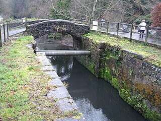
The Ulster Canal is a canal running through part of County Armagh, County Tyrone and County Fermanagh in Northern Ireland and County Monaghan in the Republic of Ireland. The Ulster Canal was built between 1825 and 1842 and was 74 km (46 mi) long with 26 locks. It ran from Charlemont on the River Blackwater to near Wattlebridge on the Finn River, south-east of Upper Lough Erne. It was an ill-considered venture, with the locks built narrower than the other Irish waterways, preventing through trade, and an inadequate water supply. It was an abject failure commercially, and contributed to the collapse of the Lagan Navigation Company, who took it over from the government but were then refused permission to abandon it when they could not afford the maintenance costs. It finally closed in 1931. Waterways Ireland started work on rebuilding the canal at its southern end in 2015.

Waterways Ireland is one of the six all-Ireland North/South implementation bodies established under the Belfast Agreement in 1999. It is responsible for the management, maintenance, development, and restoration of inland navigable waterways primarily for recreational purposes. Included as inland waterways are the Barrow Navigation, the Erne System, the Grand Canal, the Lower Bann, the Royal Canal, the Shannon–Erne Waterway and the Shannon Navigation.
Dukart's Canal was built to provide transport for coal from the Drumglass Collieries to the Coalisland Canal in County Tyrone, Ulster, Ireland. It opened in 1777, and used three inclined planes, rather than locks, to cope with changes in level. There is little evidence that it was ever used, as the planes could not be made to work properly, and they were dismantled in 1787.
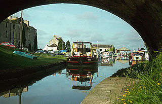
Shannon Harbour a small village on the banks of the Grand Canal of Ireland.
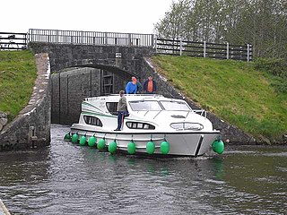
The Shannon–Erne Waterway is a canal linking the River Shannon in the Republic of Ireland with the River Erne in Northern Ireland. Managed by Waterways Ireland, the canal is 63 km (39 mi) in length, has sixteen locks and runs from Leitrim village in County Leitrim to Upper Lough Erne in County Fermanagh.

The Inland Waterways Association of Ireland is a registered charity and a limited company in the Republic of Ireland and also operates in Northern Ireland. It was founded in 1954 to campaign for the conservation and development of the waterways and their preservation as working navigations. As of 2008, the association had approximately 4,400 members which were organised in twenty branches.
John Killaly (1776–1832) was the most significant Irish canal engineer working originally for the Grand Canal company and later, as an engineer, under the Directors-General of Inland Navigation.
The Lagan Canal was a 44-kilometre (27 mi) canal built to connect Belfast to Lough Neagh. The first section, which is a river navigation, was opened in 1763, and linked Belfast to Lisburn. The second section from Lisburn to Lough Neagh includes a small amount of river navigation, but was largely built as a canal. At its peak it was one of the most successful of the Irish canals, but ultimately it was unable to compete with road and rail transport, and the two sections were closed in 1954 and 1958. The central section from Sprucefield to Moira was destroyed by the construction of the M1 motorway in the 1960s. Responsibility for most of its remains passed first to the Department of Agriculture and then to the Department of Culture, Arts and Leisure, although the section between Aghalee Bridge and Lough Neagh, including the final ten locks, passed into private ownership. There is an active campaign to re-open the canal, including reinstatement of the central section.

The Dublin–Galway Greenway is a partially completed 'coast-to-coast' greenway and partial rail trail, in Ireland, funded by the Department of Transport, which is due to become the western section of EuroVelo EV2, a cycle route from Galway, Ireland, crossing Europe and ending in Moscow, Russia. The 276 kilometres (171 mi) route was planned to be completed by 2020. It is due to be the fourth greenway in Ireland, after the Great Southern Trail, the Great Western Greenway and the Waterford Greenway.
The Royal Canal Greenway is a greenway, in Ireland, which will become part of the western section of EuroVelo EV2, and the Dublin-Galway Greenway. Since its official opening in March 2021, it is the longest greenway in Ireland. It spans from Maynooth County Kildare to Longford and Cloondara, County Longford passing through counties Meath and Westmeath.

Green and Silver is the account by Tom Rolt of a voyage through the inland waterways of Ireland just after the Second World War, published in 1949. It is notable because it was one of the last trips by any boat around the triangular loop of the River Shannon, Grand Canal, and Royal Canal before the last name was closed to navigation. It was reopened in 2010.