Jabalpur, formerly Jubbulpore, is a city situated on the banks of Narmada River in the state of Madhya Pradesh, India. According to the 2011 census, it is the third-largest urban agglomeration in Madhya Pradesh and the country's 38th-largest urban agglomeration. Jabalpur is an important administrative, industrial and business center of Madhya Pradesh. It is the judicial capital of Madhya Pradesh as The Madhya Pradesh High Court along with other important administrative headquarters of India and Madhya Pradesh are located in Jabalpur. It is generally accepted that the game of snooker originated in Jabalpur. Jabalpur is the administrative headquarters of Jabalpur district and the Jabalpur division. It also is a major education centre in India. The city is known for the marble rocks on the river Narmada at Bhedaghat.

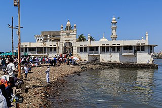
The Haji Ali Dargah is a mosque and dargah or the monument of Pir Haji Ali Shah Bukhari located on an islet off the coast of Worli in the southern Mumbai.
Singrampur is a historical place where final battle fought between Rani Durgawati and Mughal king Akbar's Senapati Asaf Khan. The town in named after Sangram which in Hindi means war.

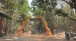
Kanger Valley National Park is a national park in the Bastar region of Chhattisgarh state in India. It came into existence in July 1982 and covers an area of approximately 200 square kilometres (77 sq mi). The park extends from the Teerathagarh waterfalls in the west to the Kolab river in the east, spanning an average length of 33.5 km (20.8 mi) and an average width of 6 km (3.7 mi) from north to south. It derives its name from the Kanger river, which flows centrally through it. Situated at a distance of 30 km (19 mi) southeast of Jagdalpur city, it is one of India's densest national parks and is known for its biodiversity, landscape, waterfalls, and subterranean geomorphologic limestone caves. It is also the home to the Bastar hill myna, the state bird of Chhattisgarh.

Malkajgiri also known as Mallikarjuna Giri is a suburb of Hyderabad, Telangana, India. It is located in Medchal–Malkajgiri district and also Sub-District in Medchal District is the headquarters of Malkajgiri mandal in Malkajgiri revenue division. Erstwhile Malkajgiri Major Grampanchayat was upgraded to a municipality in 1965 and became a municipal corporation in 1985. It was merged into the Greater Hyderabad Municipal Corporation in 2007. It was a part of Ranga Reddy district before the re-organisation of districts in 2016.

Chitradurga is a city and the headquarters of Chitradurga district, which is located on the valley of the Vedavati river in the central part of the Indian state of Karnataka. Chitradurga is a place with historical significance which is located to the North West about 200 km from the state capital Bengaluru. Chitradurga is a major tourist hub in Karnataka.

Moula-Ali commonly known as Moula Ali. It is a well-developed industrial and urban area in Malkajgiri Mandal, of the Medchal-Malkajgiri district, It is a part of Greater Hyderabad and also a part of Hyderabad Metropolitan Region of the Indian state of Telangana, This area is well connected with rail transportation through the Moula Ali Railway Station. It is noted for its Moula Ali hill, on top of which stands the Moula Ali Dargah and mosque, dedicated to Ali.

Tiruchirappalli Rock Fort, locally known as Malaikottai, is a historic fortification and temple complex built on an ancient rock. It is located in the city of Tiruchirappalli, on the banks of river Kaveri, Tamil Nadu, India. It is constructed on an 83 metres (272 ft) high rock. There are two Hindu temples inside, the Ucchi Pillayar Temple, Rockfort and the Thayumanaswami Temple, Rockfort. Other local tourist attractions include the famous Pallava-era Ganesha temple and the Madurai Nayak-era fort. The fort complex has witnessed fierce battles between the Madurai Nayakas and Adil Shahi dynasty of Bijapur, Carnatic region and Maratha Imperial forces. The fort played an important part during the Carnatic Wars, helping lay the foundations of the British Empire in India. The Rockfort is the most prominent landmark of the city.

Bugle Rock is a massive rock in the Basavanagudi area of South Bangalore, in the state of Karnataka. It is an abrupt rise above the ground of peninsular gneiss as the main rock formation and with an assessed age of about 3,000 million years. Bugle Rock has generated wide interest among the scientific community.

Natural Arch, Tirumala hills, a notified National Geo-heritage Monument, is a distinctive geological feature 1 km (0.6 mi) north of the Tirumala hills temple, near the Chakra Teertham in Tirupati district in the state of Andhra Pradesh, India. The arch is also called Silathoranam (శిలాతోరణం) in the local language. The arch measures 8 m (26.2 ft) in width and 3 m (9.8 ft) in height, and is naturally formed in the quartzites of Cuddapah Supergroup of Middle to Upper Proterozoic due to natural erosive forces.

A balancing rock, also called a balanced rock or precarious boulder, is a naturally occurring geological formation featuring a large rock or boulder, sometimes of substantial size, resting on other rocks, bedrock, or on glacial till. Some formations known by this name only appear to be balancing, but are in fact firmly connected to a base rock by a pedestal or stem.
A. S. Rao Nagar, also known as Dr. A. S. Rao Nagar, is a major commercial and residential neighbourhood of Hyderabad, Telangana, India. It is located in the north eastern side of the city falling under Kapra Village & Mandal, Medchal-Malkajgiri district. It is administered as Ward No. 2 of Greater Hyderabad Municipal Corporation.
Khajaguda is a major commercial and residential area in Hyderabad, Telangana, in the suburb of Gachibowli. It is in the vicinity of Financial district, Gachibowli and HITEC City. Several residential apartments like ASBL Lakeside, IT HEIGHTS, Niharika Interlake, Niharika Lakefront are situated in Khajaguda.

Ajmer Sharif Dargah is a Sufi Tomb (dargah) of the Sufi saint, Khawaja Moinuddin Chishti, located at Ajmer Shareef, Rajasthan, India.

Moula Ali hill also known as Maula Ali, had the ancient name dome-shaped hill located in Moula Ali, Hyderabad, India. It is well known for the Moula Ali dargah and shia masjid, which are both on top of the hill. The area is maximally inhabited by Shia Muslims.

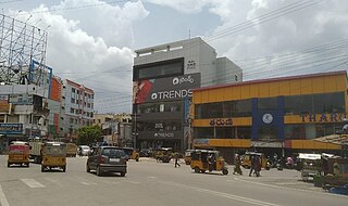
ECIL X Roads or ECIL Cross Roads is a major commercial center in Hyderabad, Telangana, India. It is an important intersection located between some of the densest residential areas in Secunderabad, including Kushaiguda and Moula Ali. The suburb is named after ECIL Factory located nearby on the road to Cherlapally. A TSRTC Bus Terminal is located beside the crossroads. The roads intersecting here are the Trimulgherry-ECIL road and the Tarnaka-Kushaiguda road that starts at Tarnaka Crossroads on the Inner Ring Road. Radhika Crossroads is another major intersection located just a kilometre away on the Trimulgherry-ECIL road and Moula Ali-Dammaiguda road.
The localities and neighborhoods of Hyderabad have unique oral histories, dating to the time of the Qutb Shahi dynasty, over 400 years ago, and are named after various people and things. Some are named after a major building or structure in the locality, others named for individuals. The names are mostly in Telugu and Urdu, the major languages of the city. This is a list of localities, neighborhoods and streets of Hyderabad and their etymology.

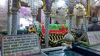
Pir Haji Ali Shah Bukhari or Baba Haji Ali was a Sufi saint, a Hajji, born to a wealthy merchant family from Uzbekistan. His shrine in Haji Ali Dargah is situated in India's largest city Mumbai.

Khajaguda Lake, also known as Bhagirathamma Cheruvu is a lake in Ranga Reddy District in the Indian state of Telangana and on the western edge of the city of Hyderabad, in the suburb of Manikonda, in the middle of Makthakousarali, Khajaguda area. It is near to SAS Infra iTower, a very high-rise commercial complex, situated on Khajaguda - Nanakramguda Road.


