Blennerhasset and Torpenhow is a civil parish in the Borough of Allerdale in Cumbria, England. It contains 14 buildings that are recorded in the National Heritage List for England as designated listed buildings. Of these, one is listed at Grade I, the highest of the three grades, and the others are at Grade II, the lowest grade. The parish contains the villages of Blennerhasset and Torpenhow, and the smaller settlements of Kirkland Guards and Whitrigg, and is otherwise rural. Most of the listed buildings are houses, cottages, farmhouses and farm buildings, the latter including buildings on a model farm. The other listed buildings are a church, a milestone, and a war memorial.
Brigham is a civil parish in the borough of Allerdale in Cumbria, England. It contains 16 listed buildings that are recorded in the National Heritage List for England. Of these, one is listed at Grade I, the highest of the three grades, one is at Grade II*, the middle grade, and the others are at Grade II, the lowest grade. The parish contains the village of Brigham and surrounding countryside. The listed buildings include a church and a sundial in the churchyard, houses and associated structures, farmhouses and farm buildings, milestones, a bridge, a war memorial, and a cattle pound.
Bromfield is a civil parish in the borough of Allerdale in Cumbria, England. It contains 20 listed buildings that are recorded in the National Heritage List for England. Of these, one is listed at Grade I, the highest of the three grades, and the others are at Grade II, the lowest grade. The parish contains the villages of Bromfield, Langrigg and Blencogo and the surrounding countryside. Most of the listed buildings are houses and associated structures, or farmhouses and farm buildings. The other listed buildings include a church, two milestones, a former windmill converted into a house, a well head, a war memorial, and a school.
Embleton is a civil parish in the Borough of Allerdale in Cumbria, England. It contains 14 listed buildings that are recorded in the National Heritage List for England. All the listed buildings are designated at Grade II, the lowest of the three grades, which is applied to "buildings of national importance and special interest". The parish contains the village of Embleton and the settlement of Wythop Mill, and is otherwise rural. Most of the listed buildings are houses, farmhouses and farm buildings. The other listed buildings are a public house, a boundary stone, and two milestones.
Greysouthen is a civil parish in the Borough of Allerdale in Cumbria, England. It contains seven listed buildings that are recorded in the National Heritage List for England. All the listed buildings are designated at Grade II, the lowest of the three grades, which is applied to "buildings of national importance and special interest". The parish contains the village of Greysouthen and surrounding countryside. The listed buildings consist of houses, farmhouses, farm buildings, and a milestone.
Thursby is a civil parish in the Borough of Allerdale in Cumbria, England. It contains 23 listed buildings that are recorded in the National Heritage List for England. All the listed buildings are designated at Grade II, the lowest of the three grades, which is applied to "buildings of national importance and special interest". The parish contains the village of Thursby, and is otherwise almost completely rural. The major building in the parish was Crofton Hall, but this was demolished in about 1958. A number of buildings associated with the hall have survived and are listed. Most of the other listed buildings are houses and associated structures, farmhouses and farm buildings. The other listed buildings include milestones, a bridge, and a public house.
Westnewton is a civil parish in the Borough of Allerdale in Cumbria, England. It contains seven listed buildings that are recorded in the National Heritage List for England. All the listed buildings are designated at Grade II, the lowest of the three grades, which is applied to "buildings of national importance and special interest". The parish contains the village of Westnewton, and is otherwise rural. The listed buildings consist of houses and associated structures, farmhouses and farm buildings, and two milestones.
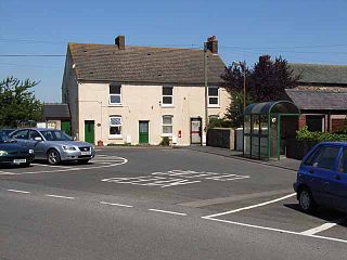
Winscales is a civil parish in the Borough of Allerdale in Cumbria, England. It contains two listed buildings that are recorded in the National Heritage List for England. Both the listed buildings are designated at Grade II, the lowest of the three grades, which is applied to "buildings of national importance and special interest". The parish is mainly rural, and the listed buildings comprise a farmhouse with attached farm buildings, and a milestone.
Cumrew is a civil parish in the Carlisle district of Cumbria, England. It contains eleven listed buildings that are recorded in the National Heritage List for England. All the listed buildings are designated at Grade II, the lowest of the three grades, which is applied to "buildings of national importance and special interest". The parish contains the village of Cumrew and is otherwise rural. Its listed buildings consist of houses, farmhouses, farm buildings, and a church.
Irthington is a civil parish in the Carlisle district of Cumbria, England. It contains 30 listed buildings that are recorded in the National Heritage List for England. Of these, one is listed at Grade II*, the middle of the three grades, and the others are at Grade II, the lowest grade. The parish contains the village of Irthington, and the smaller settlements of Laversdale, Newby East, Oldwall, Ruleholme, and Newtown, and is otherwise rural. Most of the listed buildings are farmhouses and farm buildings, and the others include private houses, milestones, a bridge, and a church.
Nether Denton is a civil parish in the Carlisle district of Cumbria, England. It contains 14 buildings that are recorded in the National Heritage List for England. Of these, One is listed at Grade I, the highest of the three grades, and the others are at Grade II, the lowest grade. The parish contains the village of Low Row, and is otherwise rural. The listed buildings include three former fortified houses, one in ruins. The other listed buildings include houses, farmhouses and farm buildings, a former water mill, a church, and three milestones.
Nicholforest is a civil parish in the Carlisle district of Cumbria, England. It contains seven listed buildings that are recorded in the National Heritage List for England. Of these, one is listed at Grade II*, the middle of the three grades, and the others are at Grade II, the lowest grade. The parish is almost entirely rural, and the listed buildings consist of a country house that originated as a tower house, an outbuilding associated with it, a farmhouse and a barn, a milestone, a church, and a monument.
Colby is a civil parish in the Eden District, Cumbria, England. It contains three buildings that are recorded in the National Heritage List for England. Of these, one is listed at Grade II*, the middle of the three grades, and the others are at Grade II, the lowest grade. The parish contains the village of Colby and the surrounding countryside, and the listed buildings consist of farmhouses and farm buildings.
Kaber is a civil parish in the Eden District, Cumbria, England. It contains ten listed buildings that are recorded in the National Heritage List for England. All the listed buildings are designated at Grade II, the lowest of the three grades, which is applied to "buildings of national importance and special interest". The parish contains the village of Kaber and the surrounding countryside. All but one of the listed buildings are in the village, and are associated with two buildings, Nelson House and The Buildings Farmhouse. The other listed building is a farmhouse and barn in the countryside.
Newby is a civil parish in the Eden District, Cumbria, England. It contains 14 listed buildings that are recorded in the National Heritage List for England. Of these, two are listed at Grade II*, the middle of the three grades, and the others are at Grade II, the lowest grade. The parish includes the village of Newby and the surrounding countryside. Most of the listed buildings are houses and associated structures, farmhouses and farm buildings, the other listing buildings consisting of the walls and memorials of a Friends' burial ground.
Waitby is a civil parish in the Eden District, Cumbria, England. It contains nine listed buildings that are recorded in the National Heritage List for England. Of these, one is listed at Grade II*, the middle of the three grades, and the others are at Grade II, the lowest grade. The parish contains the villages of Waitby and Smardale and is otherwise rural. The listed buildings consist of houses and associated structures, farmhouses and farm buildings, and a bridge, a boundary stone, and a former school.
Hutton Roof is a civil parish in the South Lakeland District of Cumbria, England. It contains ten listed buildings that are recorded in the National Heritage List for England. All the listed buildings are designated at Grade II, the lowest of the three grades, which is applied to "buildings of national importance and special interest". The parish contains the village of Hutton Roof, and is otherwise entirely rural. The listed buildings consist of farmhouses, farm buildings. houses, a church, and a war memorial.
Preston Richard is a civil parish in the South Lakeland District of Cumbria, England. It contains 14 listed buildings that are recorded in the National Heritage List for England. All the listed buildings are designated at Grade II, the lowest of the three grades, which is applied to "buildings of national importance and special interest". The parish contains the villages of Endmoor and Crooklands and is otherwise almost entirely rural. The Lancaster Canal runs through the parish, and the listed buildings associated with this are four bridges, an aqueduct, and a milestone. The other listed buildings consist of houses and associated structures, farmhouses, a former mill, two road milestones, and a boundary stone.
Staveley-in-Cartmel is a civil parish in the South Lakeland District of Cumbria, England. It contains 22 listed buildings that are recorded in the National Heritage List for England. Of these, one is listed at Grade II*, the middle of the three grades, and the others are at Grade II, the lowest grade. The parish is in the Lake District National Park. It contains the villages of Staveley-in-Cartmel and Newby Bridge, and smaller settlements, but is mainly rural. In the parish is Fell Foot Park, a country park on the shore of Windermere; four buildings in this park have been listed. The other listed buildings include farmhouses, farm buildings, other houses, a milestone, a bridge, a church, and a sundial in the churchyard.
Strickland Ketel is a civil parish in the South Lakeland District of Cumbria, England. It contains 16 listed buildings that are recorded in the National Heritage List for England. All the listed buildings are designated at Grade II, the lowest of the three grades, which is applied to "buildings of national importance and special interest". The parish contains the villages of Burneside and Bowston, and is otherwise rural. The listed buildings consist of farmhouses, farm buildings, a country house and its folly gatehouse, smaller houses, a summer house, a bridge, a monument, and three milestones.