
Little Ocmulgee State Park & Lodge is a 1,360-acre (550 ha) Georgia state park located 2 miles (3.2 km) north of McRae on the Little Ocmulgee River. Part of the park was initially built by the Civilian Conservation Corps during the Great Depression, around the natural diversion of the Little Ocmulgee into a lake. This is a 256-acre (104 ha) lake with beach, and the park includes a 60 room lodge and a championship 18-hole golf course with pro shop, known as the Wallace Adams Memorial Golf Course. The soil around the Ocmulgee River and the Little Ocmulgee is a fine white sand, and therefore the lake has its own "beach sand". Also within the park is the 2.6-mile (4.2 km) long Oak Ridge Trail, allowing visitors to see native wildlife and plants.
The Alabaha River is a 20.6-mile-long (33.2 km) tributary of the Satilla River in the U.S. state of Georgia. It forms in northwestern Pierce County at the junction of Hurricane Creek and Little Hurricane Creek and flows southeast, past the county seat of Blackshear, and joins the Satilla River at the Pierce County/Brantley County boundary.
Alligator Creek is a 48.6-mile-long (78.2 km) tributary of the Little Ocmulgee River in the U.S. state of Georgia.

Big Satilla Creek is a 55.8-mile-long (89.8 km) tributary of the Little Satilla River in the U.S. state of Georgia. It is part of the Satilla River watershed of southeastern Georgia.
The Black River is a 13-mile-long (21 km) waterway that flows into the Okefenokee Swamp in the U.S. state of Georgia.
Gum Swamp Creek is a tributary of the Little Ocmulgee River in the U.S. state of Georgia. Via the Little Ocmulgee and Ocmulgee rivers, it is part of the Altamaha River basin draining to the Atlantic Ocean.
The Hampton River is a 12.3-mile-long (19.8 km) tidal river in Glynn County, Georgia. It forms a channel between Saint Simons Island and Little Saint Simons Island on the Atlantic coast.
The Little Ogeechee River in Chatham County is one of two rivers by that name in the U.S. state of Georgia. Rising in southern Effingham County, the Little Ogeechee flows to the southeast and enters Chatham County, where it becomes tidal in the vicinity of its crossing by U.S. Route 17. From that point, the river flows through salt marshes and widens considerably, crossing under Georgia State Route 204 west of the Windsor Forest section of Savannah, and ending at Ossabaw Sound just north of the mouth of the Ogeechee River. The entire Little Ogeechee River is 42.8 miles (68.9 km) long.

The Little Ogeechee River in Hancock County is one of two rivers with that name in the U.S. state of Georgia. It rises in Hancock County northeast of Sparta and flows southeast into Washington County, passing through Hamburgh State Park and entering the Ogeechee River 3 miles (5 km) southwest of Mitchell. The river is 21.3 miles (34.3 km) long.
The Little River is a 72-mile-long (116 km) tributary of the Savannah River in the U.S. state of Georgia. It is formed by the juncture of its North and South forks 5 miles (8 km) north of Crawfordville, and it flows generally east to Clark Hill Lake, where it joins the Savannah River 2 miles (3 km) north of the dam.

The Little Satilla Creek is a 39.3-mile-long (63.2 km) tributary of the Little Satilla River in the U.S. state of Georgia. It is part of the Satilla River watershed in southeastern Georgia.
The Little Satilla River is a 22.6-mile-long (36.4 km) tidal river that forms the boundary between Glynn and Camden counties in the U.S. state of Georgia. It is a separate river from the Little Satilla River, 20 miles (32 km) to the northwest, that is a freshwater tributary of the Satilla River.

The Little Satilla River is a 28.4-mile-long (45.7 km) freshwater tributary of the Satilla River in the U.S. state of Georgia. It should not be confused with the tidal Little Satilla River that is 20 miles (32 km) to the southeast and is an inlet of the Atlantic Ocean.
The South River is a 63.5-mile-long (102.2 km) tributary of the Ocmulgee River in the U.S. state of Georgia. It originates in the city of East Point in Fulton County and eventually flows into Lake Jackson, joining the Yellow River and the Alcovy River to form the Ocmulgee.
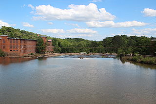
Tobesofkee Creek is a 58.9-mile-long (94.8 km) river in Georgia. It originates near Barnesville and flows roughly southeast across Lamar, Monroe, and Bibb counties to join the Ocmulgee River south of the city of Macon. A dam on this stream forms Lake Tobesofkee.

The Towaliga River is a 52.3-mile-long (84.2 km) tributary of the Ocmulgee River in central Georgia. The Towaliga passes through High Falls State Park in northwestern Monroe County, then traverses the county and joins the Ocmulgee near the town of Juliette. The river is fairly muddy above High Falls Lake, but it clears once below the falls where most of the river is rock bottomed. This region is about 50 miles (80 km) south of Atlanta and about 35 miles (56 km) north of Macon.
The Vernon River is a 12.4-mile-long (20.0 km) primarily tidal river in the U.S. state of Georgia. Located in Chatham County, it rises south of Hunter Army Airfield in Savannah and flows south into tidal marshes, where it joins the Little Ogeechee River southwest of Skidaway Island.
The Yellow River is a 76-mile-long (122 km) tributary of the Ocmulgee River in the U.S. state of Georgia.
Walnut Creek is a 30-mile-long (48 km) tributary of the South River in the U.S. state of Georgia. It originates in the city of Hampton in Henry County and flows into South River, which is a branch of the Ocmulgee River.
Walnut Creek is a 25-mile-long (40 km) tributary of the Ocmulgee River in the U.S. state of Georgia. It originates in the city of Gray in Jones County and flows into the Ocmulgee River in Macon at the southern corner of Ocmulgee National Monument.


