| Little White Salmon River | |
|---|---|
 Fish hatchery and log flume, 1898 | |
 Location of the mouth of the Little White Salmon River in Washington  Little White Salmon River (the US) | |
| Location | |
| Country | United States |
| State | Washington |
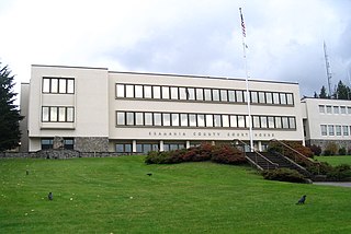
| County | Skamania, Klickitat |
| Physical characteristics | |
| Source | Monte Cristo Range of the Cascade Range |
| - location | Gifford Pinchot National Forest, Klickitat County |
| - coordinates | 45°55′07″N121°35′52″W / 45.91861°N 121.59778°W [1] |
| - elevation | 3,384 ft (1,031 m) [2] |
| Mouth | Columbia River |
- location | Drano Lake of the Bonneville Pool, Skamania County |
- coordinates | 45°43′14″N121°38′25″W / 45.72056°N 121.64028°W Coordinates: 45°43′14″N121°38′25″W / 45.72056°N 121.64028°W [1] |
- elevation | 98 ft (30 m) [1] |
| Length | 19 mi (31 km) [3] |
| Basin size | 136 sq mi (350 km2) [4] |
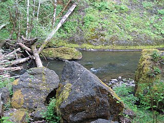
The Little White Salmon River is a tributary, about 19 miles (31 km) long, [3] of the Columbia River in the U.S. state of Washington. Its headwaters are in the Monte Cristo Range in Gifford Pinchot National Forest. The river flows from this part of the Cascade Range into Drano Lake, an arm of the Bonneville Pool of the Columbia. [4] The river drains a basin of 136 square miles (350 km2) [4] The basin's population was an estimated 513 in 2000. [4]

The Columbia River is the largest river in the Pacific Northwest region of North America. The river rises in the Rocky Mountains of British Columbia, Canada. It flows northwest and then south into the US state of Washington, then turns west to form most of the border between Washington and the state of Oregon before emptying into the Pacific Ocean. The river is 1,243 miles (2,000 km) long, and its largest tributary is the Snake River. Its drainage basin is roughly the size of France and extends into seven US states and a Canadian province. The fourth-largest river in the United States by volume, the Columbia has the greatest flow of any North American river entering the Pacific.

Washington, officially the State of Washington, is a state in the Pacific Northwest region of the United States. Named for George Washington, the first president of the United States, the state was made out of the western part of the Washington Territory, which was ceded by Britain in 1846 in accordance with the Oregon Treaty in the settlement of the Oregon boundary dispute. It was admitted to the Union as the 42nd state in 1889. Olympia is the state capital; the state's largest city is Seattle. Washington is sometimes referred to as Washington State to distinguish it from Washington, D.C., the capital of the United States.

Gifford Pinchot National Forest is a National Forest located in southern Washington, USA, managed by the United States Forest Service. With an area of 1.32 million acres (5300 km2), it extends 116 km along the western slopes of Cascade Range from Mount Rainier National Park to the Columbia River. The forest straddles the crest of the South Cascades of Washington State, spread out over broad, old growth forests, high mountain meadows, several glaciers, and numerous volcanic peaks. The forest's highest point is at 12,276 ft. at the top of Mount Adams, the second tallest volcano in the state after Rainier. It includes the 110,000-acre (450 km2) Mount St. Helens National Volcanic Monument, established by Congress in 1982
Contents
Whitewater kayaking experts sometimes run a 4-mile (6.4 km) stretch of rapids in a steep canyon between the Cook– Underwood Road bridge and Drano Lake. [5] The run, dangerous throughout, is rated Class V (extremely difficult) on the International Scale of River Difficulty. [5] Named rapids include Gettin' Busy, Boulder Sluice, Island, Sacriledge, Double Drop, Backender, S-Turn, Wishbone, Bowey's Hotel, The Gorge, Stovepipe, Spirit Falls, Chaos and Master Blaster. [5] The river has been the scene of two kayaking deaths since this stretch was first run in the 1990s. [6]
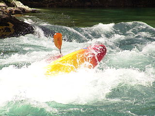
Whitewater kayaking is the sport of paddling a kayak on a moving body of water, typically a whitewater river. Whitewater kayaking can range from active, moving water, to demanding, extreme whitewater.
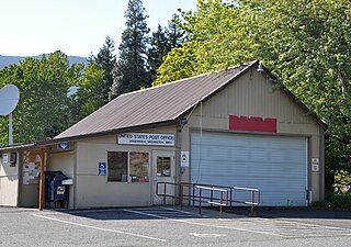
Underwood is an unincorporated community in Skamania County, Washington, United States. Underwood is located along Washington State Route 14 at the confluence of the White Salmon and Columbia Rivers. It is across the Columbia River from Hood River, Oregon, and 2 miles (3.2 km) west of White Salmon, Washington. Underwood has a post office with ZIP code 98651.