
The River Wharfe is a river in Yorkshire, England. For much of its length it is the county boundary between West Yorkshire and North Yorkshire.

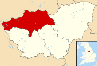
Selby District is a local government district of North Yorkshire, England. The local authority, Selby District Council, is based in the town of Selby and provides services to an area which includes Tadcaster and a host of villages. The Local Authority had a population of 83,449 at the 2011 Census. It is the southern most district of North Yorkshire, and it borders the City of York, a unitary authority, the districts of the City of Leeds and the City of Wakefield, in West Yorkshire, the town of Doncaster, in South Yorkshire, the ceremonial county of the East Riding of Yorkshire, and the Borough of Harrogate.
The Metropolitan Borough of Barnsley is a metropolitan borough of South Yorkshire, England; its main town is Barnsley.

The East Yorkshire Borough of Beverley was a local government district and borough of Humberside, England, from 1974 to 1996.

Hatfield is a town and civil parish in the Metropolitan Borough of Doncaster in South Yorkshire, England. It had a population of 16,776 at the 2011 Census, with its population split between the Hatfield and Thorne wards.

The Colne Valley is a steep sided valley on the east flank of the Pennine Hills in the English county of West Yorkshire. It takes its name from the River Colne which rises above the town of Marsden and flows eastward towards Huddersfield.

Garforth Town Association Football Club is a football club based in Garforth, West Yorkshire, England. They are currently members of the Northern Counties East League Premier Division and play at Wheatley Park.

The Little Don River also known as the Porter, is a tributary of the River Don in South Yorkshire, England. Arising on the Langsett Moors in the northern Peak District, the Little Don River feeds the Langsett and Underbank Reservoirs. It runs through the town of Stocksbridge before joining the River Don.

Harrogate and Knaresborough is a parliamentary constituency in North Yorkshire which has been represented in the House of Commons of the UK Parliament since 2010 by Andrew Jones, an MP from the Conservative Party. The constituency was first contested at the 1997 general election, and is in an affluent part of Yorkshire, historically being a Conservative-Liberal Democrat marginal seat.

Skidby is a small village and civil parish in Yorkshire Wolds of the East Riding of Yorkshire, England. It is situated about 6 miles (10 km) north-west of Hull city centre and 5 miles (8 km) south of Beverley.

Barnsdale, or Barnsdale Forest, is an area of South Yorkshire, England. The area falls within the Whitley Ward of the Wakefield Metropolitan Council. Barnsdale is historically part of the West Riding of Yorkshire. Barnsdale lies in the immediate vicinity north and northwest of Doncaster, and which was formerly forested and a place of royal hunts, and also renowned as a haunt of the outlaw Robin Hood in early ballads.

Oldfield is a small hamlet within the county of West Yorkshire, England, situated north of Stanbury and near to Oakworth. It is approximately 4 miles (6.5 km) west of the town of Keighley. It mainly consists of farmland and has panoramic views across the Worth Valley towards Brontë Country. Top Withens, the house featured in the novel Wuthering Heights, is clearly visible.

Wetherby was a rural district in the West Riding of Yorkshire from 1894 to 1974. It was named after the town of Wetherby.
Elmet and Rothwell is a constituency in West Yorkshire represented in the House of Commons of the UK Parliament since its creation in 2010 by Alec Shelbrooke, a Conservative. In the 2017 general election, Elmet and Rothwell recorded the largest turnout of any seat in West or South Yorkshire, with almost 60,000 electors casting a vote.

Staincross was a Wapentake (Hundred), which is an administrative division, in the historic county of the West Riding of Yorkshire. It consisted of seven parishes, and included the towns of Barnsley and Penistone

Emley Association Football Club is a football club based in Emley, West Yorkshire, England. They are currently members of North West Counties League Division One North and play at the Welfare Ground.

Charterhouse was a town in the Roman province of Britannia. Its site is located just to the west of the village of Charterhouse-on-Mendip in the English county of Somerset.

South Elmsall bus station serves the town of South Elmsall, West Yorkshire, England. The bus station is managed and operated by Metro.

Frizinghall is a district in the Heaton ward of the City of Bradford, West Yorkshire, lying 2 miles (3 km) north of the city centre close to the town of Shipley, itself a part of the City of Bradford Metropolitan District along with such other nearby towns as Keighley and Ilkley.

The Way of the Roses is the newest of Great Britain's coast-to-coast, long-distance cycle routes and is based on minor roads, disused railway lines and specially constructed cycle paths. It lies entirely within the counties of Lancashire and Yorkshire, crossing the Yorkshire Dales and the Yorkshire Wolds in the north of England, passing through the historic cities of Lancaster and York and scenic towns and villages including Settle, Pateley Bridge and Ripon.

