External links
52°28′N1°13′W / 52.47°N 1.21°W
| | This Leicestershire location article is a stub. You can help Wikipedia by expanding it. |
The rural district of Lutterworth in Leicestershire, England existed from 1894 to 1974. It contained the following civil parishes:
In 1974 it was merged under the Local Government Act 1972 to form part of the new Harborough non-metropolitan district, along with Market Harborough Rural District and Market Harborough.
52°28′N1°13′W / 52.47°N 1.21°W
| | This Leicestershire location article is a stub. You can help Wikipedia by expanding it. |

Leicestershire is a ceremonial county in the East Midlands of England. It is bordered by Derbyshire, Nottinghamshire, and Lincolnshire to the north, Rutland to the east, Northamptonshire to the south-east, Warwickshire to the south-west, and Staffordshire to the west. The city of Leicester is the largest settlement and the county town.

Harborough is a local government district in Leicestershire, England. It is named after its main town, Market Harborough, which is where the council is based. The district also includes the town of Lutterworth and numerous villages and surrounding rural areas. In the north of the district it includes parts of the Leicester Urban Area, notably at Thurnby, Bushby and Scraptoft. Covering 230 square miles (600 km2), the district is the largest by area of the eight districts in Leicestershire and covers almost a quarter of the county.

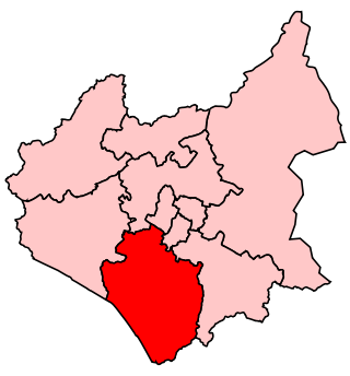
Harborough, Oadby and Wigston is a constituency covering the south east of Leicestershire represented in the House of Commons of the UK Parliament since 2017 by Neil O'Brien of the Conservative Party.
Blaby was a county constituency represented in the House of Commons of the Parliament of the United Kingdom, which existed from 1974 until 2010. It elected one Member of Parliament (MP) by the first past the post system of election. It was a safe seat for the Conservative Party, being held by Conservative MPs throughout its existence.
The A427 road is a major road in the English Midlands. It connects the Leicestershire town of Market Harborough and the A6 with the Northamptonshire town of Oundle and the A605.
Billesdon was a rural district of Leicestershire, England. It originated with the Billesdon Poor Law Union, formed in 1835. In 1894 the area became a rural district. It was named for the village of Billesdon.

Ashby Magna is a small English village and civil parish in the Harborough district of Leicestershire. The parish has a population of 294, increasing at the 2011 census to 347. It is in the west of the district, and lies midway between junctions 20 and 21 of the M1. Nearby places are Willoughby Waterleys, Peatling Parva and Dunton Bassett.
The rural district of Market Harborough existed in Leicestershire, England, from 1894 to 1974. It covered the area around Market Harborough, but not including the actual town. It was greatly extended in 1935 by the abolition of Hallaton Rural District. In 1974 under the Local Government Act 1972, it merged with Market Harborough urban district, Billesdon Rural District, Lutterworth Rural District to form the Harborough non-metropolitan district.

South Leicestershire is a constituency represented in the House of Commons of the UK Parliament since 2015 by Alberto Costa, a member of the Conservative Party.

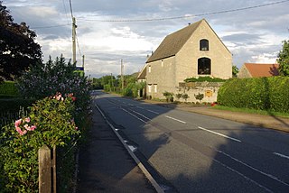
Claybrooke Magna is a village and civil parish in the Harborough district of Leicestershire, England, close to the A5 trunk road. The village is located between junctions 20 and 21 of the M1, and the towns of Leicester, Rugby, Lutterworth and Market Harborough are easily accessible.

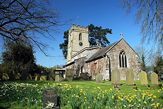
Claybrooke Parva is a village and civil parish in the Harborough district south west Leicestershire, England close to Claybrooke Magna. The village is the site of a church which is thought to originally be part Anglo Saxon with Norman and Medieval additions. The population of the civil parish at the 2011 census was 208.

Willoughby Waterleys is a small village and civil parish in the Harborough district of Leicestershire, England. It is situated near the A426 Leicester–to–Lutterworth road. Nearby villages are Ashby Magna, Peatling Magna and Countesthorpe. Main Street is the basis of the village running north to south, there have been some new developments such as bungalows and large detached houses however many farms still remain in the parish.

Dunton Bassett is a small village in the Harborough district of Leicestershire, England. It lies between Leicester and Lutterworth, and close to Broughton Astley, Ashby Magna & Leire. It had a population of 795 at the 2001 UK census, falling to 759 at the 2011 census.

Welford and Kilworth railway station was a railway station serving Welford and the villages of North Kilworth and South Kilworth in Leicestershire, England. It was opened as Welford on the Rugby and Stamford Railway in 1850.

Kimcote and Walton is a civil parish situated in the Harborough district, in Leicestershire, England, approximately 4 miles north east of Lutterworth. The population of the civil parish at the 2011 census was 600. The parish includes the villages of Kimcote and Walton. All Saints Parish Church is situated in Kimcote. Walton once had a church but it was defunct in about 1630. Walton still has a Baptist Chapel and until recently a Public House, the Dog and Gun, which is now a private house but retains it's signage.

Peatling Magna is a village in Harborough district, south Leicestershire. The population of the civil parish at the 2011 census was 210. It lies 3.7 km north-east of Ashby Magna and 2.9 km north-north-east of Peatling Parva.
Peatling Parva is a village and civil parish in the Harborough district, south Leicestershire, England. It lies 2.6 km west-north-west of Ashby Magna and 2.9 km south-south-west of Peatling Magna.