
Ayrshire is a historic county and registration county, in south-west Scotland, located on the shores of the Firth of Clyde. The lieutenancy area of Ayrshire and Arran covers the entirety of the historic county as well as the island of Arran, formerly part of the historic county of Buteshire. Its principal towns include Ayr, Kilmarnock and Irvine and it borders the counties of Renfrewshire and Lanarkshire to the north-east, Dumfriesshire to the south-east, and Kirkcudbrightshire and Wigtownshire to the south. Like many other counties of Scotland, it currently has no administrative function, instead being sub-divided into the council areas of East Ayrshire, North Ayrshire and South Ayrshire. It has a population of approximately 366,800.

Kilmaurs is a village in East Ayrshire, Scotland which lies just outside of the largest settlement in East Ayrshire, Kilmarnock. It lies on the Carmel Water, 21 miles southwest of Glasgow. Population recorded for the village in the 2001 Census recorded 2,601 people resided in the village It was in the Civil Parish of Kilmaurs.
Chapeltoun is an estate on the banks of the Annick Water in East Ayrshire, a rural area of Scotland famous for its milk and cheese production and the Ayrshire or Dunlop breed of cattle.
Lambroughton is a village in the old Barony of Kilmaurs, Scotland. This is a rural area famous for its milk and cheese production and the Ayrshire or Dunlop breed of cattle.
The village or hamlet of Gatehead is lin East Ayrshire, Kilmaurs, Scotland. It is one and a quarter miles from Crosshouse and one and a half miles from Kilmarnock. In the 18th and 19th centuries the locality was a busy coal mining district. The settlement runs down to the River Irvine where a ford and later a bridge was located.
Knockentiber is a village in East Ayrshire, Parish of Kilmaurs, Scotland. Knockentiber is two miles west-northwest of Kilmarnock and 1⁄2 mile northeast of Crosshouse. Latitude:55.6193°N Longitude:4.5455°W and grid reference NS397392. The population was 359 in 1991, however the population is much higher following the construction of several housing estates (2007). In the 18th and 19th and mid 20th centuries the locality was a highly industrialised coal mining district. The settlement is on the Carmel Burn, which runs into the River Irvine, around one mile to the south.

The River Irvine is a river that flows through southwest Scotland. Its watershed is on the Lanarkshire border of Ayrshire at an altitude of 810 feet (250 m) above sea-level, near Loudoun Hill, Drumclog, and 7 miles SW by W of Strathaven. It flows 29+1⁄2 mi (47.5 km) westward, dividing the old district of Cunninghame from that of Kyle, until it reaches the sea via Irvine Harbour in the form of the Firth of Clyde, and flows into Irvine Bay by the town of Irvine. It has many tributaries, some of which form parish, district and other boundaries.

Rowallan Castle is an ancient castle located in Scotland. The castle stands on the banks of the Carmel Water, which may at one time have run much closer to the low eminence upon which the original castle stood, justifying the old name Craig of Rowallan. Elizabeth Mure was mistress and then wife of Robert, High Steward of Scotland, and Guardian of Scotland, who later became King Robert II of Scotland. She may have been born at Rowallan.
Riccarton is a village and parish in East Ayrshire, Scotland. It lies across the River Irvine from Kilmarnock, this river forming the boundary between Riccarton and Kilmarnock parishes, and also between the historical districts of Kyle and Cunningham. The name is a corruption of 'Richard's town', traditionally said to refer to Richard Wallace, the uncle of Sir William Wallace. The parish also contains the village of Hurlford.
Kilmaurs Place, The Place or Kilmaurs House, is an old mansion house and the ruins of Kilmaurs Tower grid reference NS41234112 are partly incorporated, Kilmaurs, East Ayrshire, Scotland. The house stands on a prominence above the Carmel Water and has a commanding view of the surrounding area. Once the seat of the Cunningham Earls of Glencairn it ceased to be the main residence after 1484 when Finlaystone became the family seat. Not to be confused with Kilmaurs Castle that stood on the lands of Jocksthorn Farm.

Kilmaurs Castle was located on the lands of Jocksthorn Farm, near Kilmaurs in East Ayrshire, Scotland. It is described by Timothy Pont in the early 17th century as "Ye castell is ane ancient ftronge building belonging to ye Earls of Glencairne environed with a fair park called Carmell wod from ye vatter of Carmell yat runs by it." Dobie goes on to state that "The old baronial manor place is supposed to have been situated about a mile south-east of Kilmaurs, where some ruins can still be pointed out on the farm of Jakisthorn or Jock's-thorn, probably the original Villam de Cuninghame - the first possession of the family." The castle is not to be confused with the later Cunninghame family possession known as Kilmaurs Place which Dobie calls "..comparatively modern" in 1876.

Busbie Castle was situated in what is now known as Knockentiber, a village in East Ayrshire, Parish of Kilmaurs, Scotland. Knockentiber is 2 miles (3.2 km) WNW of Kilmarnock and 1/2 mile NE of Crosshouse. The castle overlooked the Carmel Glen and its Burn, which runs into the River Irvine, a mile or so to the south, after passing through the old Busbie Mill.
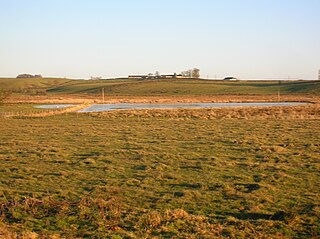
Buiston Loch, also known as Buston, Biston and Mid Buiston, was situated in the mid-Ayrshire clayland at an altitude of 90 m OD. The loch was natural, sitting in a hollow created by glaciation. The loch waters drained via the Garrier Burn that joins the Bracken and Lochridge Burns before joining the River Irvine.
The old village or hamlet of Old Rome, Rome or Old Rome Ford is located in South Ayrshire, Parish of Dundonald, Scotland. It is one and a half miles from Crosshouse and one and less than a quarter of a mile from Gatehead. In the 18th and 19th centuries the locality was a busy coal mining district and many of the houses have been demolished. The settlement is situated near the River Irvine.

The Murder of Hugh Montgomerie, 4th Earl of Eglinton at the Annick Ford in Stewarton, East Ayrshire, Scotland, took place in 1586 as a consequence of a long running feud between the Montgomeries, Earls of Eglinton and the Cunninghames, Earls of Glencairn, families who were competing for power and influence locally and nationally. The significant repercussions of this act were felt throughout the county of Ayrshire and beyond. The spelling 'Montgomerie' is used throughout for both the family and Montgomery for the clan and clan and district names 'Cunninghame' in the same fashion.

The Lands of Tour and Kirkland (NS416406) formed a small estate close to the old Kirktoun and St Maurs-Glencairn collegiate church about 1 km south-east of Kilmaurs, East Ayrshire, Parish of Kilmaurs, Scotland. The word 'Tour' in Scots refers to a 'tower' and 'kirk' to a parish church.

Bailliehill Mount, known locally as Bully Hill is a roughly circular earthwork associated with the Iron Age, located near the village of Kilmaurs in East Ayrshire, Scotland.

Duncan McNaught LL.D., J.P., was born in Alexandria, Dunbartonshire in 1845. He was the parochial school teacher at Kilmaurs in East Ayrshire from 1867 and served at the school for over fifty years, having served as assistant from 1865. He founded the Kilmarnock Conservative Association, jointly founded the Robert Burns World Federation, acted as the editor of the "Burns Chronicle" and was the president of what became the Robert Burns World Federation.

The Glencairn Aisle or Glencairn Vault at Kilmaurs, East Ayrshire is a Category B Listed vaulted sepulchral chapel built as a place for private contemplation and prayer that also contains a large memorial monument, as well as the burial crypt of the Cunningham Earls of Glencairn and their family members. An 'Aisle' is defined as a structure normally attached to a church, which may have burial crypt below, a family pew above, and sometimes a retiring room as at the Glencairn Aisle.

James M'Kie or James McKie (1816–1891) was an apprentice of Hugh Crawford, John Wilson's successor at the Kilmarnock Cross printing business. In 1867, M'Kie published the first facsimile edition of the 1786 "Kilmarnock Edition" or Poems, Chiefly in the Scottish Dialect as well as various bibliographies, reprints, special editions, limited editions, etc. of Robert Burns' and other works for the Scottish, British, British Empire or North American markets. He became an avid collector of Burnsiana and put together the largest collection of published in the world at the time, that was eventually purchased by the local Kilmarnock Corporation and housed in the Kay Park Burns Museum.


