Asyrmatos is a neighbourhood in the city of Patras, Achaea, Greece.

Logan is an unincorporated community in Logan Township, Dearborn County, Indiana.
Hidalgo Municipality is a municipality located in the Mexican state of Tamaulipas. El Chorrito is a centre of pilgrimage in the municipality.

Jadwigowo is a village in the administrative district of Gmina Mrocza, within Nakło County, Kuyavian-Pomeranian Voivodeship, in north-central Poland. It lies approximately 4 kilometres (2 mi) west of Mrocza, 13 km (8 mi) north of Nakło nad Notecią, and 34 km (21 mi) north-west of Bydgoszcz.
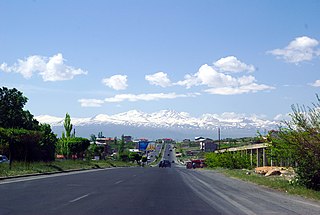
Proshyan, is a major village in the Kotayk Province of Armenia.
Sucha Góra is a village in the administrative district of Gmina Suchowola, within Sokółka County, Podlaskie Voivodeship, in north-eastern Poland. It lies approximately 11 kilometres (7 mi) south-east of Suchowola, 23 km (14 mi) north-west of Sokółka, and 47 km (29 mi) north of the regional capital Białystok.
Bogdany Wielkie is a village in the administrative district of Gmina Chorzele, within Przasnysz County, Masovian Voivodeship, in east-central Poland.

Qian County or Qianxian is a county under the administration of the prefecture-level city of Xianyang, in the central part of Shaanxi province, China.
Zdroje is a settlement in the administrative district of Gmina Łobżenica, within Piła County, Greater Poland Voivodeship, in west-central Poland. It lies approximately 11 kilometres (7 mi) east of Łobżenica, 47 km (29 mi) east of Piła, and 100 km (62 mi) north of the regional capital Poznań.
Borki is a village in the administrative district of Gmina Słupca, within Słupca County, Greater Poland Voivodeship, in west-central Poland.
Bolesławowo is a village in the administrative district of Gmina Debrzno, within Człuchów County, Pomeranian Voivodeship, in northern Poland. It lies approximately 4 kilometres (2 mi) north of Debrzno, 13 km (8 mi) south-west of Człuchów, and 128 km (80 mi) south-west of the regional capital Gdańsk.
Minkowice is a village in the administrative district of Gmina Krokowa, within Puck County, Pomeranian Voivodeship, in northern Poland. It lies approximately 2 kilometres (1 mi) east of Krokowa, 18 km (11 mi) north-west of Puck, and 55 km (34 mi) north-west of the regional capital Gdańsk.

Brock Creek is a former settlement in Humboldt County, California. It was located on the Northwestern Pacific Railroad 7.5 miles (12 km) northwest of Alderpoint, at an elevation of 279 feet. It still appeared on maps as of 1949.
Puiatu is a village in Järva Parish, Järva County in central Estonia.
Vodenice is a village in the municipality of Višegrad, Bosnia and Herzegovina.
Souk El Had is a town and commune in Relizane Province, Algeria.
Kelhat (قلحات), Qalhat, Kelhatt, is a Greek Orthodox village in Koura District of Lebanon. It extends from the shores of the Mediterranean Sea to an elevation of around 400m above sea level.
Pisokal is a former village in Municipality of Prilep, Republic of Macedonia.
Patten Mills is an unincorporated community in Washington County, in the U.S. state of Ohio.
The Führer Headquarters Bärenhöhle was a bunker facility built by the German organization Todt, which was built during the Second World War near Smolensk in the Soviet Union.