
Eswatini, officially the Kingdom of Eswatini and also known as Swaziland, is a landlocked country in Southern Africa. It is bordered by Mozambique to its northeast and South Africa to its north, west and south. At no more than 200 kilometres (120 mi) north to south and 130 kilometres (81 mi) east to west, Eswatini is one of the smallest countries in Africa; despite this, its climate and topography are diverse, ranging from a cool and mountainous highveld to a hot and dry lowveld.

Eswatini is a country in Southern Africa, lying between Mozambique and South Africa. The country is located at the geographic coordinates 26°30′S31°30′E. Eswatini has an area of 17,363 square kilometres, of which 160 are water. The major regions of the country are Lowveld, Midveld and Highveld.
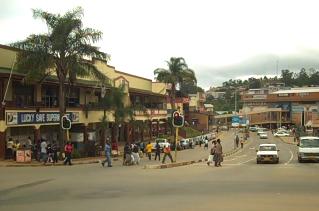
Mbabane is the capital and largest city in Eswatini. With an estimated population of 94,874 (2010), it is located on the Mbabane River and its tributary the Polinjane River in the Mdzimba Mountains. It is located in the Hhohho Region, of which it is also the capital. The average elevation of the city is 1243 meters. It lies on the MR3 road.

Hhohho is a region of Eswatini, located in the north western part of Eswatini from the north and running southwards to the centre, Hhohho was named after the capital of King Mswati II, who expanded the Swazi territory to the north and west, taking in the districts of Barberton, Nelspruit, Carolina and Piet Retief. These areas were later acquired by what was the Province of Transvaal and today they form part of the Mpumalanga Province of South Africa. It has an area of 3,625.17 km², a population of 320,651 (2017), and is divided into 14 tinkhundla. The administrative center is the national capital of Mbabane. It borders Lubombo Region on the southeast and Manzini Region in the southwest.
Articles related to Eswatini include:
Hluthi is a town in south-western Eswatini about 40 kilometres south-west of Maloma. It has a population of 7000 (2006).
Mhlosheni is an Evangelical Mission Boarding School with in south western Eswatini about 25 kilometres north-west of Hluthi and 75 kilometres west of Maloma.
Nsoko is a town in southern Eswatini about five kilometres (3.1 mi) from the border with South Africa. It lies about 65 kilometres (40 mi) north-east of Lavumisa and 45 kilometres (28 mi) south-east of Maloma. The town lies on the Ngwavuma river.

Bulembu is a small town located in northwestern Hhohho, Eswatini, 10 km west of the town of Piggs Peak. Located above the Komati Valley in Swaziland's Highveld, Bulembu is named after the siSwati word for a spider's web.
Mhlambanyatsi is a town in western Eswatini. It is located 18 kilometres southwest of the capital, Mbabane.
Lubuli is a town in southeastern Eswatini. It is located close to the South African border just to the northwest of the town of Nsoko on the road between there and Maloma.

Malolotja National Park covers 18,000 hectares of mountain wilderness on Eswatini's northwestern border with South Africa. The park includes Ngwenya Mountain, Eswatini's second highest mountain, and Malolotja Falls which drop 89 metres (292 ft), the highest in Eswatini. Habitats include short grassland to thick riverine scrub, bushveld and Afromontane forest.

The Ngwenya Mine is located on Bomvu Ridge, northwest of Mbabane and near the northwestern border of Eswatini (Swaziland). This mine is considered to be the world's oldest. The haematite ore deposit was used in the Middle Stone Age to extract red ochre, while in later times the deposit was mined for iron smelting and iron ore export.
Gege is a town in the Shiselweni district of southern Eswatini.

Eswatini–South Africa relations refers to the current and historical relationship between Eswatini and South Africa. South Africa surrounds Swaziland on the north, west and south. The two states share strong historical and cultural ties. Mutual High Commissions were established in Pretoria and Mbabane at the end of the apartheid era in 1994. Swaziland's High Commission in Pretoria is also accredited to Botswana, Lesotho, Namibia, Zambia and Zimbabwe.
The MR8 road is a major highway of Eswatini. Along with the MR3 and MR7 roads it is considered to form the "backbone of Eswatini's internal transport system." It connects the MR3 road east of Manzini at 26°29′16″S31°27′17″E with Lavumisa/Golela at 27°19′4″S31°53′18″E. It passes through the Mkhaya Game Reserve.

Lubombo is a region of Eswatini, located in the east of the country. It has an area of 5,849.11 km² and a population of 212,531 (2017). Its administrative center is Siteki. It borders all three other regions: Hhohho to the north, Manzini to the west, and Shiselweni to the south. It is divided into 11 tinkhundla.

The mining industry of Eswatini vests with the Ngwenyama who authorizes mineral rights after due consultation with the Minerals Committee, which he appoints. Fiscal contribution from mining operations to Eswatini’s GDP is 2% and also accounts for 2% of export earnings.
Whroo is a rural locality and ghost town in Victoria, Australia, between Shepparton and Seymour in the Shire of Strathbogie. The area at 36°34S 145°01′e is a former mining area and remains predominantly agricultural today. The locality includes the Whroo Historical Area state reserve.
The geology of Eswatini formed beginning 3.6 billion years ago, in the Archean Eon of the Precambrian. Eswatini is the only country entirely underlain by the Kaapvaal Craton, one of the oldest pieces of stable continental crust and the only craton regarded as "pristine" by geologists, other than the Yilgarn Craton in Australia. As such, the country has very ancient granite, gneiss and in some cases sedimentary rocks from the Archean into the Proterozoic, overlain by sedimentary rocks and igneous rocks formed during the last 541 million years of the Phanerozoic as part of the Karoo Supergroup. Intensive weathering has created thick zones of saprolite and heavily weathered soils.


