
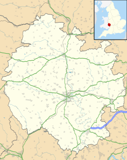
Leominster (district) was a local government district in England from 1 April 1974 to 1 April 1998 with its administrative seat in the town of Leominster.
Walford, Letton and Newton is a civil parish in north Herefordshire, England, close to the border with Shropshire. The population of this civil parish at the 2011 census was 179.

Herefordshire Council is the local government authority for the county of Herefordshire in England. It is a unitary authority, combining the powers of a non-metropolitan county and district.
Cornett is a hamlet in the English county of Herefordshire.
The A4113 road is a single-carriageway road that runs from Knighton in Powys to Bromfield in Shropshire, United Kingdom, passing through north Herefordshire.

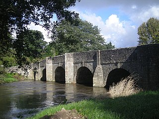
Brimfield is a village and civil parish in north Herefordshire, England. The village lies on the A49 road at the border with Shropshire.

Gamages was a department store in Holborn, London. Trading between 1878 and 1972, it was particularly well known for its toy and hardware departments.
Saint Guthlac's Priory was a Benedictine priory in Hereford, England at grid reference SO51534019. a site between the present day Bath Street and Commercial Road. Upon the dissolution of the monasteries John Prise bought the priory of St. Guthlac, Hereford.
Titley Priory was a priory near Titley in Herefordshire, England at grid reference SO32966011.
Mansel Lacy is a small village and civil parish in Herefordshire, England. It is located 7 miles (11 km) north west of Hereford, close to the A480 road.
Norton Canon is a village in Herefordshire near the A480 road and the B4230 road. The population of this village at the 2011 Census was 242.
Poston Camp is an Iron Age hill fort located just south of Vowchurch, Herefordshire.
Ivington Camp is an Iron Age hill fort located at Brierley, 3 km south of Leominster, Herefordshire.

Wapley Hill is an Iron Age hill fort located in Herefordshire, England, 3 km south-east of Presteigne.

Ledwyche Brook is a minor river in south Shropshire, England. It is sometimes referred to as the River Ledwyche and spelled variously, including "Ledwich" or "Ledwych". The brook is a tributary of the River Teme.
Eggleton is a small civil parish in the English county of Herefordshire. Its main centres of population are Lower Eggleton and Upper Eggleton. Each of these is also spelled "Egleton".

The R885 road is a very short regional road in Ireland, located in Carrick-on-Suir, County Tipperary.

Grendon Bishop is a civil parish in the county of Herefordshire, England.

Pencombe with Grendon Warren is a civil parish in the county of Herefordshire, England. The parish was created in 1895 from the parishes of Pencombe and Grendon Warren, its only nucleated settlement being the village of Pencombe.


